
Third Avenue Railway System
$135.00
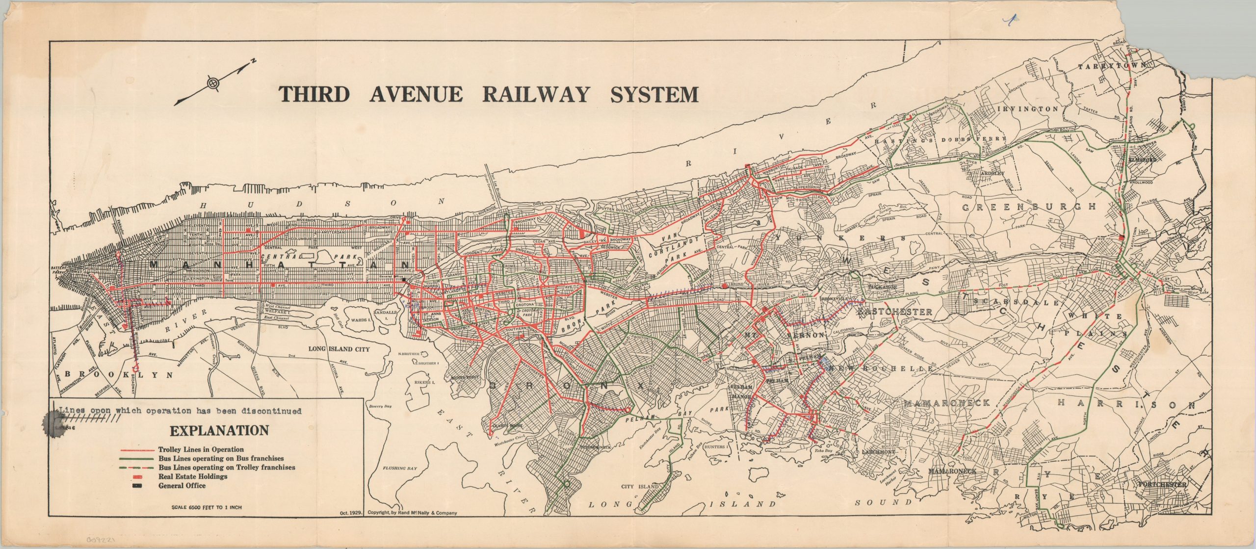
Operations of the Third Avenue Railway System in the late 1920s.
1 in stock
Description
This color-coded map of Manhattan, the Bronx, and portions of Westchester County highlights the operational extent of the Third Avenue Railway System (TARS). Trolley lines are shown in bright red, while bus routes, introduced only a few years earlier, are colored green. The company’s General Office, located on Third Avenue, and scattered real estate holdings are also identified. Handwritten updates mark several discontinued segments, including service into Brooklyn and portions of southeastern Westchester.
The map was copyrighted by Rand McNally & Company of Chicago and is dated October 1929. That same month, the Wall Street Crash of October 29 (Black Tuesday) marked the beginning of a period of severe economic contraction that would soon transform the operating environment for the city’s transit companies.
Map Details
Publication Date: 1929
Author: Rand McNally & Company
Sheet Width (in): 25.00
Sheet Height (in): 11.00
Condition: B
Condition Description: Color printed map on strong paper, creased along three vertical folds. A large chip missing in the upper right corner, while the upper left and the margins exhibit moderate toning and wear. Small ink splatter in the lower left. About good condition overall.
$135.00
1 in stock