
The Yellowstone Trail
$145.00
“A Good Road from Plymouth To Puget Sound.”
1 in stock

Description
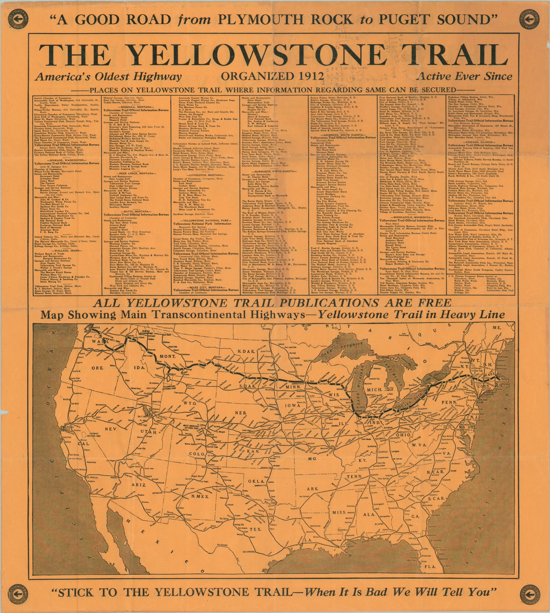
First ‘opened’ in 1912, the Yellowstone Trail was an early transcontinental automobile route that connected Plymouth, Massachusetts to Seattle, Washington. Black arrows on a yellow background (or plain yellow bands) posted on utility poles helped guide adventurous motorists along the ~3,600-mile path, which passed through Buffalo, Chicago, the Twin Cities, Yellowstone National Park, and Puget Sound. The Yellowstone Trail Association was incorporated in 1918 to promote the route and advise motorists on conditions and amenities.
The organization sponsored this map, created around 1925 by the Automobile Blue Book Company. One side of the sheet shows the entire route across the northern U.S., accompanied by a long list of ‘Places on Yellowstone Trail where information regarding same can be secured’ (mostly service stations, garages, hotels, and retail establishments). The verso is bifurcated into Eastern and Western sections, each with a list of towns that notes populations and available accommodations.
Map Details
Publication Date: c. 1925
Author: The Automobile Blue Book Company
Sheet Width (in): 17.00
Sheet Height (in): 18.75
Condition: B
Condition Description: Double-sided flyer with creasing and moderate wear along old folds. Scattered penciled annotations, toning, and marginal wear, including a few small chips. About good condition overall.
$145.00
1 in stock