The World’s Greatest War
$85.00
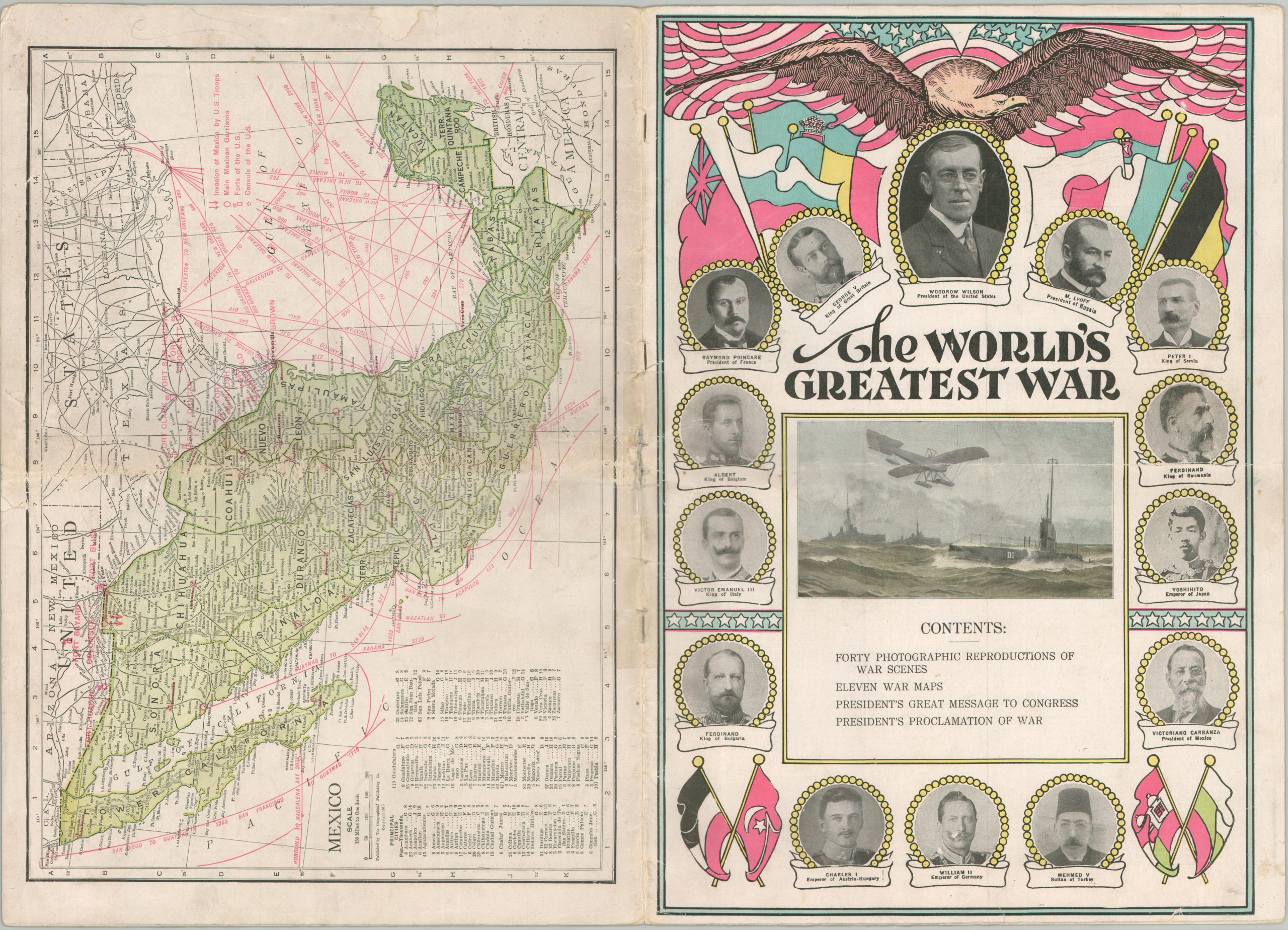
America joins the Great War.
1 in stock


Description
“The greatest war of all the ages is waging, and no man can say how long it will continue, nor upon what terms it will be ended. During the past couple of years the progress of humanity has been checked, and civilization has been turned backward over two thousand years, for ever since the light was reflected from the cross on Calvary, have such atrocities been perpetrated by Christian nations,as have disgraced the annals of this terrific conflict.” – Introduction.
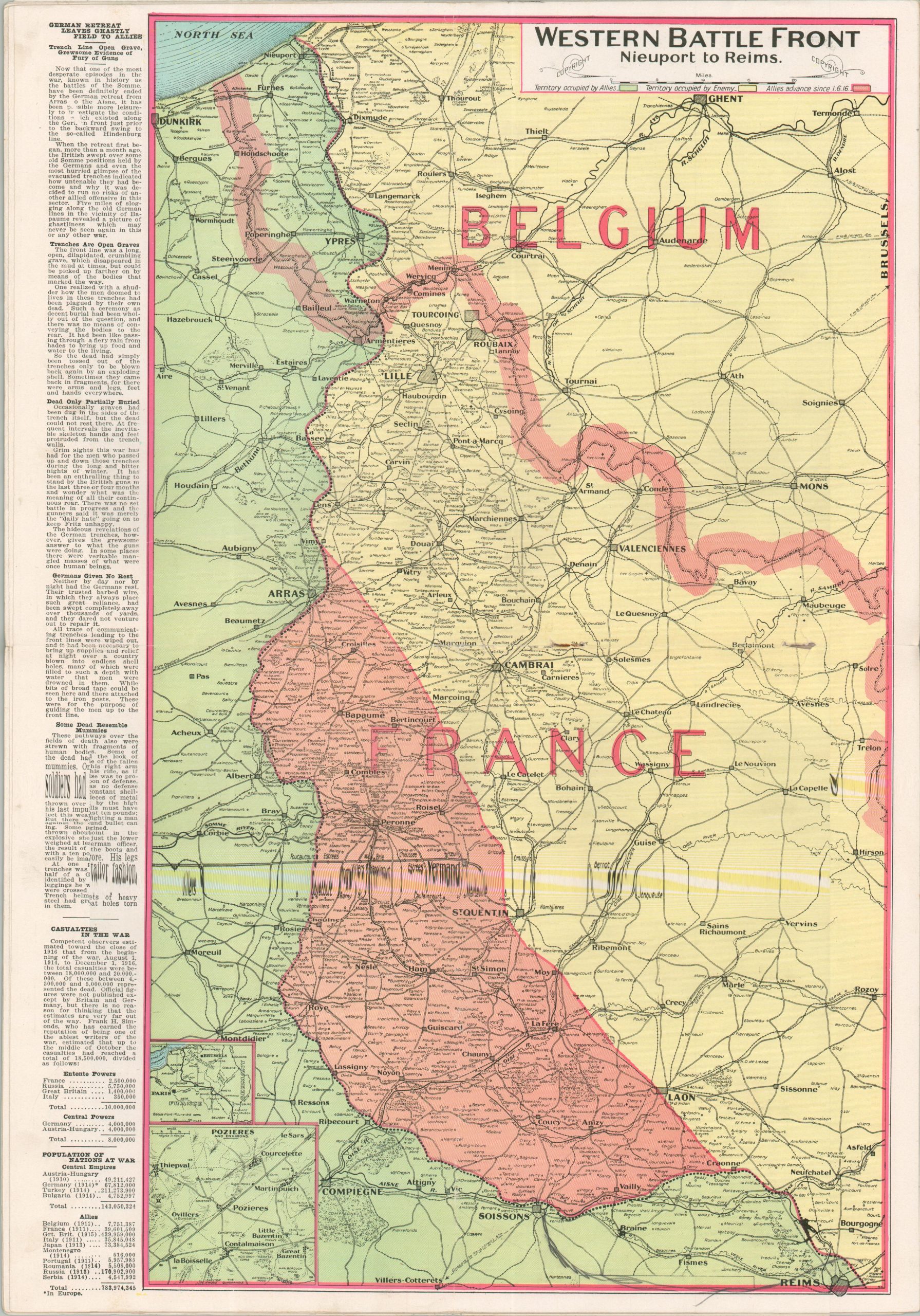
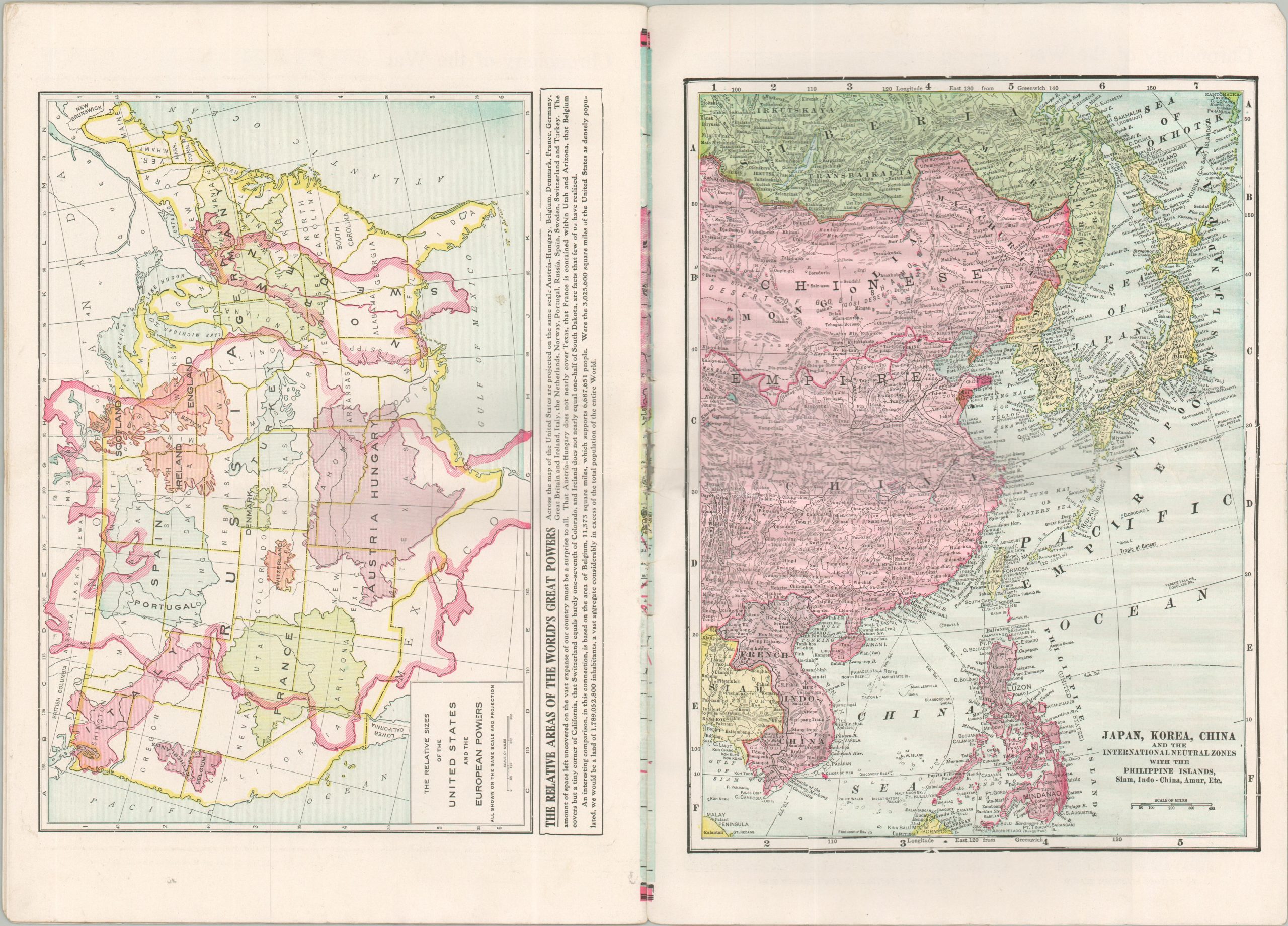
This fascinating World War I atlas was published by the Geographical Publishing Company of New York in early 1917, shortly after President Woodrow Wilson signed an official declaration of war against Germany. Color maps (some double-page) of major battlefields and theaters of war, portraits of important figures, and photographs of battle scenes offer a lively overview of the global conflict, which had been waging for nearly three years. Of notable interest is a map showing the relative sizes of the European powers in comparison to the United States that grossly underestimates the size of the Russian Empire.
Map Details
Publication Date: 1917
Author: Geographical Publishing Company
Sheet Width (in): 10.50
Sheet Height (in): 14.90
Condition: B
Condition Description: 32 pp. atlas with stapled binding and illustrated paper wraps. Heavy wear along the spine, with old tape repairs that are confined to the margins. About good condition overall.
$85.00
1 in stock