The World’s Fair of 1940 in New York
$40.00
The second year of the ‘World of Tomorrow.’
1 in stock
Description
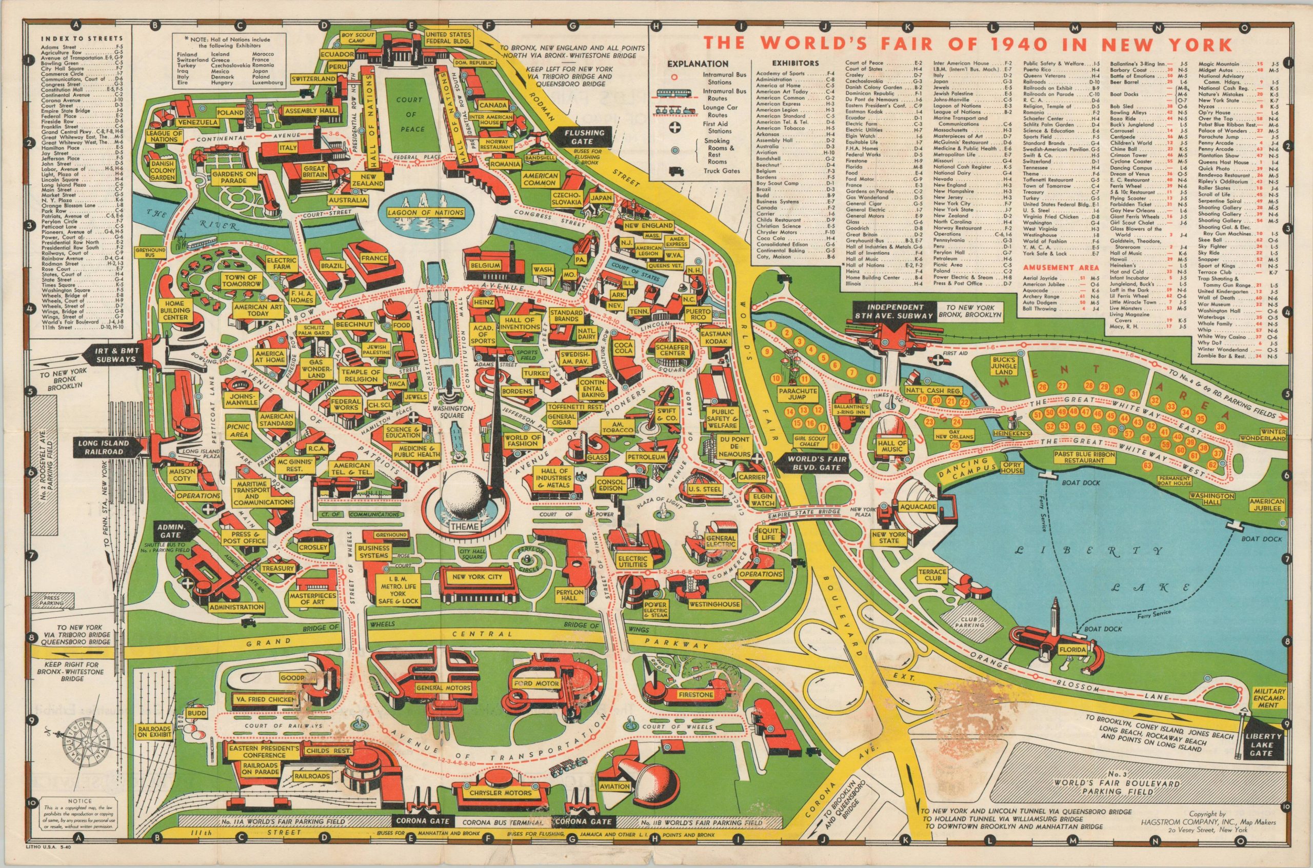
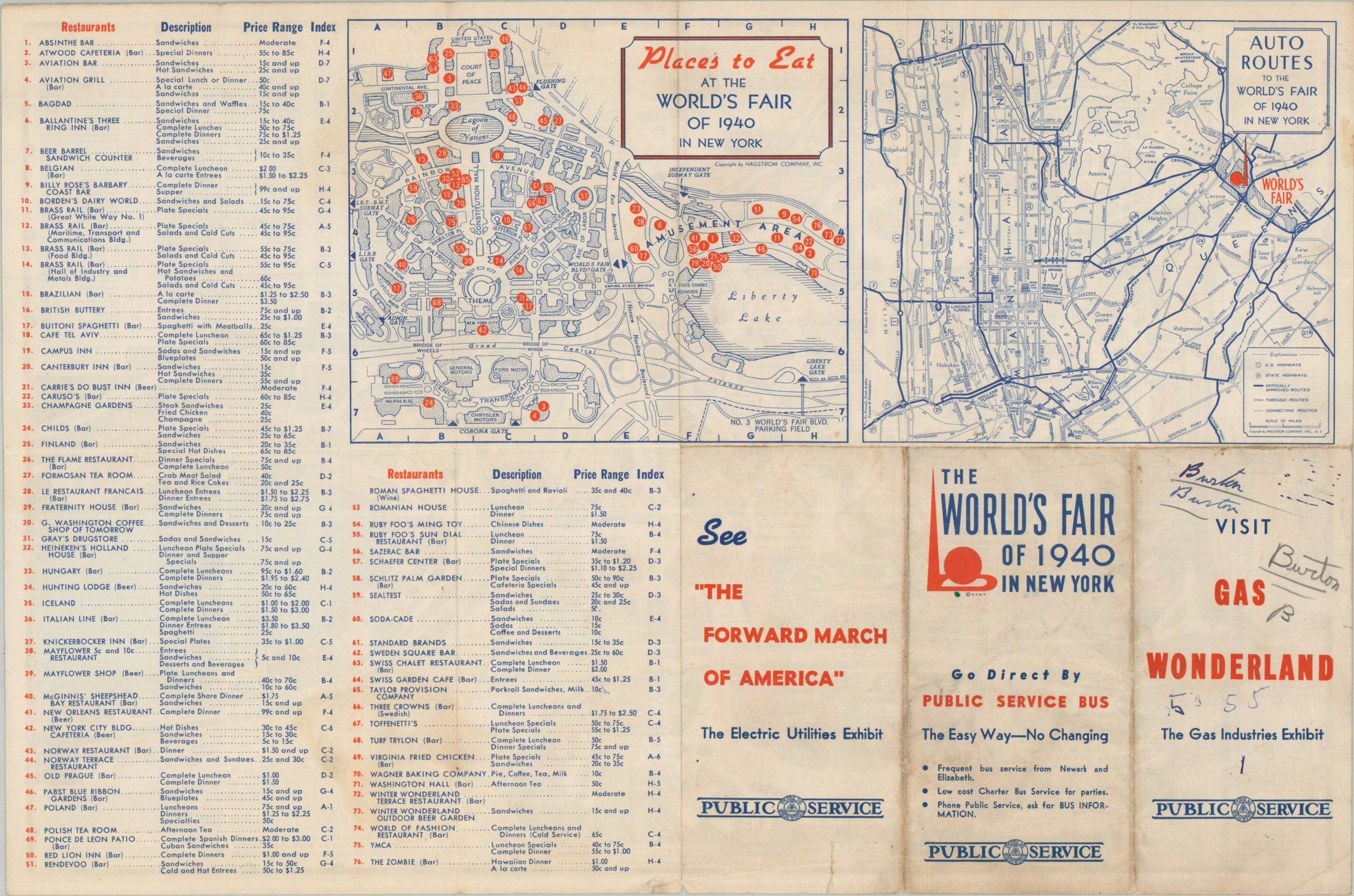
This colorful aerial perspective, oriented with east at the top, shows the grounds of the 1940 New York World’s Fair. Dozens of exhibits, galleries, and amusements are outlined and labeled, dominated by the distinctive outlines of the Trylon and Perisphere in the center. Other notable attractions include the Hall of Nations (adjacent to the Court of Peace), Liberty Lake, and the Avenue of Transportation. Two maps on the verso identify places to eat at the World’s Fair (with corresponding index and price range) and the primary auto routes to the fairgrounds.
The 1939 New York World’s Fair, with the theme “The World of Tomorrow,” was a major international exhibition held at Flushing Meadows. Designed to look forward to a better future after the Great Depression, the fair showcased technological innovations like television and the Futurama exhibit. Despite its optimistic vision, the fair’s second season was overshadowed by the outbreak of World War II in Europe, which led to lower attendance and a somber mood.
Map Details
Publication Date: 1940
Author: Hagstrom Map Company
Sheet Width (in): 16.4
Sheet Height (in): 10.9
Condition: B
Condition Description: Double-sided pocket map, creased along original folds. A half-dollar sized spot of old adhesive residue in the lower right corner (see scan) and moderate wear along the lower edge of the sheet. Fair to good condition overall.
$40.00
1 in stock