
The World Prepared Especially for the National Geographic Magazine
$195.00
Mapping a world in transition.
1 in stock
Description
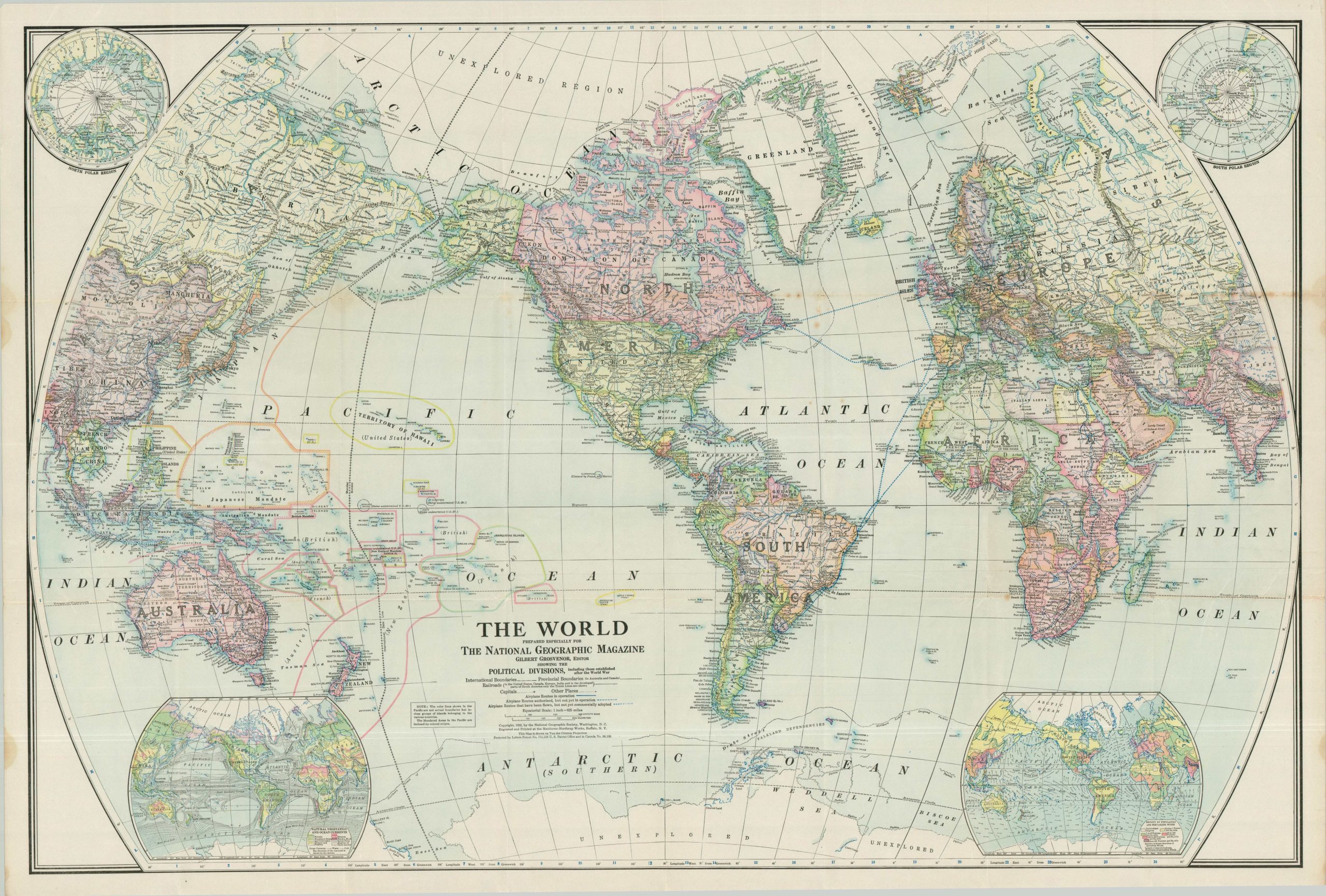
This detailed map was published in 1922 by the National Geographic Society – an example of the first supplemental world map ever published by the in-house cartography department (established in 1915). To avoid the distortions of Mercator, a cutting-edge projection developed by Alphons J. van der Grinten was used to depict global geography. Vibrant lithographed color (using the offset technique) is used to highlight political divisions, including the distinctive pink hue of the British Empire at its territorial height.
Other elements of contemporary interest include the novel presentation of aviation routes, newly defined nations across Europe (due to the 1919 Treaty of Versailles), and the impending territorial conflicts in the South Pacific. Russia has not yet adopted the title of the U.S.S.R., Ireland remains a united island, and the Ottoman Empire has totally vanished. Insets in each corner show the polar regions, plus maps of natural vegetation and ocean currents (lower left) and population density and prevailing winds (lower right).
Map Details
Publication Date: 1922
Author: National Geographic Society
Sheet Width (in): 40.75
Sheet Height (in): 28.40
Condition: B+
Condition Description: Color lithographed map on a single-sided sheet of thin paper. Sharply creased along old folds, with some resultant splits and separation at fold intersections, plus discoloration in the upper right. Some staining in the left margin, scattered wrinkles and foxing. Good condition overall.
$195.00
1 in stock