
The World on Mercator’s Projection
$85.00
The world of the early 19th century.
1 in stock
Description
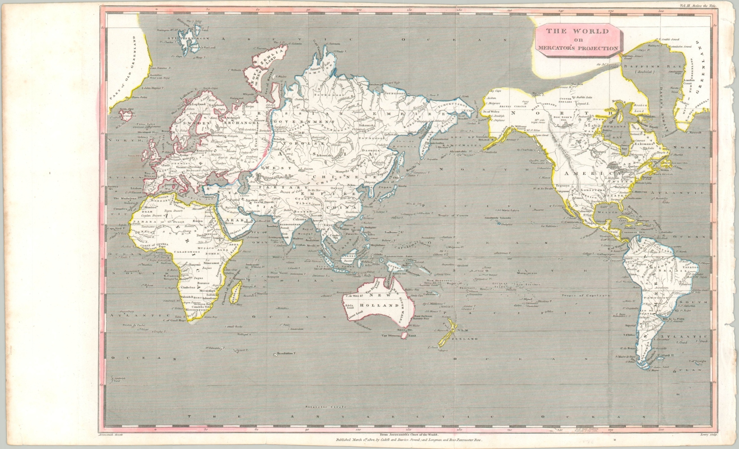
This interesting map of the world showcases the continental outlines on the now-ubiquitous Mercator’s Projection. The distortion in the upper latitude is evident with the expansion of Greenland, divided into Old and New sections, in the upper corners of the sheet.
The image presents a wonderful mix of geographic discovery and cartographic myth. Near Baffin’s Bay (marked doubtful) can be seen a clear entrance to a speculative Northwest Passage via Lancaster Sound. Two Grand Islands are labeled close to one another in the South Atlantic and other ‘phantom’ islands include Saxonburg (South Atlantic), Company (north of Japan), and María de Lajara (north of Hawaii).
Despite the fictitious content, the cartographer did include details from the latest voyages of discovery including Cook, Flinders, Mackenzie, Vancouver, and others. Designed by Aaron Arrowsmith, engraved by Lowry, and published in London by Caddell and Davis in 1802.
Map Details
Publication Date: 1802
Author: Aaron Arrowsmith
Sheet Width (in): 17
Sheet Height (in): 10.25
Condition: A
Condition Description: Faint creasing along former fold lines and light wear along the outer edges of the sheet. Slightly narrowed margins. Modern hand color.
$85.00
1 in stock