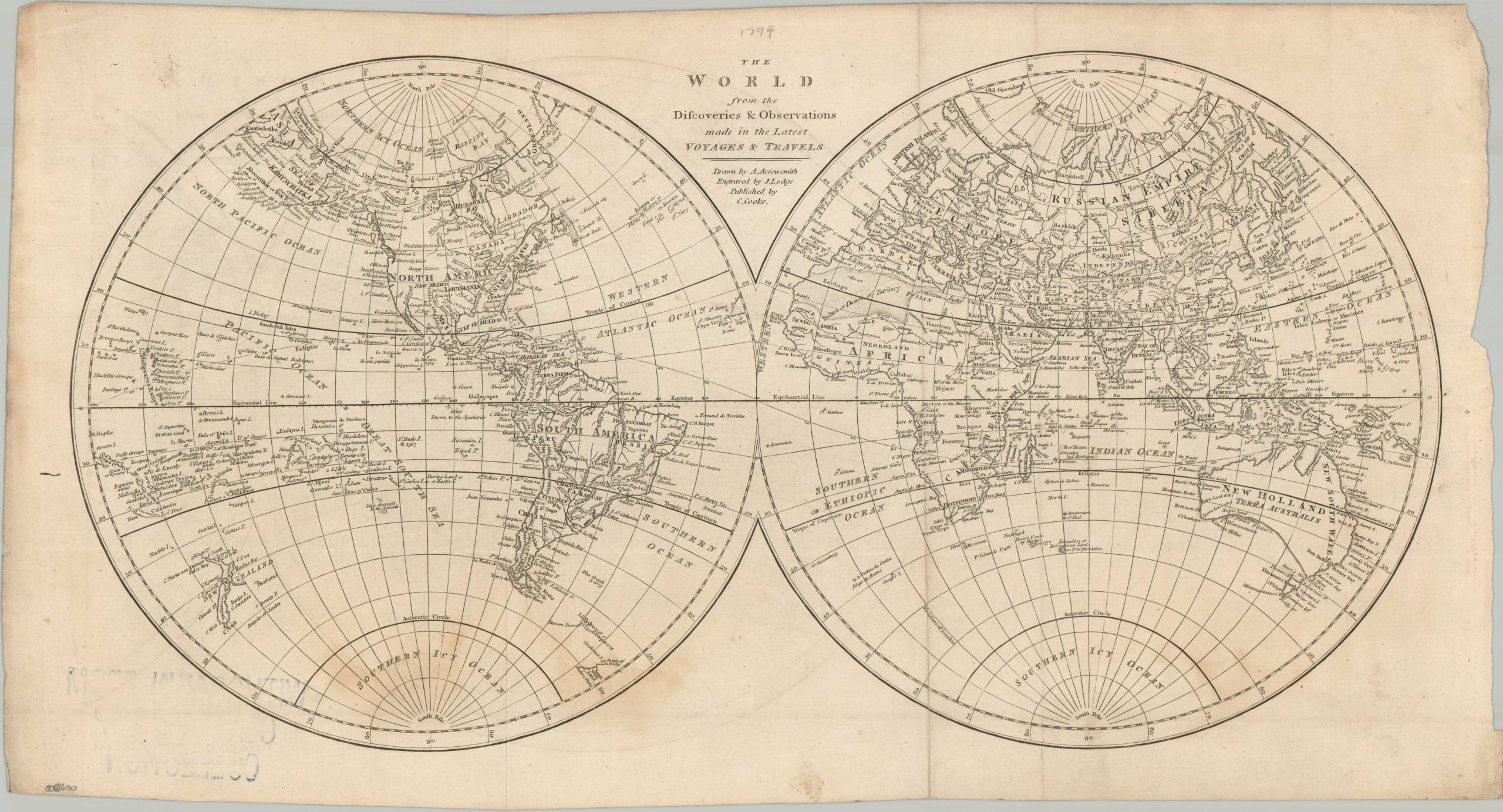
The World from the Discoveries & Observations made in the Latest Voyages & Travels
$145.00
Revealing Cook’s discoveries near the end of the 18th century.
1 in stock
Description
This double-hemisphere world map is a fascinating example of the ‘Scientific Era’ of British cartography. Published in London by Charles Cooke around 1800, it features the work of Aaron Arrowsmith, arguably the most influential cartographer of the period. Arrowsmith was famous for his “zero-tolerance” policy regarding geographic myths; if a coastline hadn’t been verified by a modern navigator like Captain Cook or George Vancouver, Arrowsmith often left it blank or noted it as uncertain.
An engaging variety of features is depicted throughout the image, finely engraved by John Lodge. The discoveries from the three voyages of James Cook have been incorporated throughout the Pacific. Gaps in the Pacific Northwest and Arctic Circle were gradually being filled in, though much of Africa’s interior remains blank. A large Southern Icy Ocean presents a tempting target for future exploration.
Map Details
Publication Date: c. 1800
Author: Aaron Arrowsmith
Sheet Width (in): 18.75
Sheet Height (in): 10.20
Condition: B
Condition Description: Ex-libris from Stanford University, with a withdrawn stamp on the verso that bleeds into the lower right. Creasing along former folds, minor offsetting, and scattered foxing along the lower half of the sheet. About good condition overall.
$145.00
1 in stock