
The United States of America
Transitioning from the West to the Midwest.
Out of stock
Description
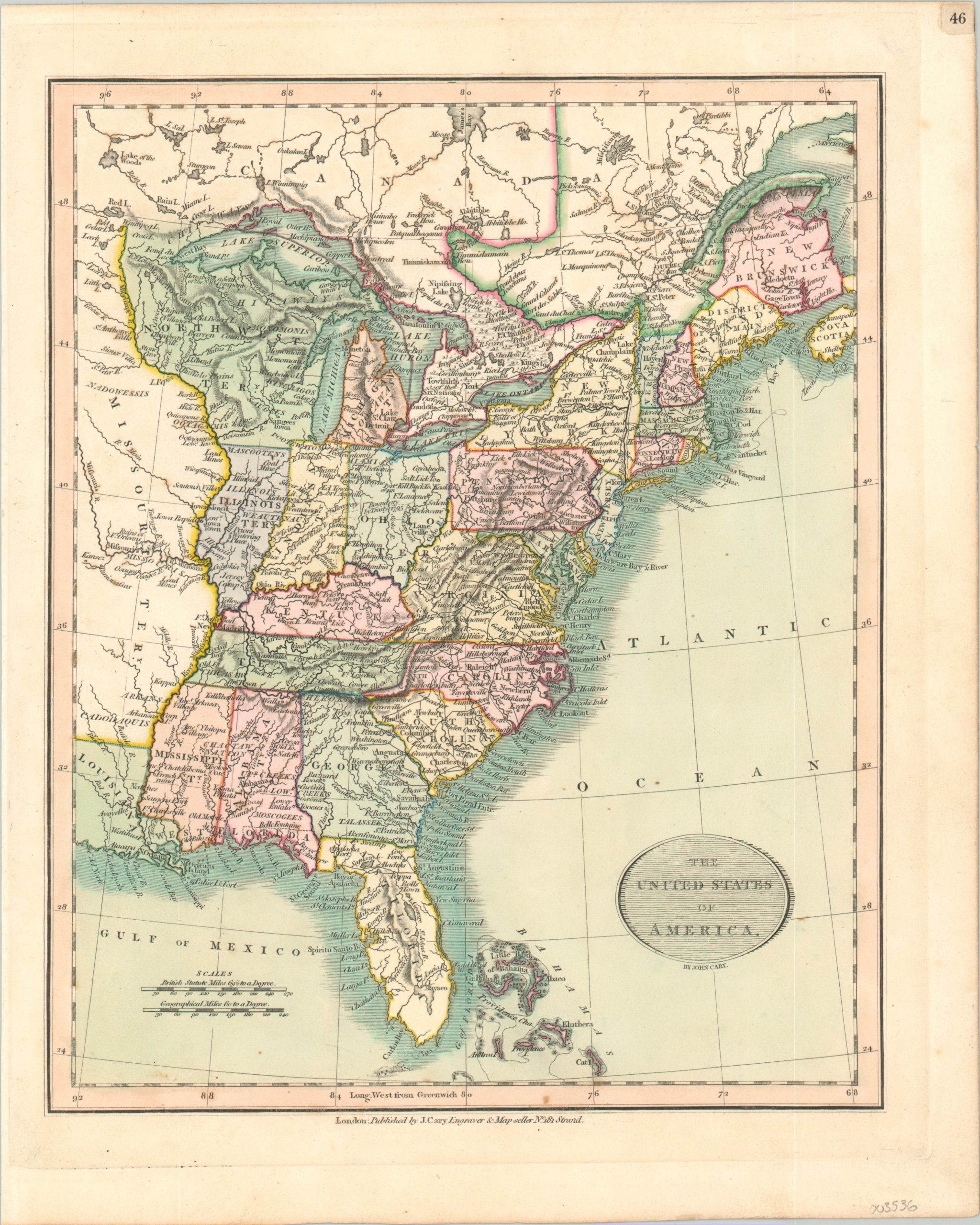
This attractive and detailed map of the United States vividly captures a brief window in the first two decades of the 19th century. Louisiana is the newest state, having been admitted to the Union in 1812, but the rest of the South retains early territorial outlines, in addition to the claims of Spanish Florida.
The Northwest Territory is beginning to fill in with the outlines of the Michigan, Indiana, and Illinois Territories, though a huge Missouri Territory still extends over nearly everything west of the Mississippi River. Geographic features, early American settlements, Native American tribes, and even prominent local industries are labeled across the map.
Published in London by John Cary as part of the 1819 edition of his New Universal Atlas. Described by Rumsey as “a fine atlas, one of the best of the period and a source for American mapmakers.”
Map Details
Publication Date: 1819
Author: John Cary
Sheet Width (in): 10.25
Sheet Height (in): 12.75
Condition: A
Condition Description: One tiny spot just inside the neatline at the bottom of the page, otherwise in near fine condition.
Out of stock