The United States from the Latest Authorities
$295.00
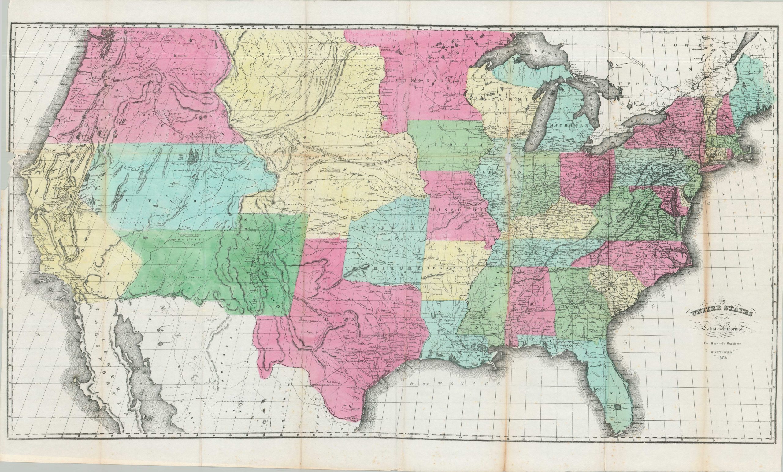
A striking hand colored map of the United States in the early 1850s.
1 in stock
Description
This map of the United States was published in Hartford by Case, Tiffany & Co. for the 1853 edition of Hayward’s Gazetteer. It provides a clear record of the American West during a period of rapid territorial change. The state of California is prominently featured alongside the massive territories of Utah, New Mexico, Oregon, and Washington. Of particular note is the expansive Nebraska Territory, which at this time covered much of the central plains prior to the Kansas-Nebraska Act of 1854.
The engraving identifies a growing network of railroads, post roads, and canals that supported westward migration in the decade before the Civil War. In the Trans-Mississippi West, the map delineates the established Oregon and Santa Fe Trails, as well as the strategic military routes blazed by John C. Frémont and Stephen W. Kearny. These paths served as the primary conduits for both civilian settlers and the U.S. Army during the mid-19th century. Because the map was designed to be folded into a reference book, the sheet typically displays the original publisher’s folds. The geography reflects the “Latest Authorities” of 1853, notably predating the Gadsden Purchase, which would later alter the southern border of New Mexico.
Map Details
Publication Date: 1853
Author: John Hayward
Sheet Width (in): 39.50
Sheet Height (in): 24.00
Condition: B
Condition Description: Stone engraved map on a thin sheet of paper with full original hand color. Heavily creased, toned, and worn along original folds, with several repaired splits and tears. Some image loss as a result, the worst through the center of Illinois.
$295.00
1 in stock