The United States at War
$145.00
An interesting and uncommon wartime production by the Canadian Stanley Turner.
1 in stock
Description
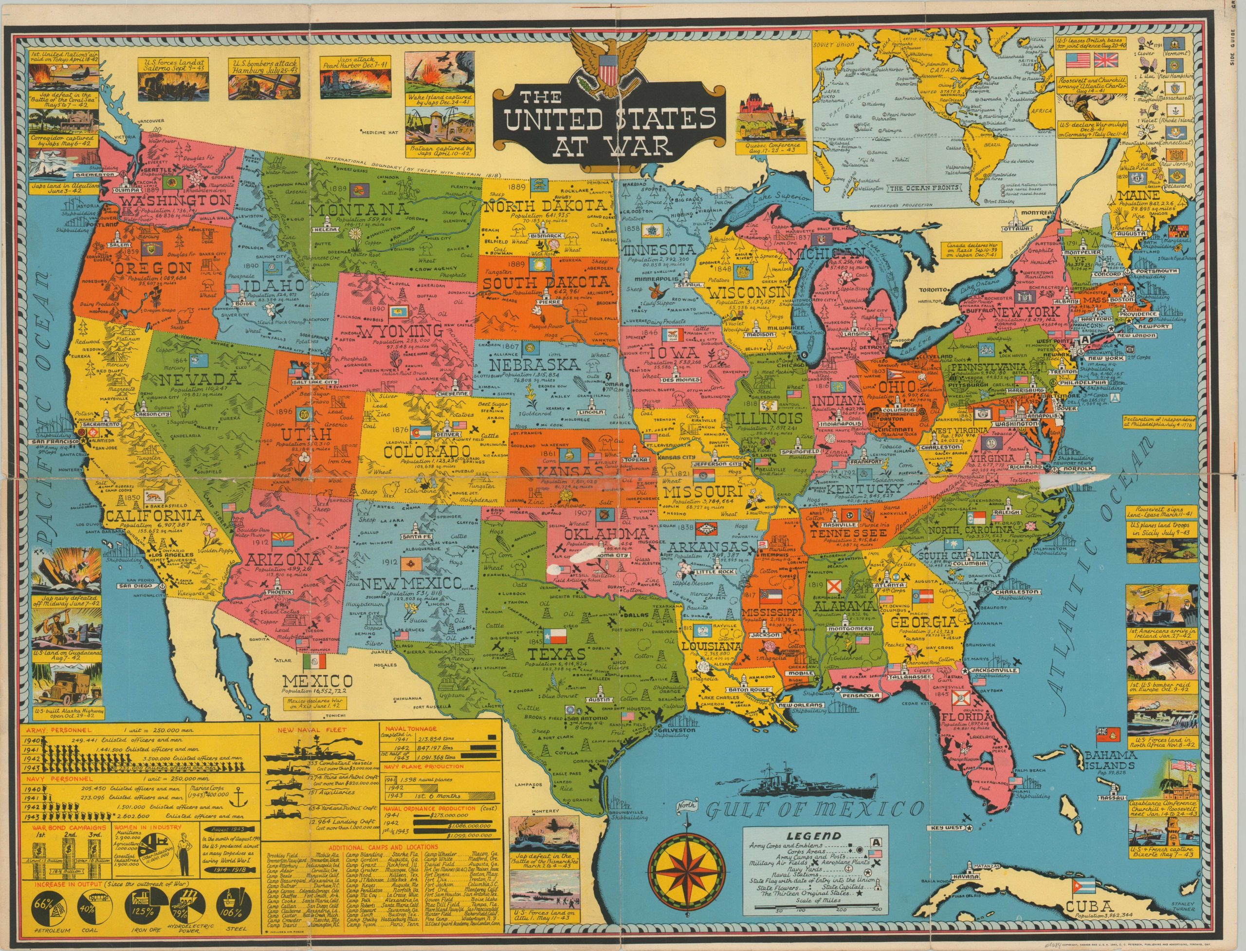
This vibrant pictorial map of the United States was designed by Stanley Turner and copyrighted in 1943 by the C.C. Petersen Advertising Firm. It is one of the numerous wartime publications issued by the pair, the most common of which were marketed as Dated Events War Maps and encompassed nearly 30 different editions. This is one of the scarcer productions, emphasizing America at war.
The contiguous 48 states are shown in bright colors with their respective flags. Vignettes and symbols highlight strategic resources, military facilities, and state flowers. Dated scenes along the edges of the sheet showcase many of the major events of the conflict, with a table in the lower left highlighting the extreme growth in the size of the U.S. military. A black-and-white strategic map of the world, designed in a similar style, is provided on the verso. For more information on Dated Events War Maps, check out my blog post here.
Map Details
Publication Date: 1943
Author: Stanley Turner
Sheet Width (in): 26.5
Sheet Height (in): 20.4
Condition: B-
Condition Description: A large chip along the horizontal fold, off the coast of North Carolina, has resulted in some minor image loss. Some surface abrasion in Oklahoma also resulting in minor image loss. Moderate wear elsewhere along folds, with several areas of separation repaired with old tape. Between fair and good condition overall.
$145.00
1 in stock