The Underground Water Resources of the Coastal Plain Province of Virginia
$95.00
Bulletin 5 of the Virginia Geological Survey.
1 in stock


Description
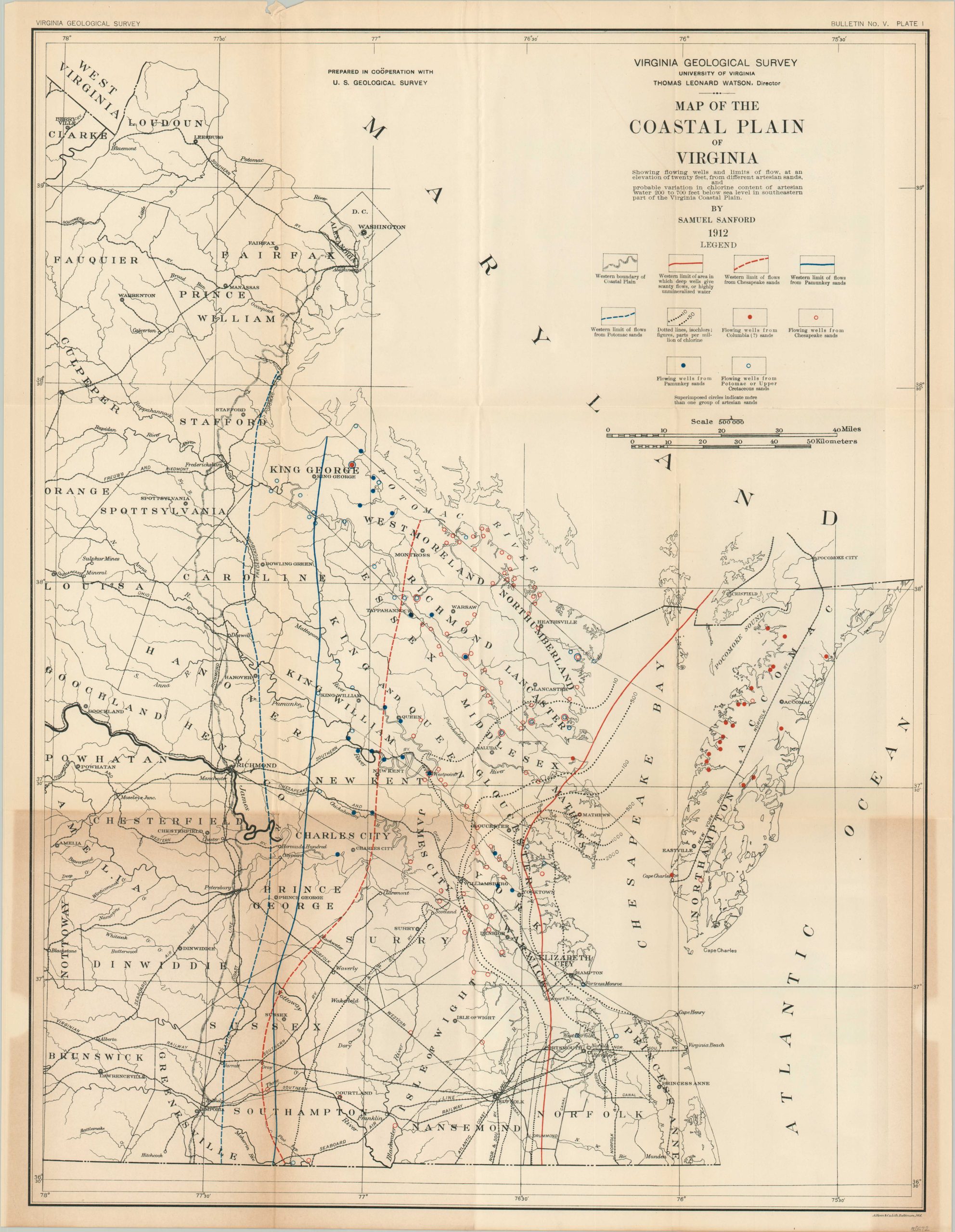
“This report deals with an investigation of the underground waters of the Coastal Plain Province of Virginia, a tract of country some 9,500 square miles in extent, which roughly corresponds with what has been known since Colonial times as Tidewater Virginia. The purposes of the investigation were to continue the study, begun by Darton, of the artesian waters of the Coastal Plain, and to examine the waters obtainable by open wells.” – Preface
This exhaustive scientific publication was compiled by the Virginia Geological Survey. It not only offers an in-depth look at the available water resources in Tidewater Virginia, but also an explanation of sedimentary deposits, risks of water-borne diseases, and recommendations on the recovery of water.
Test results and cross-sections are illustrated with tables and folding diagrams. A pocket in the back contains a fold-out map titled Map of the Coastal Plain of Virginia that notes the locations of wells and outlines of their respective sources.
Map Details
Publication Date: 1913
Author: Samuel Sanford
Sheet Width (in): 10.25
Sheet Height (in): 7
Condition: A-
Condition Description: Ex-Libris from the Carleton College Library, with a bookplate and embossed stamp on the title page. 362 pp. bound with glue to original grey paper wraps. Includes 2 folding charts and a map in the back pocket (toned in the lower right). Very good condition overall.
$95.00
1 in stock