The Trails of Illinois
$125.00
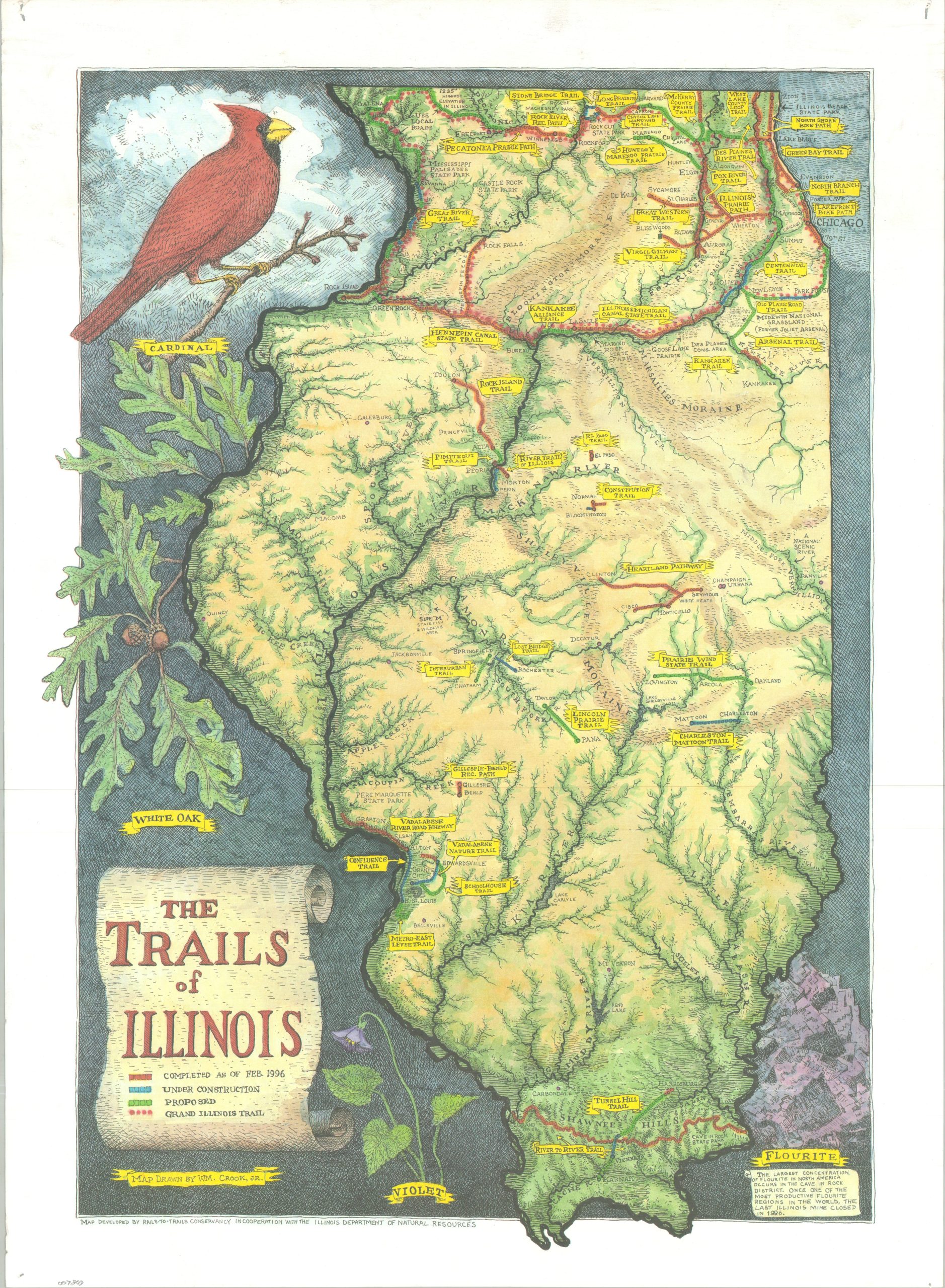
A ‘green’ map of the hiking and biking trails across Illinois during the mid-1990s.
1 in stock
Description
This lovely illustrated map of Illinois was drawn by William Crook, Jr. and published in 1996 by the Rails-to-Trails Conservancy, in cooperation with the Illinois Department of Natural Resources. The image presents a verdant overview of the primary Illinois watersheds, with red, blue, and green routes indicating completed, under construction, and proposed trails, respectively. Specific segments are named throughout, including the Illinois Prairie Path and the Lakefront Bike Path.
The negative spaces are filled with symbols of the Land of Lincoln, including the state bird (cardinal), tree (white oak), flower (violet), and gemstone (fluorite). The last is relevant, as the final operating Illinois fluorite mine closed the same year as printing.
Map Details
Publication Date: 1996
Author: William Crook, Jr.
Sheet Width (in): 18.25
Sheet Height (in): 25.00
Condition: B+
Condition Description: Color printed map on a single-sided sheet of nice textured paper. A bit of light wrinkling where previously rolled, pinholes in each corner, and scattered soiling in the margins. Good to very good condition overall.
$125.00
1 in stock