The Trail of Lewis and Clark 1804 – 1806
Original price was: $150.00.$95.00Current price is: $95.00.
Pictorial celebration of America’s greatest western explorers.
1 in stock
Description
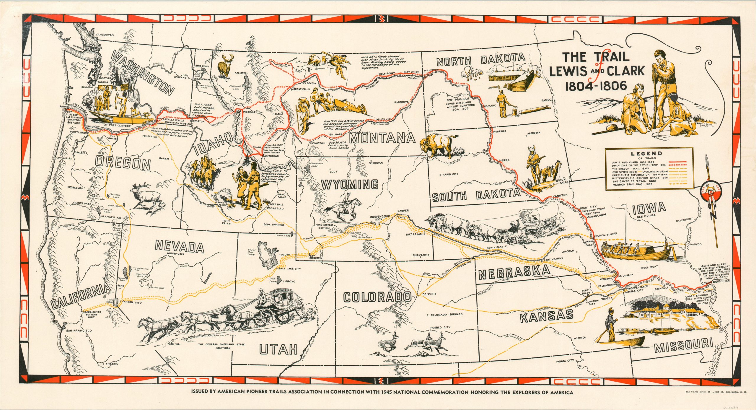
Though the title refers to the trail of only one of America’s greatest exploring expeditions, in reality the map shows the routes undertaken by numerous parties and individuals across the western United States. Fremont’s Explorations, the Pony Express, Oregon, Mormon and Sante Fe Trails are all shown according to the accompanying legend, while numerous illustrations throughout provide a vivid sense of the spirit of adventure associated with this period of discovery and settlement. Major landmarks along each route are noted, but the idealized vignettes, simple topography, and brief annotations do little to provide a true sense of the hardships experienced by those celebrated within the image.
The map was published in 1945 by the Pioneer Trails Association and printed in Manchester, New Hampshire by The Clarke Press. Based on the design of other similar maps, the artwork was provided by Irvin ‘Shorty’ Shope, though the image is unsigned.
Map Details
Publication Date: 1945
Author: American Pioneer Trails Association
Sheet Width (in): 30.40
Sheet Height (in): 16.30
Condition: A
Condition Description: A bit of wear along the outer edges, but in near fine shape overall.
Original price was: $150.00.$95.00Current price is: $95.00.
1 in stock