The Tourist’s Pocket Map of the State of Indiana
$225.00
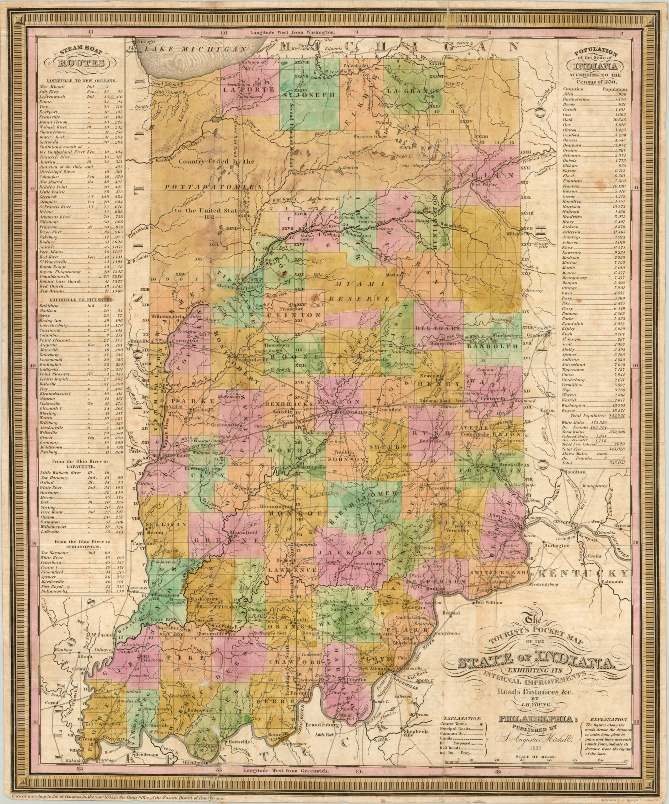
Early map of Indiana showing the state near the end of the Midwestern frontier period.
1 in stock
Description
As explained by the title, this map was designed for tourists, settlers and immigrants looking to leave behind the bustle of the eastern seaboard and stretch their legs in the new states created as part of the Northwestern Territory. Indiana was declared a state over 15 years prior to publication, in 1816, but a keen eye can spot a wide swath of territory in the north that was ceded by the Pottawatomie in 1832.
Other details allude to the frontier nature of the state at the time of publication, including Indian reserves, villages and agencies, old forts, and scattered settlements. During this period, John Chapman was roaming the Midwestern states and founding the nurseries that would earn him his famous moniker as Johnny Appleseed.
Change is on the horizon, however. Proposed railroads, canals, and steamboat routes reflect the enormous change in transportation wrought by the Industrial Revolution, while tables listing population (both free and slave) allude to the upcoming war over liberty and freedom. A fledgling Chicago can be seen along the shores of Lake Michigan – 1833 was the year it was incorporated as a town. A fascinating piece of history for any Hoosier!
Map Details
Publication Date: 1833
Author: S.A. Mitchell
Sheet Width (in): 12.75
Sheet Height (in): 15.75
Condition: B-
Condition Description: The map has been professionally restored and reinforced, but remains soiled. Minor edge tears have been repaired on the verso, but several spots remain where the image is missing. Disbound from original gilt red cloth boards. A very presentable copy.
$225.00
1 in stock