The Strategical Record Map of the Western Front 1914-1918
$185.00
‘Illustrated by a Large Scale Coloured Map & Numerous Official Photographs’ – Front cover
1 in stock

Description
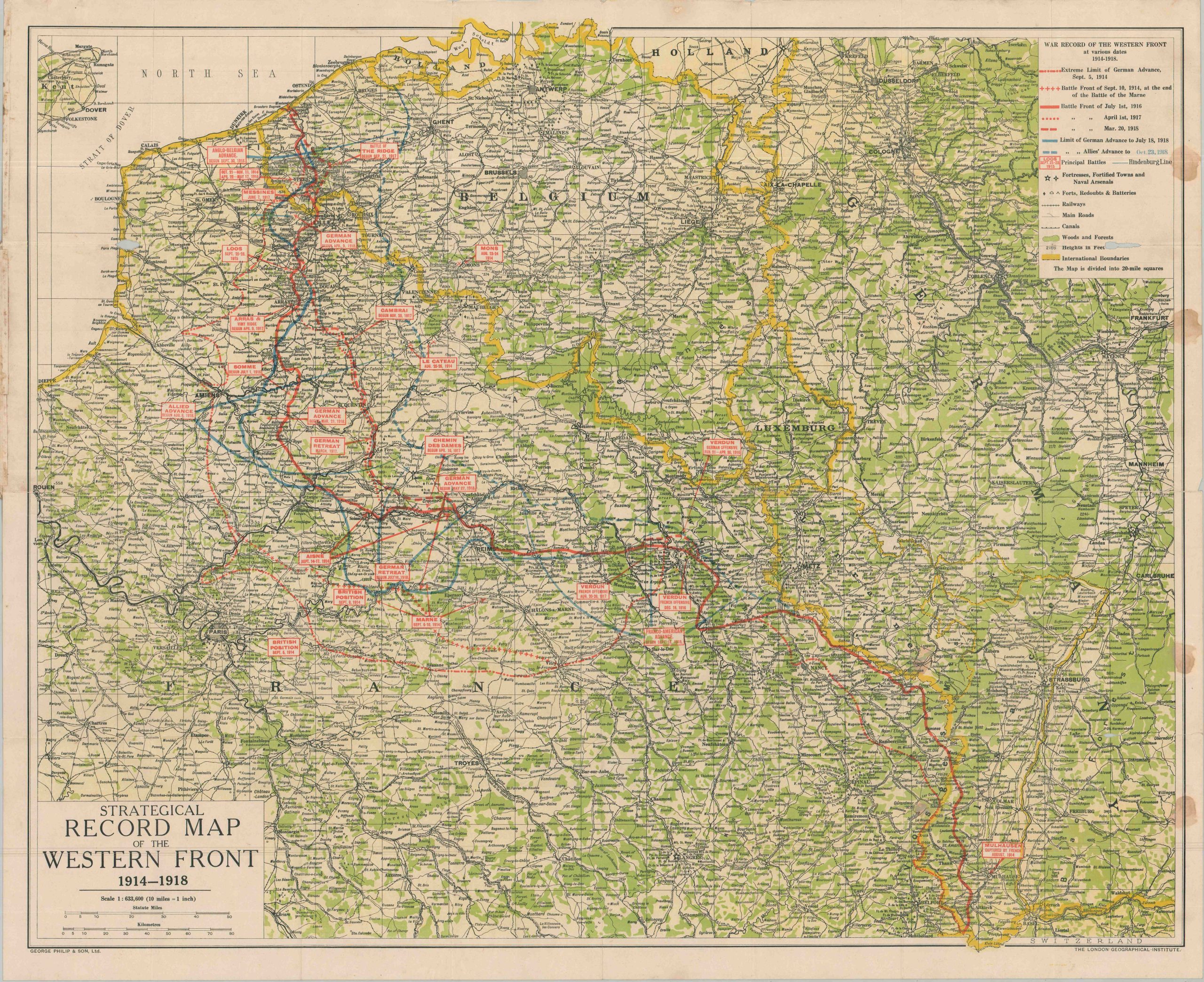
This striking map of the Western Front near the end of World War I was published in London by George Philip & Son, Ltd to inform an eager public about the latest happenings in the ongoing conflict. Fortresses, forts, and transportation routes are noted around labeled and dated battle sites, with the earliest at Mons (August 1914) and the latest counterattacks on two fronts in late September, 1918.
A series of carefully overprinted blue and red lines chronicles the ebb and flow of the catastrophe, ending with the Allies’ advance (still in France) as of October 23, 1918. Just a few weeks later, fighting would mercifully end across all fronts. Photographs on the verso of the sheet show scenes of battle and use illustrations of German medals to present a sympathetic narrative about the outbreak of the war.
Map Details
Publication Date: 1918
Author: George Philip & Son, Ltd.
Sheet Width (in): 35.75
Sheet Height (in): 29.75
Condition: B
Condition Description: Double-sided map affixed to original brown paper wraps, heavily soiled with old repairs on the spine. Printed on thick paper that's creased and worn along folds, with a few small splits repaired on the verso with archival tape. Minor image loss in the upper corners (see the bottom of the legend) and four spots of staining evenly space on the right side.
$185.00
1 in stock