
The Route of the Ninth Division Thru the NATOUSA & ETOUSA Nov 8, 1942 – June 1945
From among the first in Africa to the last in Europe – the 9th Infantry Division during World War II.
Out of stock
Description
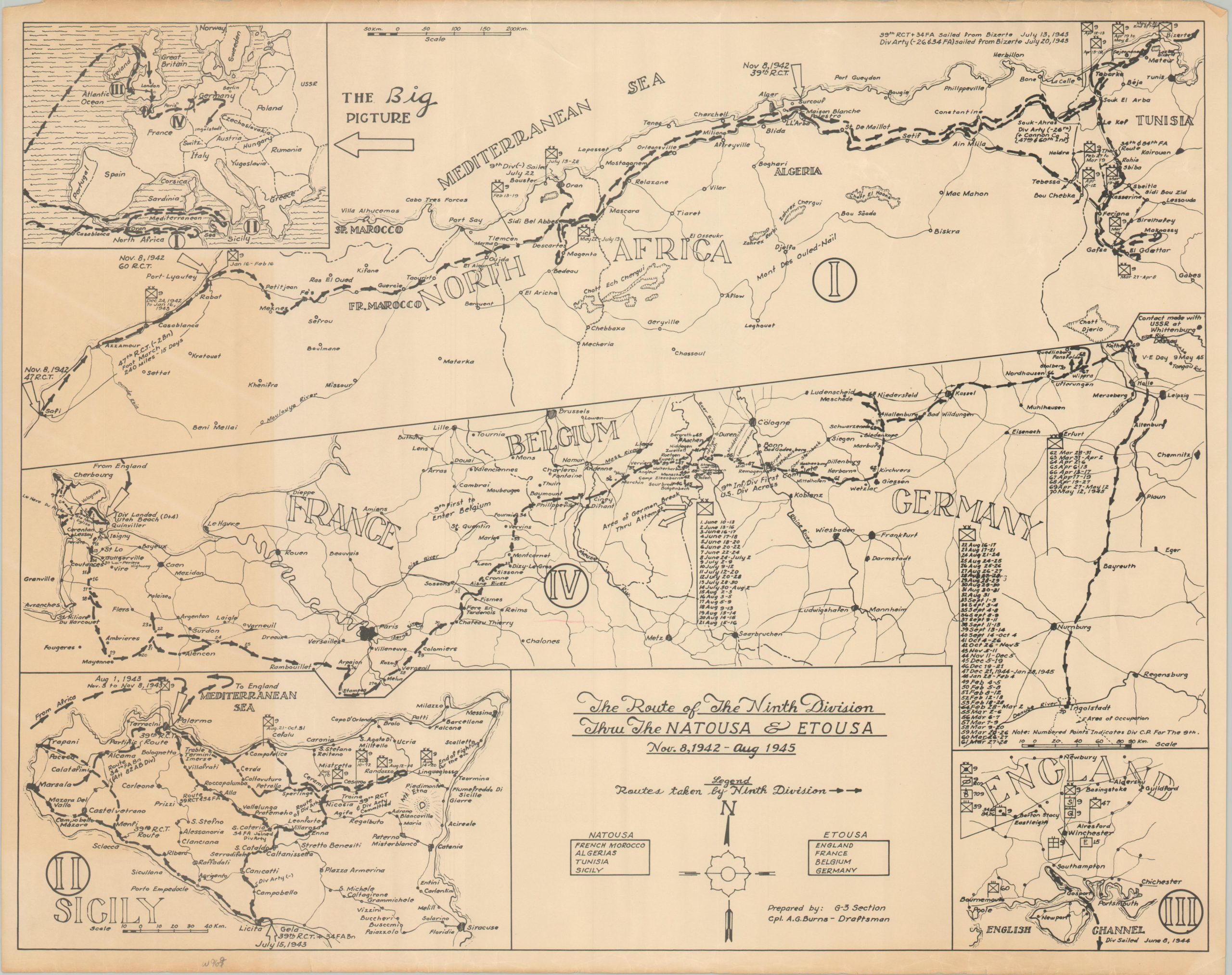
This tremendous compilation of four numbered maps documents the extensive efforts of the 9th Infantry Division to defeat Axis forces and liberate Europe during the Second World War. ‘The Big Picture’ in the upper left offers a visual key for the campaign across two continents. Chronologically, the story begins at the top of the sheet, with the 39th Infantry Regiment’s landing on the shores of Algiers on November 8, 1942.
The division continued to support the conquest of North Africa and was eventually sent to Italy, landing on Sicily in August of 1943 (shown in map 2, lower left). Retraining in England (map 3, lower right) was followed by landing on the shores of Normandy at Utah Beach on D-Day +4 (June 10, 1944). The march through France and Belgium into Germany can be seen in the center image, #4, and includes the notable achievement of being the first complete U.S. division across the Rhine River, crossing near Remagen in early March.
The map was designed by Cpl. A.G. Burns, prepared by the G-3 Section and published in Germany in 1945. One of at least three different variants issued as commemorative souvenirs for members of the unit.
Map Details
Publication Date: 1945
Author: Cpl. A.G. Burns
Sheet Width (in): 22.75
Sheet Height (in): 18
Condition: B+
Condition Description: Moderately toned along a 4" strip on the left side of the sheet (see scan). Light edge wear including small tears, creased corners, and some discoloration. Good condition overall. Blank on verso.
Out of stock