
The Road from Bristoll to Worcester
$200.00
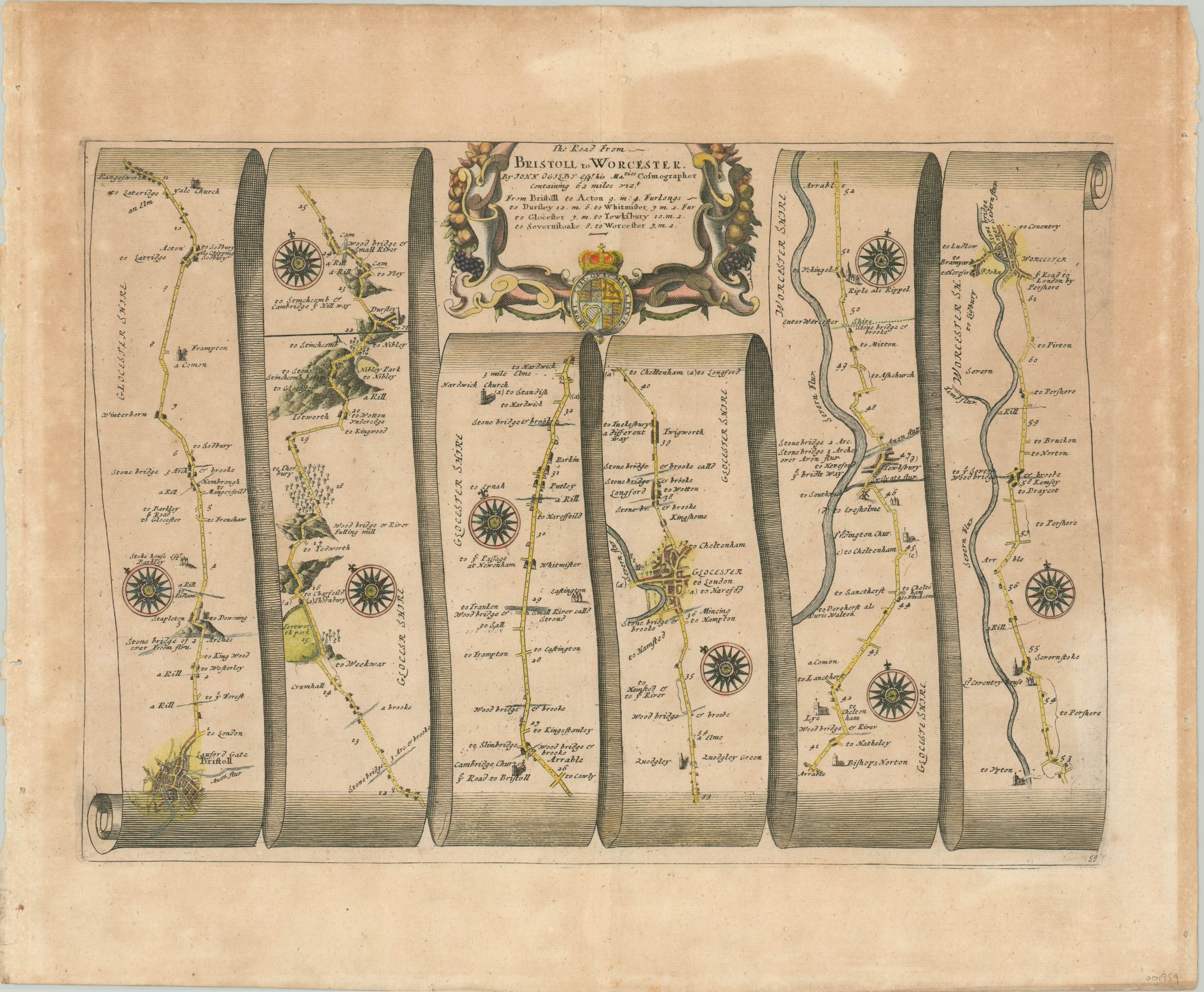
Ogilby’s strip map showing the route from Bristol to Worcester.
1 in stock
Description
While strip-style road maps had existed long before John Ogilby, the Scottish cartographer was the first to popularize their use for land travel through the publication of his atlas Brittania, first issued in 1675. It included 100 maps of British roads, created at a uniform scale of 1 inch to 1 mile. The large scale allows for the presentation of minute details like individual buildings, brooks and streams, bridges, windmills, ponds, signal beacons and estate halls.
Topography is depicted pictorially, with the hills situated according to whether the traveler was descending or ascending. All these details, as well as the compass roses on each strip, would have been of particular relevance to someone traveling by carriage, on horseback, or even by foot.
This particular example presents the path from Bristol to Worcester, on Britain’s southeast coast. The route begins in the lower left, proceeding to the top with mileage markers noted accordingly. The road continues through Glocester (center), crossing the River Severn, and ends in the upper right. As noted on the map, the intrepid traveler would cross stone bridges, see numerous country homes, estates and churches, and climb a few hills during the 61 mile journey. Several villages dot the road and would have provided food and lodging, albeit perhaps not in the most comfortable of circumstances!
Map Details
Publication Date: c. 1676
Author: John Ogilby
Sheet Width (in): 20.25
Sheet Height (in): 16.6
Condition: B+
Condition Description: Discoloration and faint matte burn in the margins and throughout portions of the image. Otherwise in good shape, with modern hand color.
$200.00
1 in stock