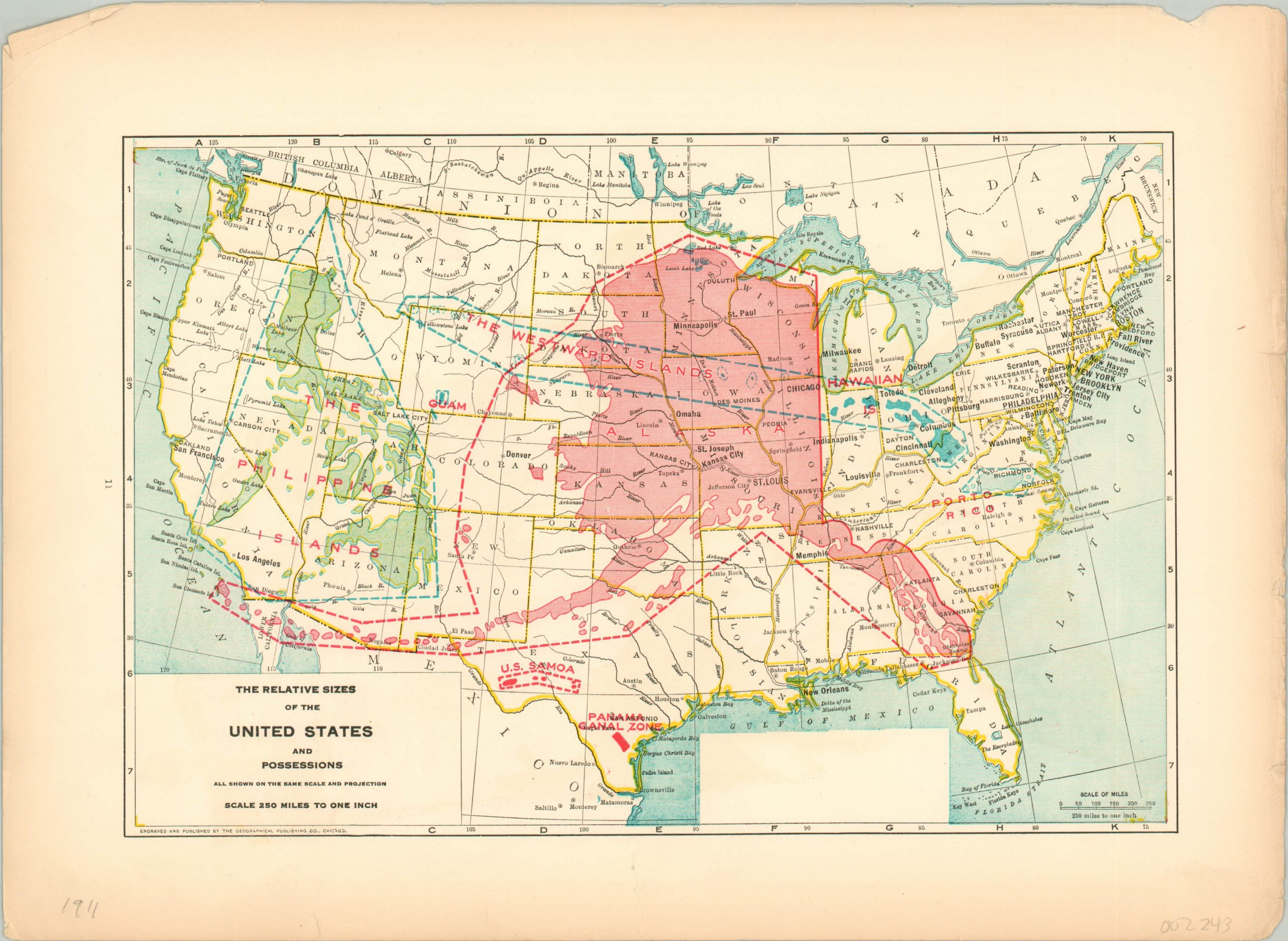
The Relative Sizes of the United States and Possessions
Visual comparison of America’s Empire in the early 20th century.
Out of stock

Description
Though everything may be bigger in Texas, this map of the United States embedded with its non-contiguous possessions highlights the geographic reality of Alaska’s immense size. Other overseas territories like the Philippines, Westward Islands, Puerto Rico, Samoa, Hawaii, and the Panama Canal Zone are also shown snugly within the continental borders.
The verso presents a vibrant overview of the topography across the United States, with various colors highlighting elevation change across land and sea. Published in Chicago in 1911 by the Geographical Publishing Company.
Map Details
Publication Date: 1911
Author: Geographical Publishing Company
Sheet Width (in): 14.60
Sheet Height (in): 10.60
Condition: B
Condition Description: Several tears along the outer edges, including one 2" tear that just touches the neatline (repaired on verso). Slight toning in the margins, but remains in good condition.
Out of stock