The Rand-McNally New Commercial Atlas Map of Chicago District
$90.00
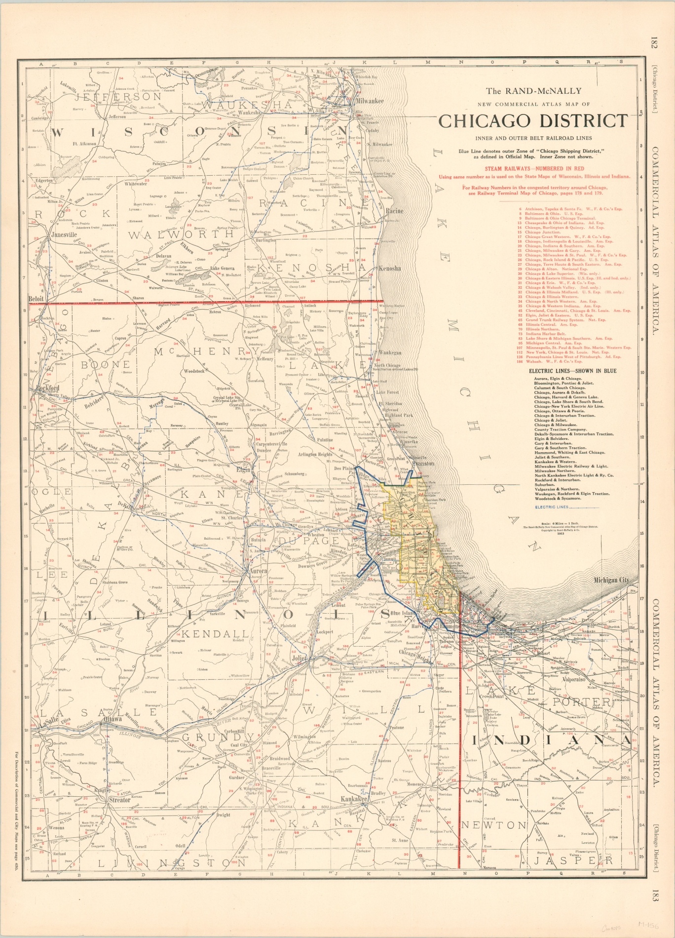
Pre-WWI railroad map of the Chicago District.
1 in stock
Description
Published the year prior to the outbreak of WWI in Europe, this map shows a detailed look at the transportation network beyond the Chicago Shipping District (heavy blue outline) in Illinois, Indiana, and Wisconsin. Steam railways are numbered in red and electric lines are shown in blue; both are labeled in the accompanying legends in the upper right.
Details within the district are focused on industries and locations related to transportation such as the Union Stockyards, depots, and belt (connecting) railways. The unique regional depiction highlights Chicago’s prominence and importance to regional rail and maritime commerce in the early 20th century.
Map Details
Publication Date: 1913
Author: Rand McNally
Sheet Width (in): 20.25
Sheet Height (in): 28
Condition: A
Condition Description: Lightly toned around the outer edges, consistent with age, and faintly creased along horizonal centerfold. Near fine.
$90.00
1 in stock