
The Prussian Government of Stralsund
$300.00
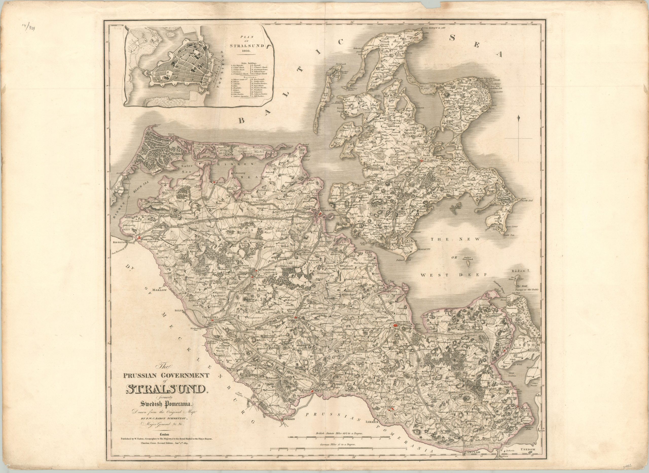
The Prussian territory of Stralsund just a few years after the Congress of Vienna redefined the borders of Europe.
1 in stock
Description
This fabulously detailed map covers a large territory along the coast of the Baltic Sea centered on the German city of Stralsund. It was published in London by William Faden in 1819, using an earlier map created by the Prussian military officer Baron Schmettau.
Less than five years prior to publication, the region was transferred from Swedish control to the kingdom of Prussia at the 1815 Congress of Vienna. Prior to that, it has a long history as a battleground as part of the territory of Pomerania and was an important theater in the Thirty Years’ War, Great Northern War, and Napoleonic Wars.
The image shows a comprehensive overview of the region, including its geographic composition and political organization. Fortified cities are connected by tree-lined roads that run through a hilly countryside, punctuated by small groves of trees and low-lying river valleys. These early ‘highways’ contrast sharply with the more rudimentary paths connecting the smaller towns, of which there are many. An inset in the upper left, dated 1803, shows a simple city plan of Stralsund with various public buildings and bastions identified within.
Map Details
Publication Date: 1819
Author: William Faden
Sheet Width (in): 32.3
Sheet Height (in): 23.2
Condition: B+
Condition Description: Moderate wear visible in the margins, including discoloration, wrinkling, and a few small chips along the top edge. The image shows minor scattered spotting and some faint discoloration in the lower left, near the title block. Between good and very good condition. A crisp impression on thick paper with original outline color.
$300.00
1 in stock