
The Prudential Map of Discovery and Exploration
Global summary of nearly a millennium of human exploration.
Out of stock
Description
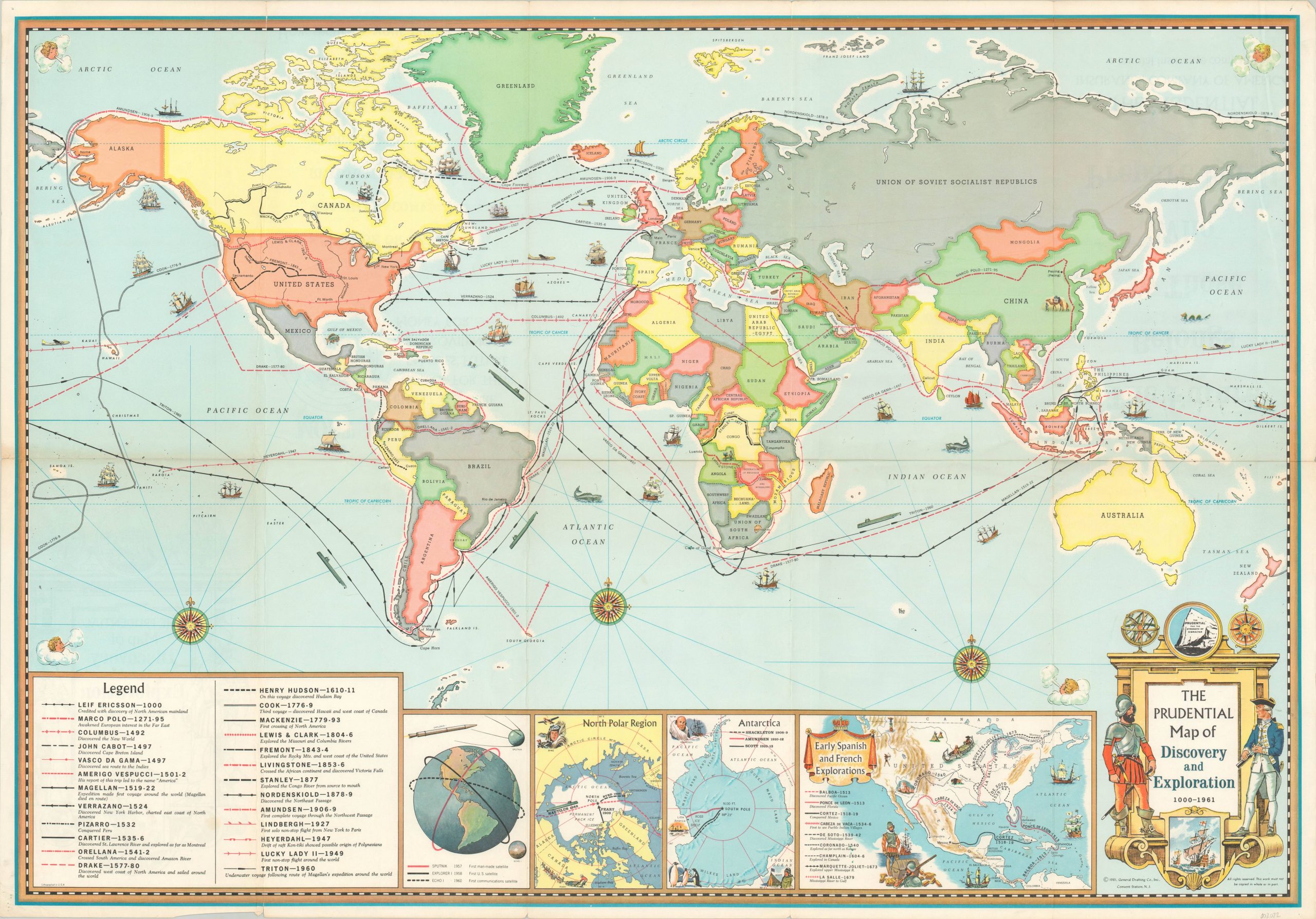
This vibrant world map on Mercator’s projection highlights the routes of twenty-five adventures of exploration and discovery across the globe. Heroic feats from Leif Ericsson’s first landfall in Greenland in 1000 to Roald Amundsen’s all-water transit of the Northwest Passage in 1906 are commemorated according to the legend in the lower left. Three inset maps along the bottom show further explorations across both poles and throughout North America.
A fourth inset map, as well as several of the more recent ‘explorers’ routes, reflects the ongoing tension between the Soviet Union and United States. The orbits of Sputnik, Explorer I, and Echo I highlight how the U.S. has recently (temporarily) surpassed the U.S.S.R. in the Space Race, while the route of the Lucky Lady (1949) and Triton (1960) within the main image showcase U.S. military technology during the Cold War.
The map was published in 1961 by General Drafting Company on behalf of Prudential Insurance. What does insurance have to do with exploration, you ask? An advertisement on the verso provides a loose connection by suggesting “most men chart a secure course for their families’ future…”
Map Details
Publication Date: 1961
Author: General Drafting Company
Sheet Width (in): 36.00
Sheet Height (in): 24.90
Condition: B+
Condition Description: Originally issued folded into 10 panels, with moderate wear and creasing along fold lines. Separation along the horizontal crease, including a 3" tear on the far left side (repaired on verso).
Out of stock