
The Pilgrims of the Mayflower
Remembering the Mayflower over 300 years after it set sail.
Out of stock
Description
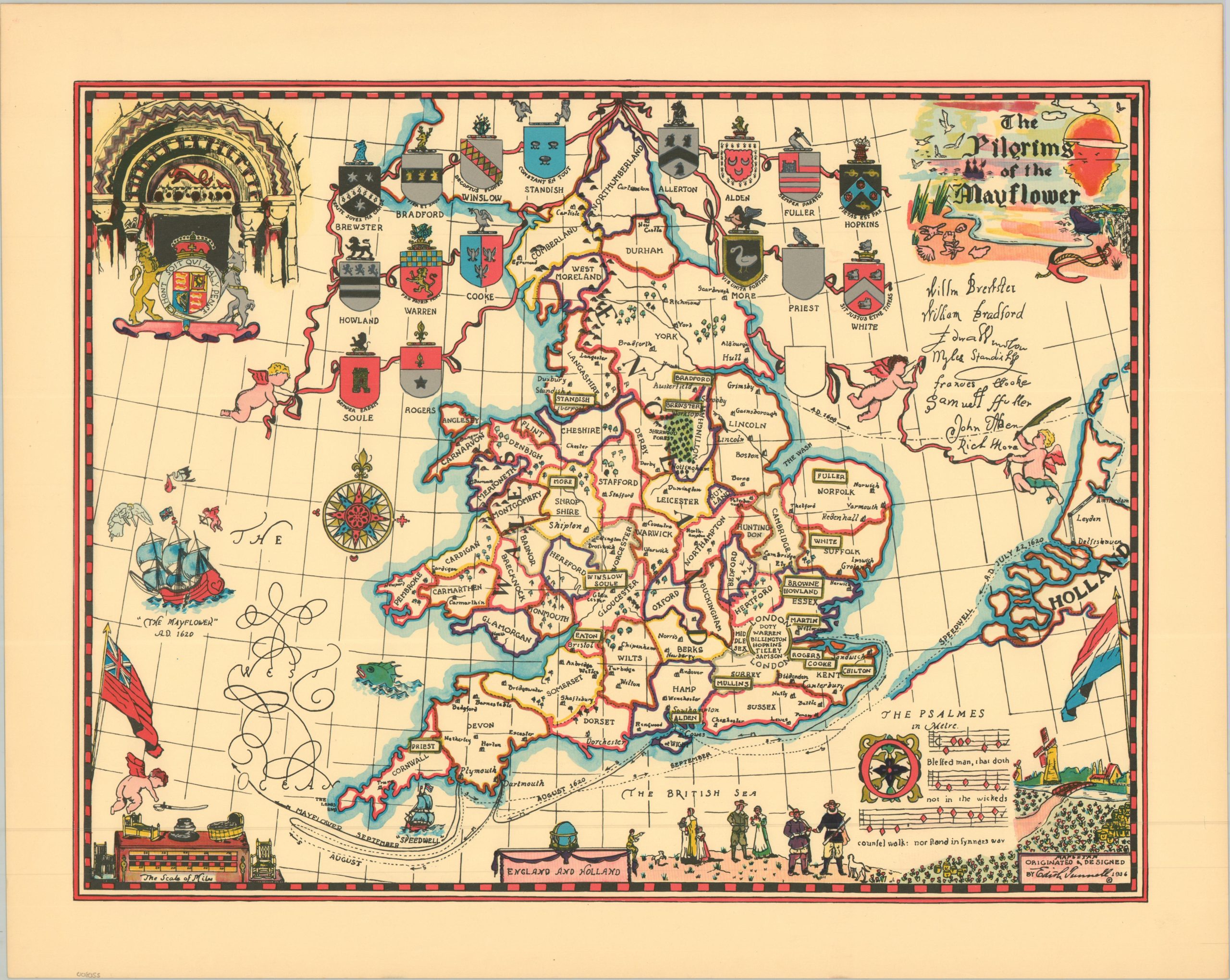
This charming pictorial map of 17th-century England was designed and illustrated by Edith Tunnell (signed, lower right) in 1936. A somewhat whimsical image commemorating the voyage of the Mayflower mimics several features from the Golden Age of Cartography, including decorative cartouches, a compass rose, sailing ships, and scroll-wielding puttis.
The Mayflower is shown alongside a stork, ghostly angel, and Cupid; likely reflecting the well-known stories of love, birth, and death on the perilous voyage. Coats of arms from prominent Pilgrim families like Standish, Bradford, Brewster, and Winslow are shown along the upper part of the sheet. The origins of these surnames are noted within their respective counties – the vast majority were from London and the surrounding area.
Map Details
Publication Date: 1936
Author: Edith Tunnel
Sheet Width (in): 22.40
Sheet Height (in): 17.90
Condition: A
Condition Description: Color printed map on a single-sided sheet of thick, cream colored paper. Creased upper left corner and some light spotting in the margins. Very good condition overall.
Out of stock