The Pennsylvania Railroad
The nationwide organization of ‘The Pennsy’ in the mid-20th century.
Out of stock
Description
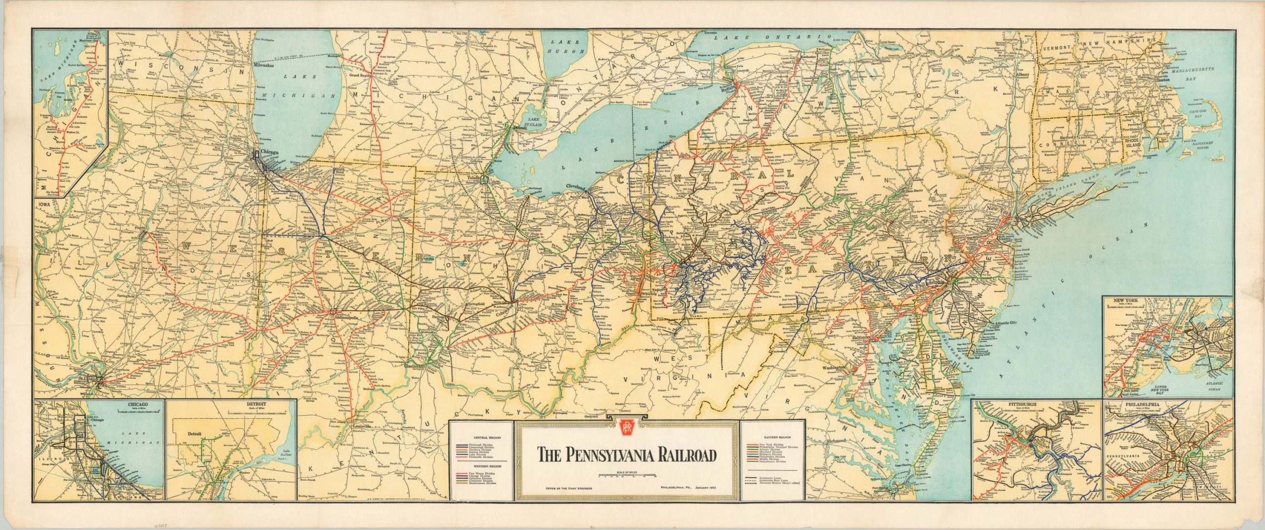
This vibrant map of the northeastern and upper Midwestern United States highlights the complex organization and vast reach of the Pennsylvania Railroad network. Three separate regions each contain upwards of five different divisions, each of which would oversee multiple different railroad lines. Associated rail and boat lines and trackage rights are noted according to the legend in the lower right. Competitor’s lines are also shown, but station stops are only labeled along the routes of the Pennsy.
Apart from railroads and major rivers, geographic information and detail are limited. Several inset maps show the area around Chicago, Detroit, Pittsburgh, Philadelphia, and New York – all major hubs of the Pennsylvania Railroad network. Another inset in the upper left shows the extension of the Grand Rapids & Indiana Railroad to the Straits of Mackinac in Michigan.
Published in Buffalo, New York by the J.M. Clement Co. of the Matthews-Northrup Works in 1953.
Map Details
Publication Date: 1953
Author: The Pennsylvania Railroad
Sheet Width (in): 43.75
Sheet Height (in): 18.25
Condition: B+
Condition Description: Light creasing and faint wear along originally issued fold lines and along the outer margins. Two spots of cellophane tape are visible on either side, though it does not affect the image. Good to very good overall.
Out of stock