
The Pacific Railways.
$175.00
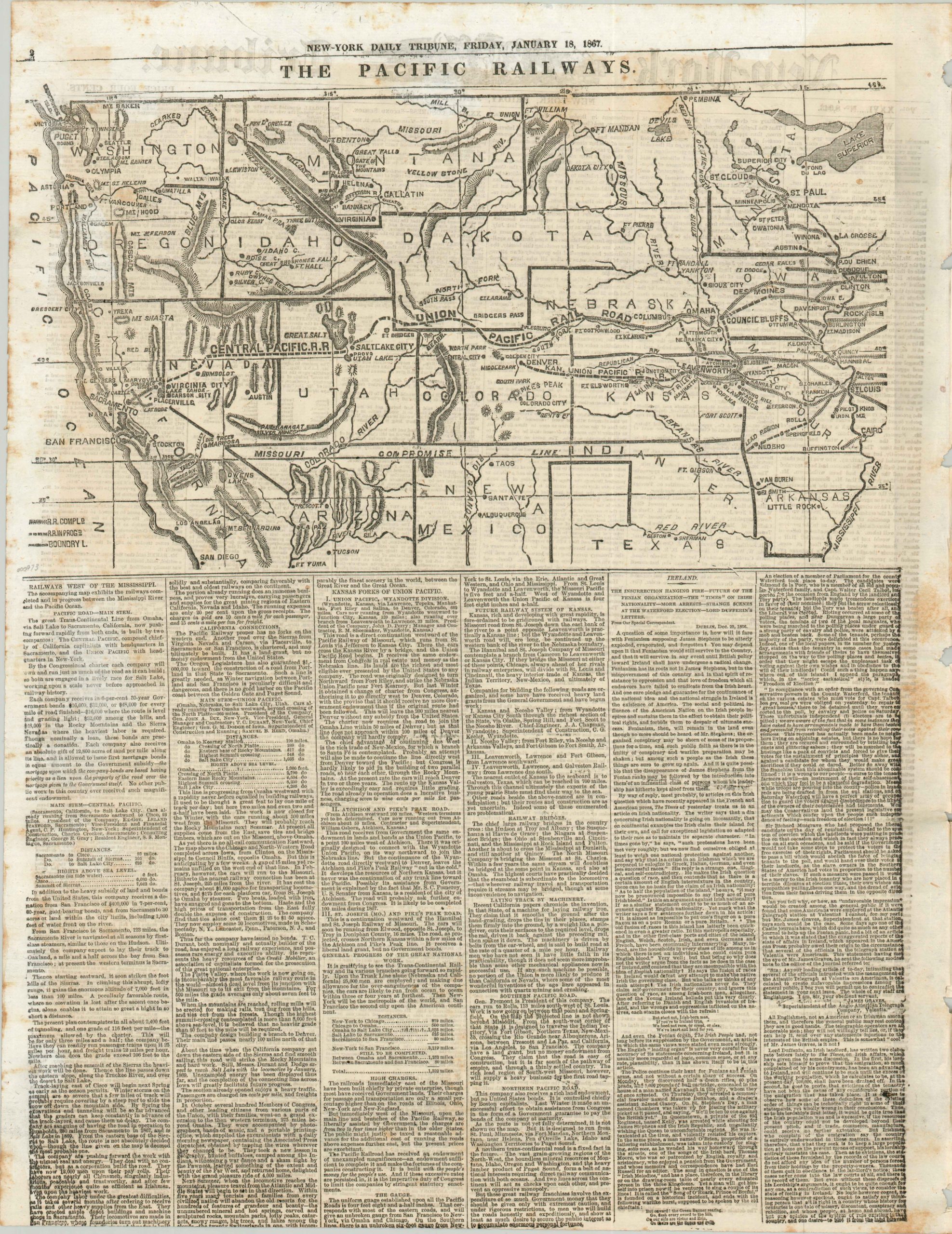
Newspaper map reporting on the construction progress of the Transcontinental Railroad.

Description
The 1,912 mile long First Transcontinental Railroad was constructed between 1863 and 1869, connecting the pre-existing U.S. rail network to the vast west at Council Bluffs, Iowa. The pace of construction fluctuated wildly based on the season, availability of workers and especially the terrain.
This map, issued four years after construction began, emphasizes this geographical reality by showing the glacial progress of the Central Pacific fighting through the Sierra Nevada mountains, compared to the progress of the Union Pacific which had already reached the western end of the plains of Nebraska. Below the map are five columns of text providing an overview of the construction process, background on the railroad companies, and a summary of the route.
The map was included on page 2 of the January 18, 1867 edition of the New York Daily Tribune, which is included in the price.
Map Details
Publication Date: 1867
Author: New York Daily Tribune
Sheet Width (in): 17.70
Sheet Height (in): 22.60
Condition: B
Condition Description: Moderate discoloration and foxing evident throughout the sheet and several holes along the centerfold where the publication was previously bound. A slightly offset printing, but otherwise very good condition overall.
$175.00