
The Old National Road
$400.00
The eastern end of the Ocean to Ocean Highway.
1 in stock


Description
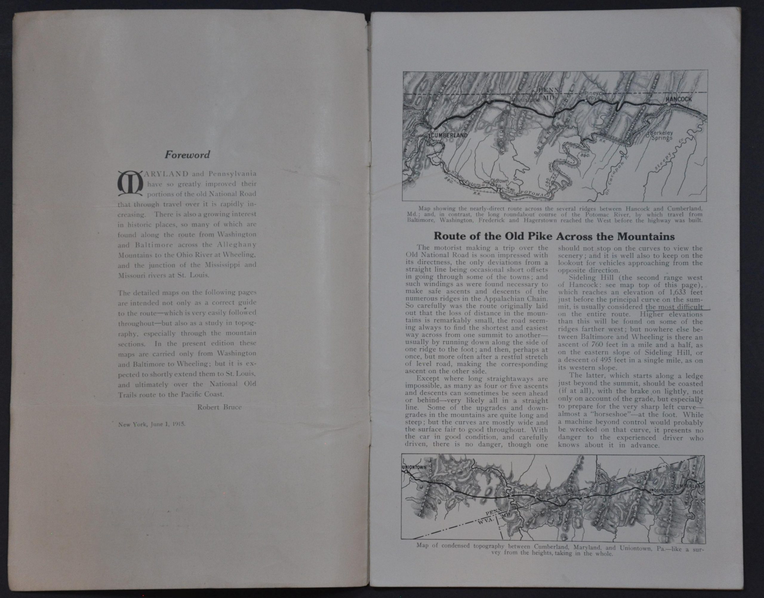
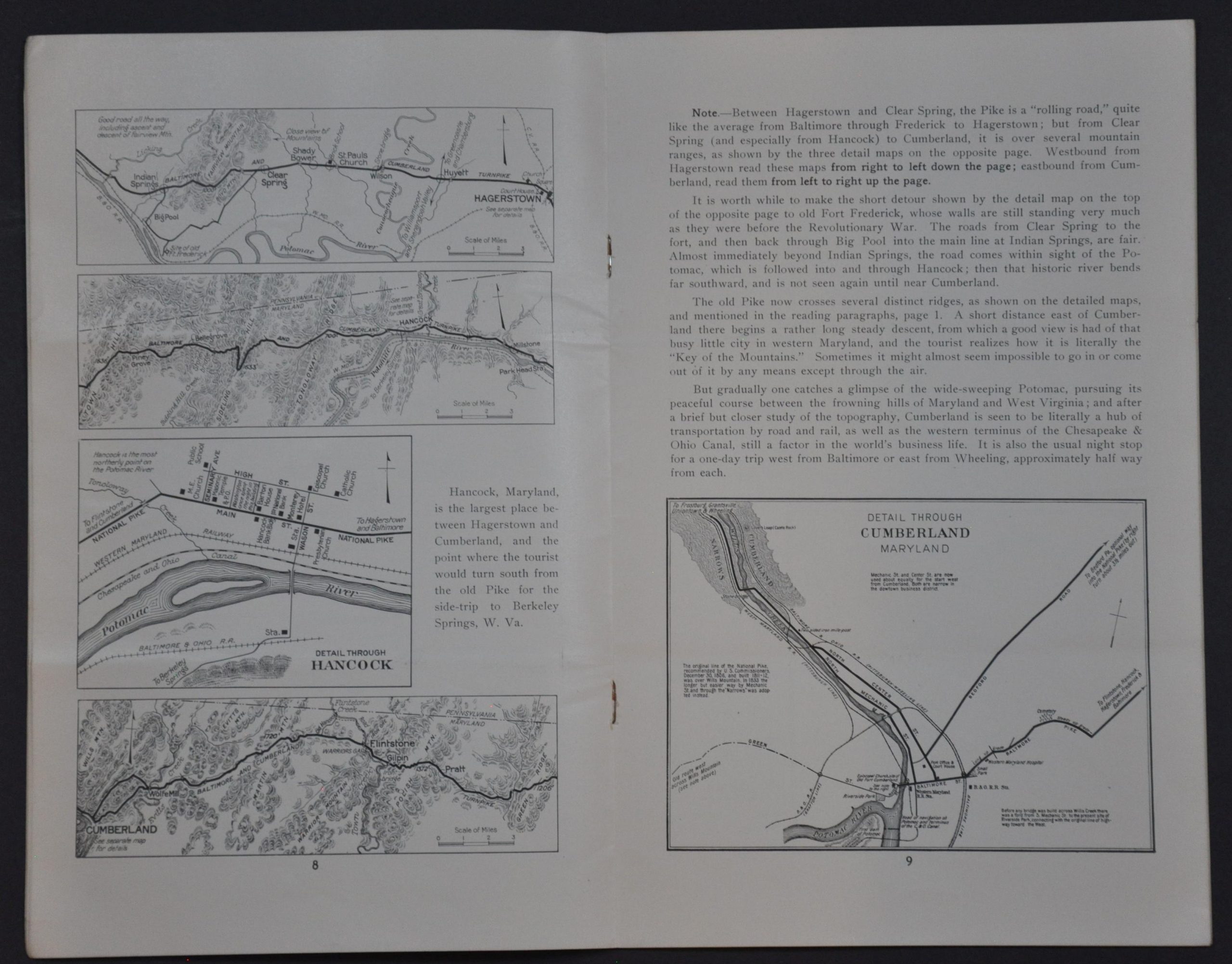
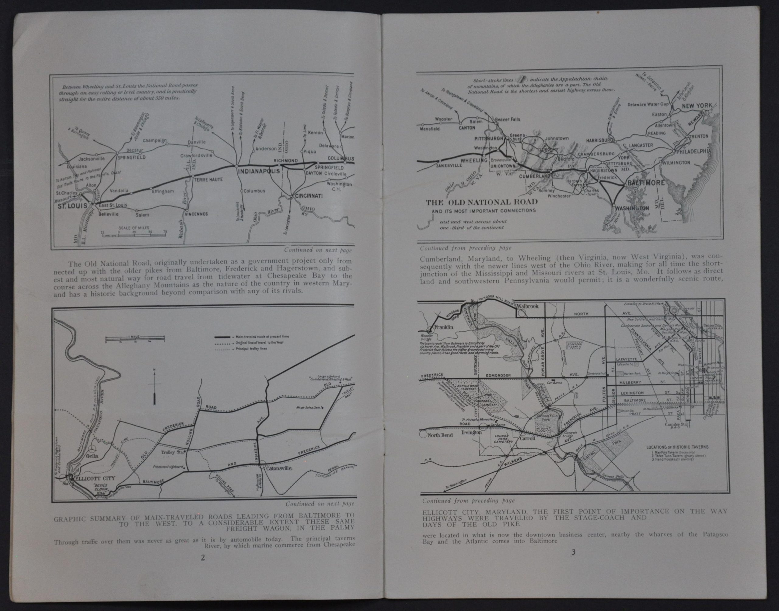
“Maryland and Pennsylvania have so greatly improved their portions of the old National Road that through travel over it is rapidly increasing. There is also a growing interest in historic places, so many of which are found along the route from Washington and Baltimore across the Allegheny Mountains to the Ohio River at Wheeling, and the junction of the Mississippi and Missouri rivers at St. Louis. The detailed maps on the following pages are intended not only as a correct guide to the route – which is very easily followed throughout – but also as a study in topography; especially through the mountain sections. In the present edition these maps are carried only from Washington and Baltimore to Wheeling; but it is expected to shortly extend them to St. Louis, and ultimately over the National Old Trails route to the Pacific Coast.” – Foreword.
This fantastic guide to the eastern section of The Old National Road was published in 1915 by the D.C.-based American Automobile Association. It references the extensive personal notes of Robert Bruce, one of the era’s premier advocates of the ‘Good Roads’ movement. Bruce was a prolific writer and touring manager who drafted promotional literature for both the AAA and the National Highways Association. He conducted extensive field research to provide up-to-date information on road conditions, traveler amenities, and more.
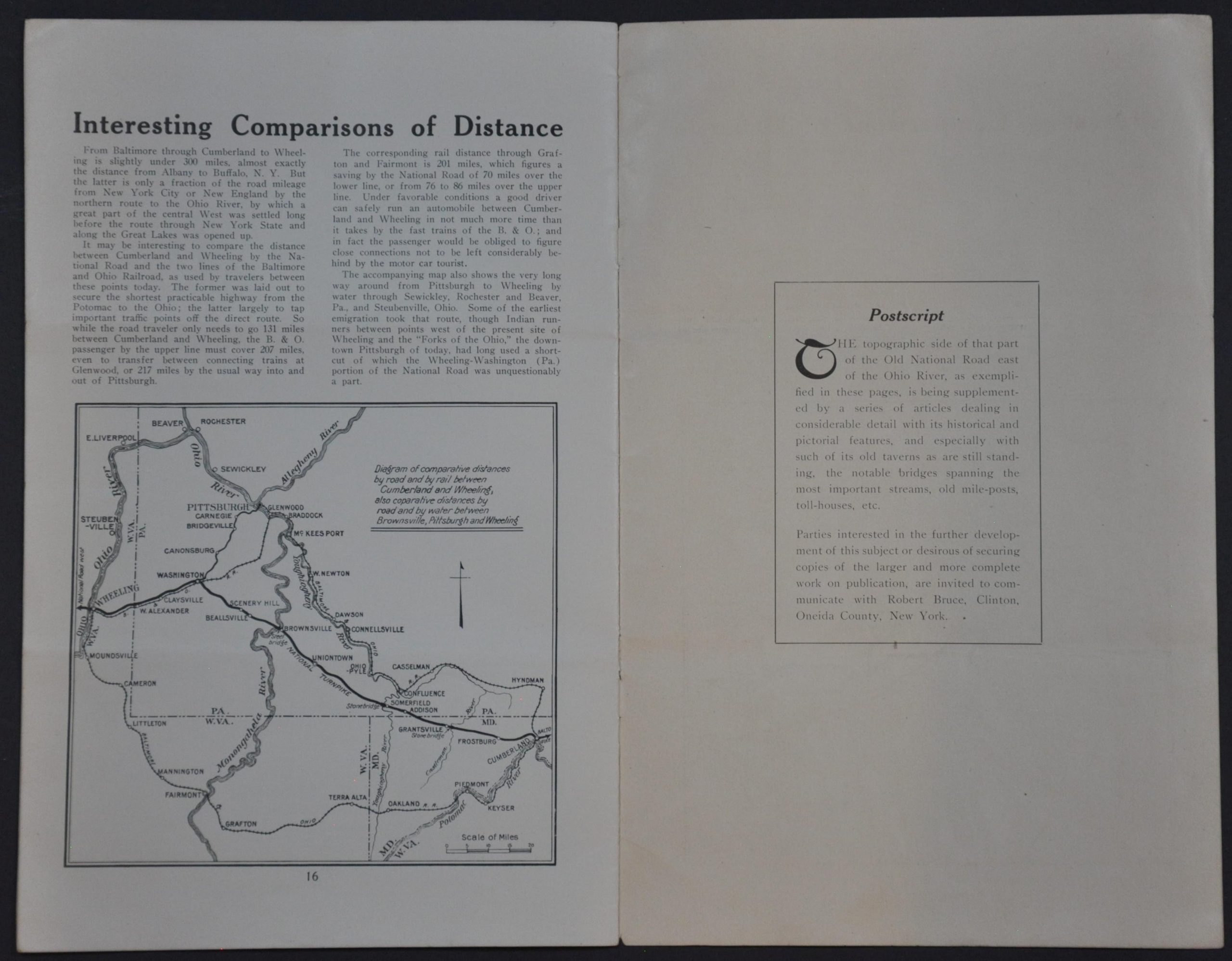
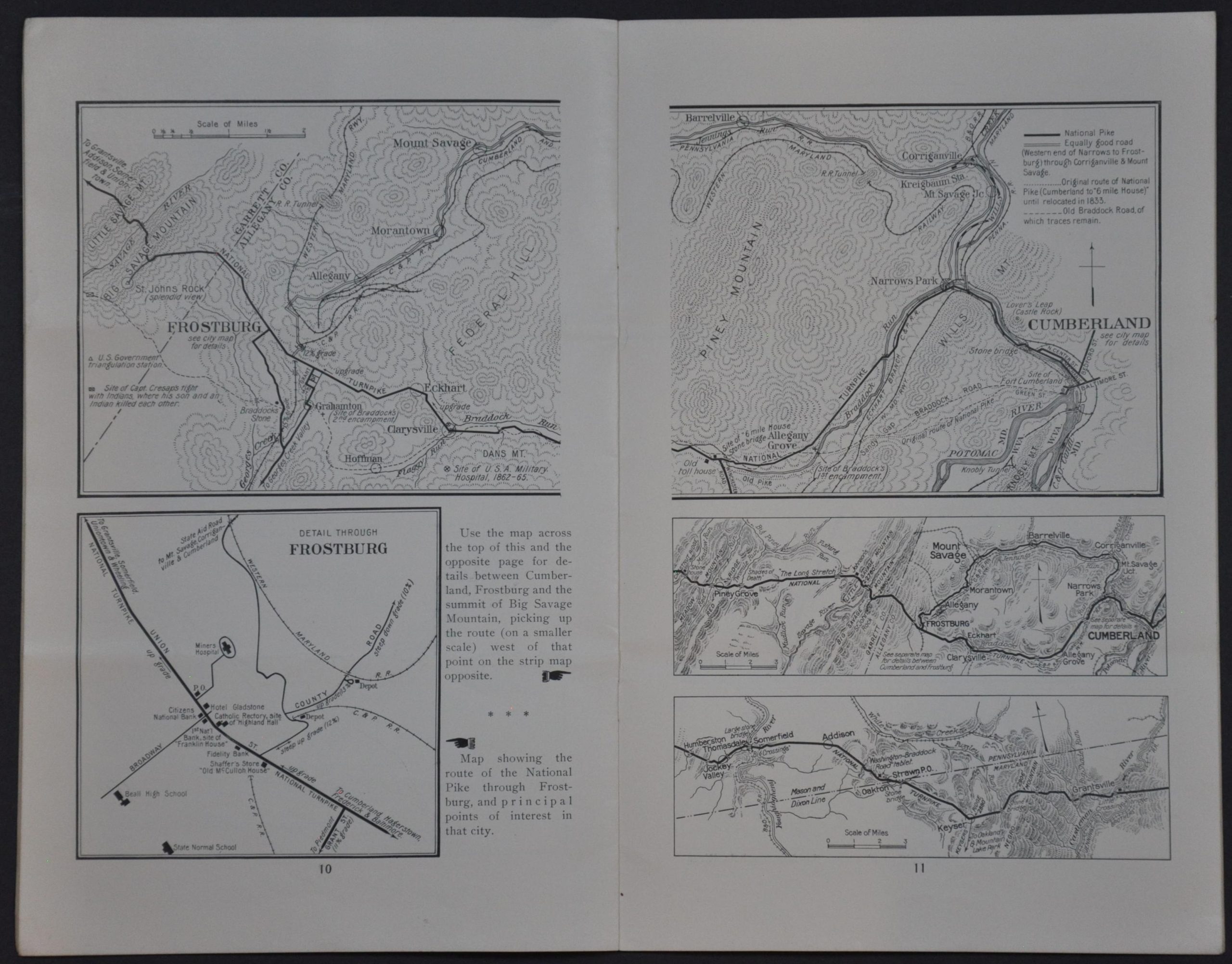
The contents focus on the easternmost section of the highway, stretching from Baltimore and Washington, D.C. to Wheeling, West Virginia. A series of rather incongruous insets of varying scales offer detailed route maps of specific segments. Street plans of places like Uniontown, Brownsville, and Hagerstown label locations of interest, landmarks, and more. The accompanying text, mostly provided by Bruce, provides a truncated tour of the landscape.
Map Details
Publication Date: 1915
Author: American Automobile Association Touring Information Board
Sheet Width (in): 7.00
Sheet Height (in): 11.00
Condition: B+
Condition Description: 16pp. booklet with stapled binding and original paper wraps. Formerly folded into thirds, with soft creasing as a result. Minor spotting, toning, and wear, consistent with age and use. Good condition overall.
$400.00
1 in stock