The Official Map of Richmond, Indiana
$75.00
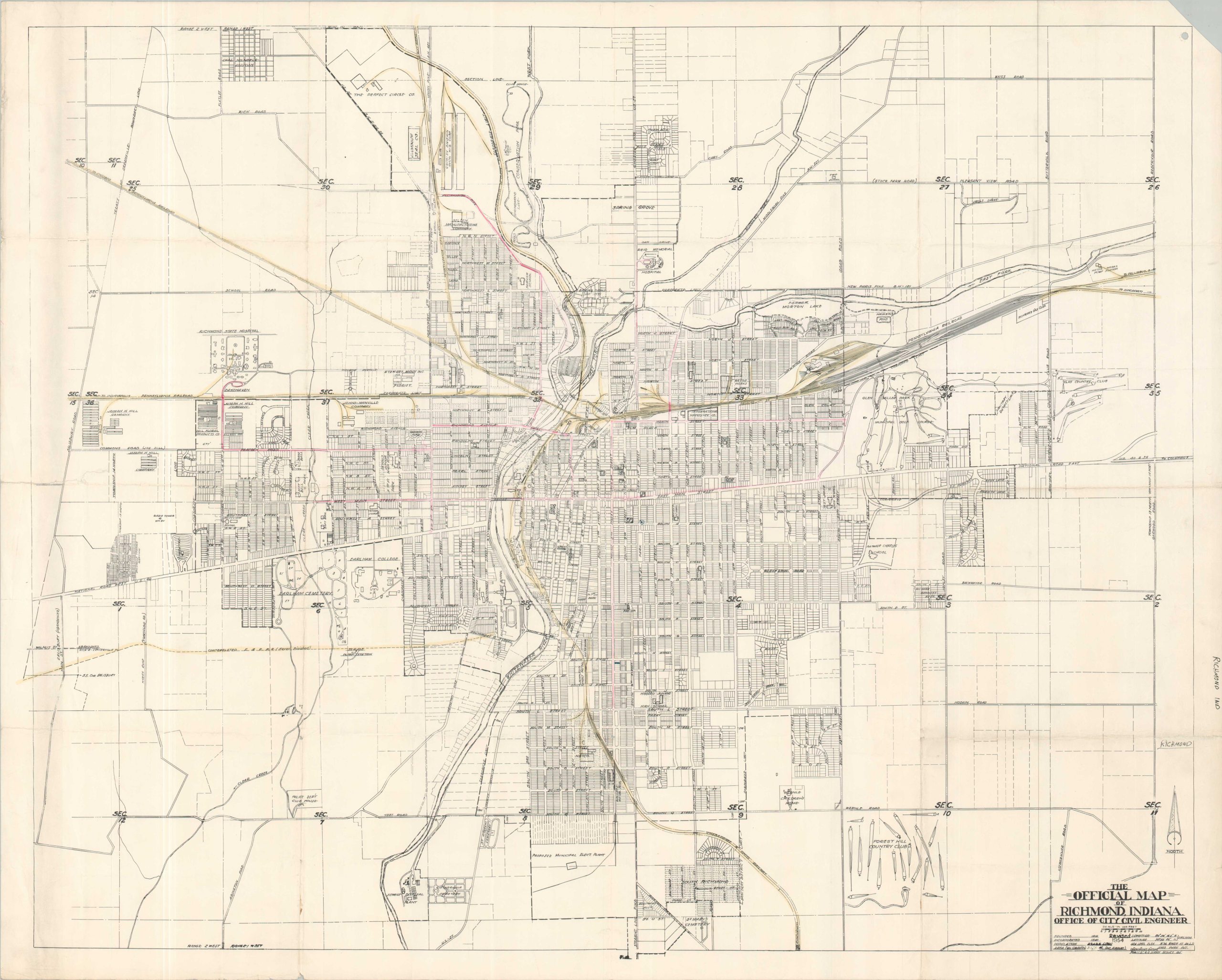
Richmond, Indiana during the mid-1950s.
1 in stock
Description
This detailed street plan of Richmond, Indiana was created by the city’s Office of the Civil Engineer in 1954. A wealth of information is preserved within the image, including primary transportation routes, large property owners, and notable geographic features. Locations of interest include Earlham College, the Forest Hill County Club, Wernle Children’s Home, and several local industries.
Map Details
Publication Date: 1954
Author: Richmond City Civil Engineer
Sheet Width (in): 34.25
Sheet Height (in): 28
Condition: A-
Condition Description: Large lithographed map printed on a sheet of sturdy paper, though creased and moderately worn along old folds. An irregular tear, about 3", on the left side has been repaired on the verso with archival tape. Manuscript annotations throughout in pink and yellow, reflecting the maps' prior use in the archives of the Pennsylvania Railroad.
$75.00
1 in stock