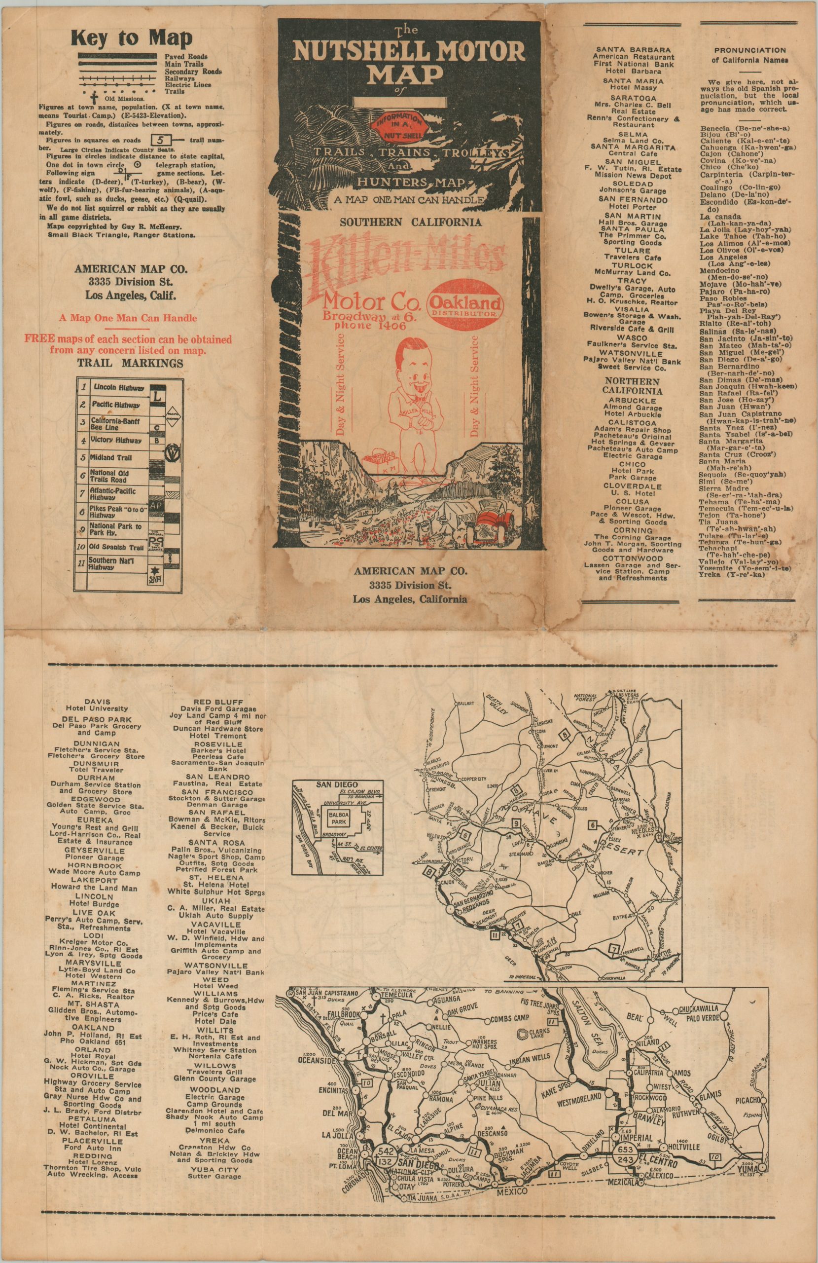
The Nutshell Motor Map of Southern California
$80.00
“A Map One Man Can Handle”
1 in stock
Description
“Trails, Trains, Trolleys and Hunters Map” – Front Cover.
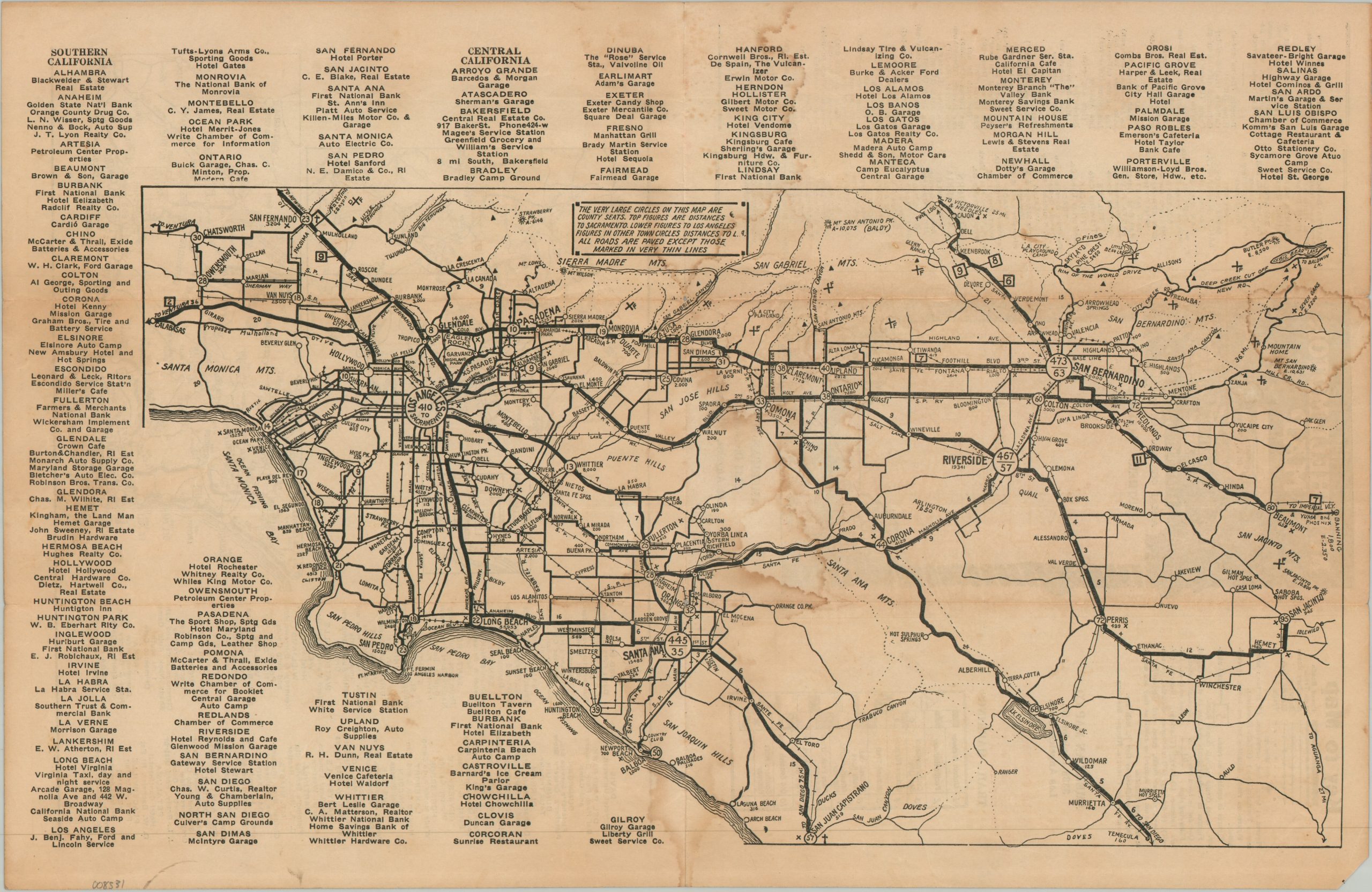
This functional road map of Southern California, promising ‘Information in a Nut Shell’, was copyrighted around 1924 by Guy R. McHenry. It was published by the American Map Company of Los Angeles, which hoped to capitalize on the exploding popularity of automobile tourism during the 1920s. A rudimentary overview shows the primary roads between the coast and Big Bear Lake, ranging as far north as San Fernando and as far south as San Juan Capistrano. The expansive network of the Pacific Electric Railway plays second fiddle to the miles of paved streets that allowed a previously unknown degree of travel freedom.
Accompanying text lists sponsoring businesses (hotels, garages, auto supply, etc.) in many of the region’s primary cities – several of which were not along the available rail lines. Two insets on the verso extend the image across the Mojave Desert and down to San Diego, with a tiny street plan of the area around Balboa Park. The map key and a guide to the various trail markings are also provided. The front cover notes that this example was distributed by the Killen-Milles Motor Company.
Map Details
Publication Date: c. 1924
Author: Guy R. McHenry
Sheet Width (in): 16.80
Sheet Height (in): 10.90
Condition: B-
Condition Description: Double-sided map brochure on a toned sheet with heavy damp staining and moderate edge wear.
$80.00
1 in stock