The New York 1939 Official World’s Fair Pictorial Map
Spectacular pictorial guide to the 1939 New York World’s Fair.
Out of stock


Description
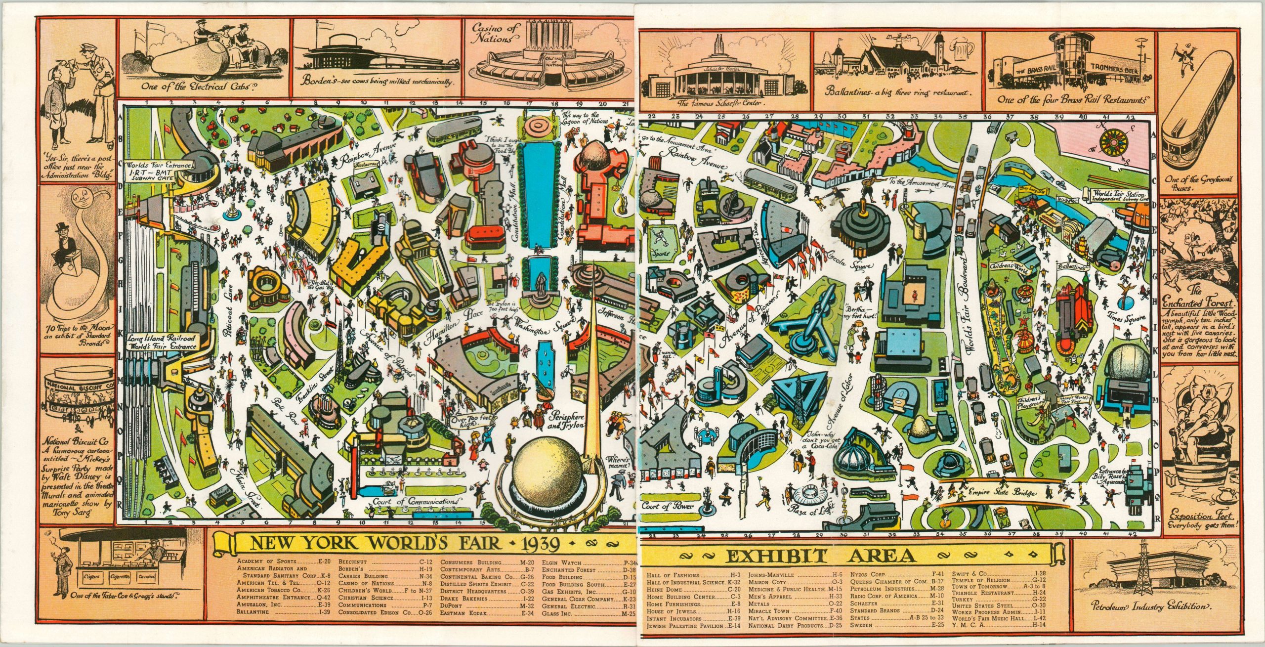
Visitors at the 1939 World’s Fair, held in Queens at Flushing Meadows Park, were drawn into an event advertised as ‘the world of tomorrow.’ The latest in technology was on display across the fairgrounds, dominated by the futuristic Trylon & Perisphere sculpture.
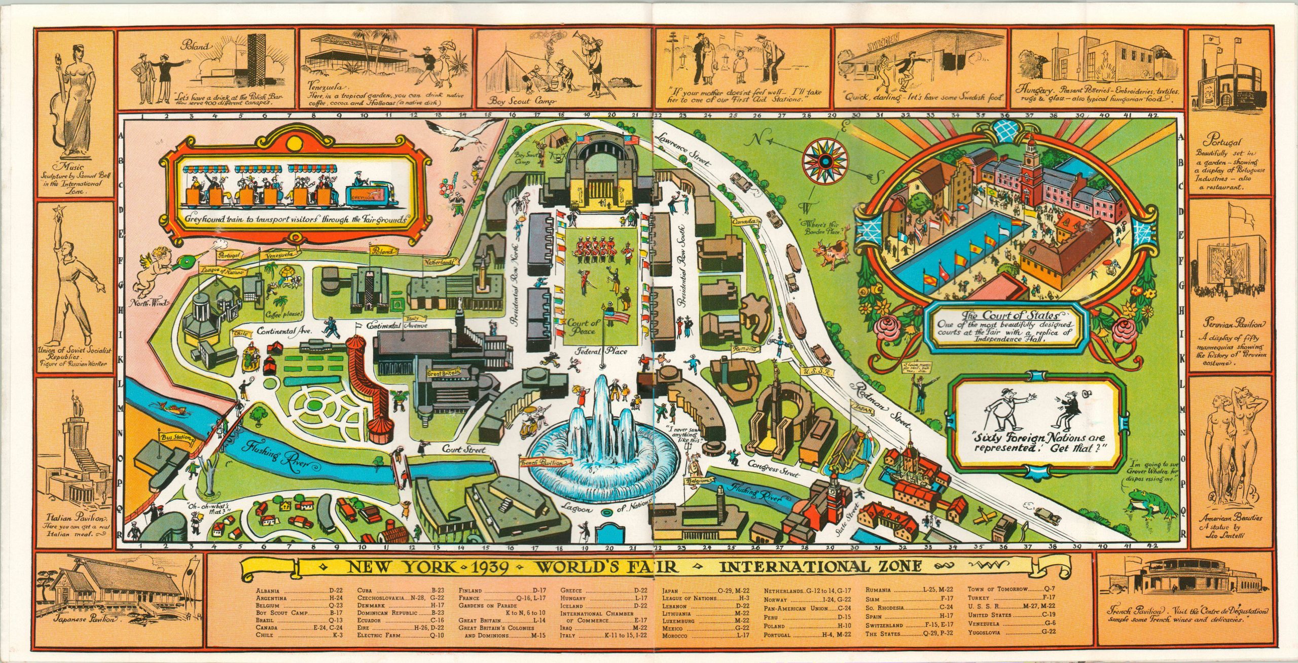
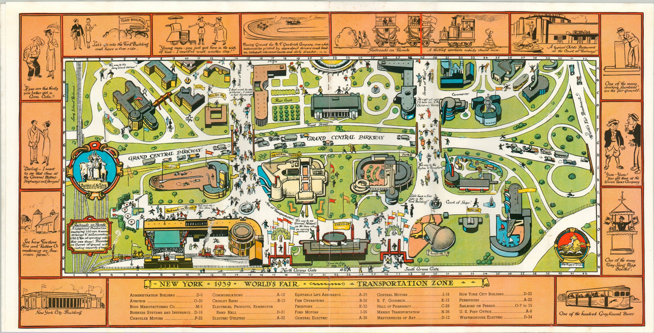
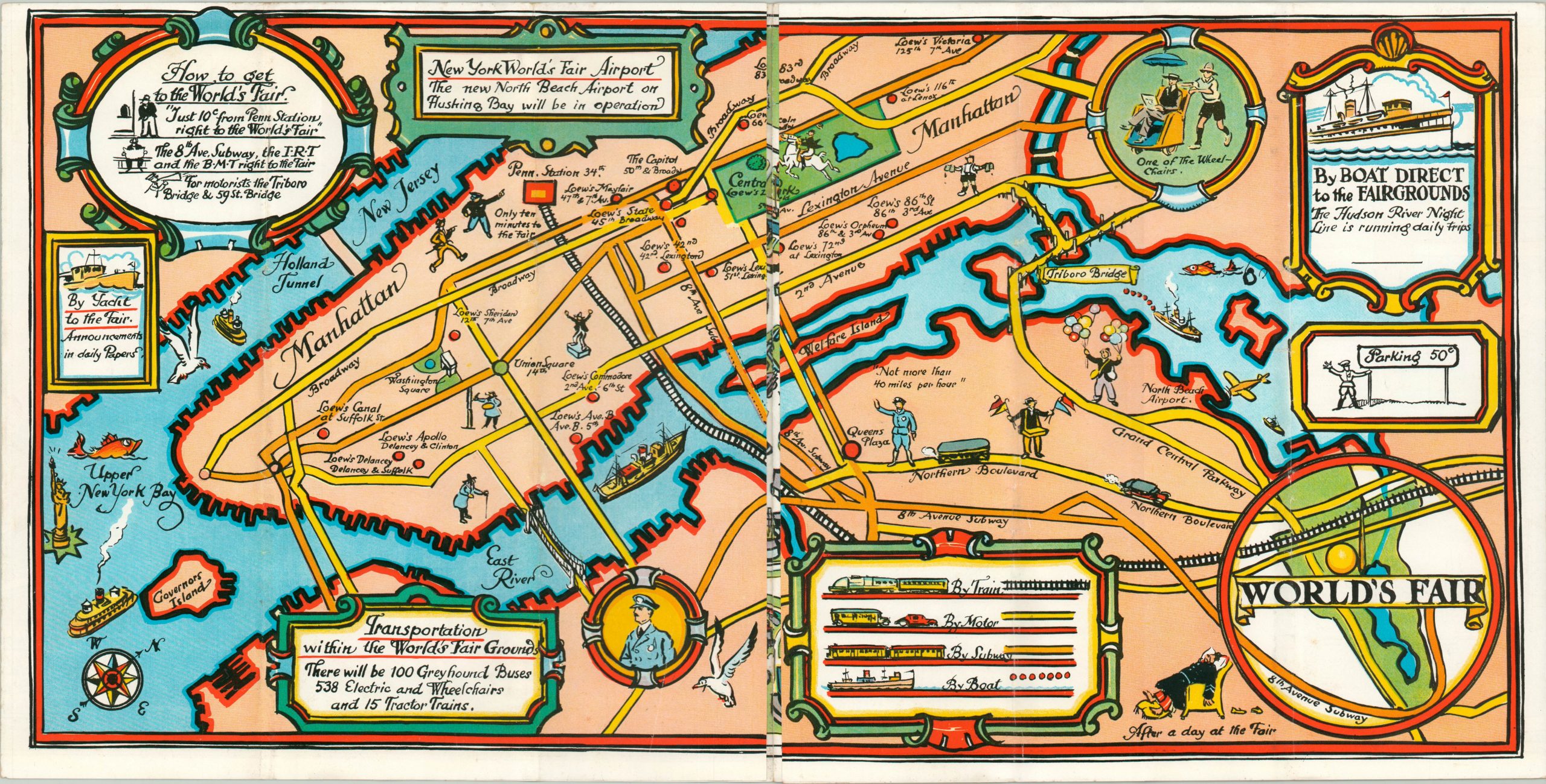
This pictorial brochure was drawn by Tony Sarg and published by Pace Press in 1939 as a souvenir of the fair, and contains a variety of maps detailing nearly every aspect. The book opens to a charming transportation map of New York, highlighting accessibility by train, car, subway and boat. This spreads into a spectacular panorama of the entire grounds. Buildings are individually illustrated and labeled, and notable attractions are highlighted in several insets.
The book continues to show detailed views of the Exhibit Area, International Zone (note: no Germany), Transportation Zone, and Amusement Area – each depicted in Tony Sarg’s signature cartoon style. A tremendous relic from the last World’s Fair prior to the outbreak of WWII.
Map Details
Publication Date: 1939
Author: Tony Sarg
Sheet Width (in): 22.25
Sheet Height (in): 11.25
Condition: B
Condition Description: 12 pp. brochure with stapled bindings and colorful pictorial wrappers, folded over twice. Covers, show spotting and moderate soiling. Each page reveals a centerfold map, with the first unfolding to approximately 44.75" long. Minor wear visible in each map along fold lines and faint soiling around the edges, but the contents are in good condition overall.
Out of stock