The New World Map
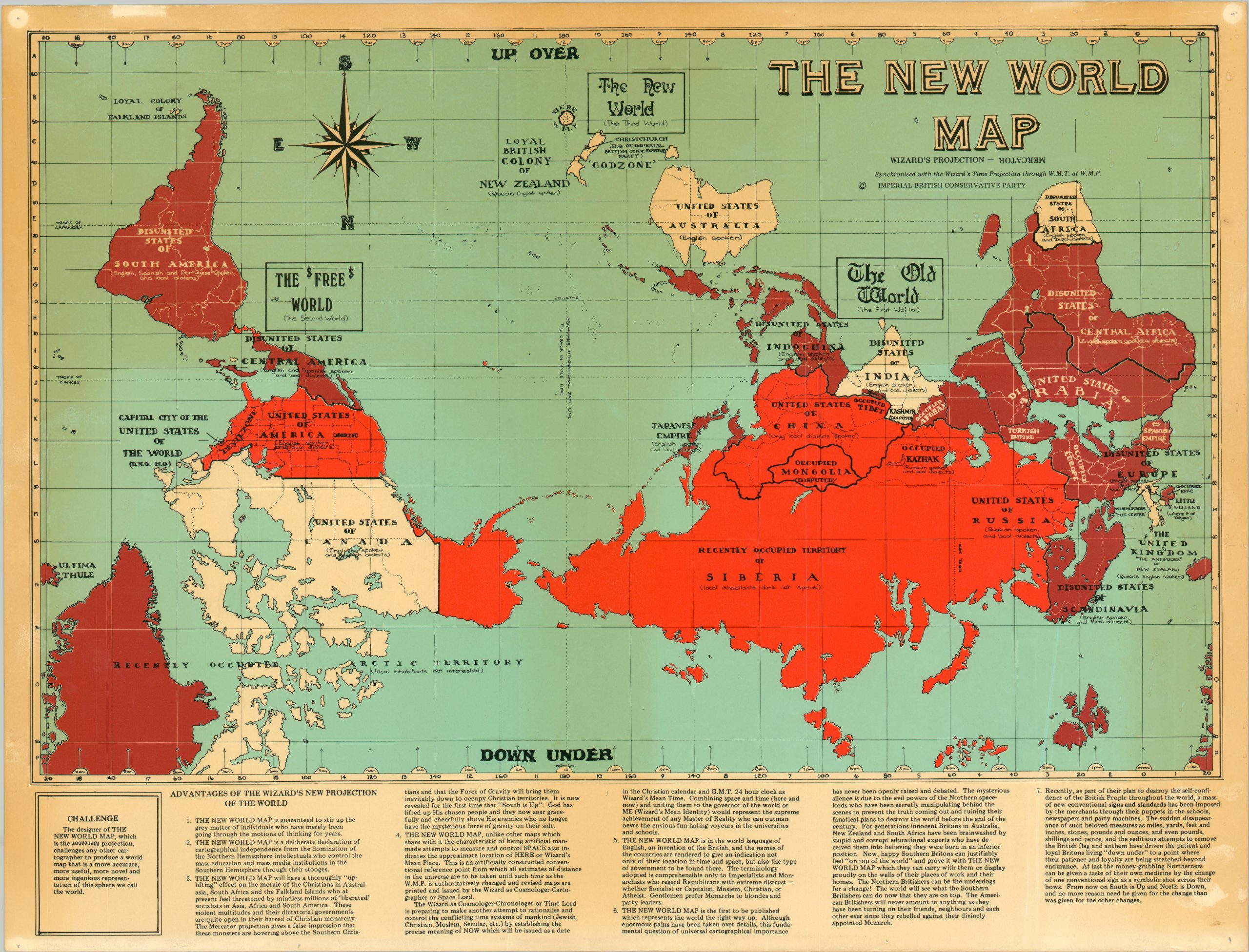
A satirical image of the ‘New World’ from a vocal New Zealander.
Out of stock
Description
A deliberate declaration of cartographical independence from the domination of the Northern Hemisphere intellectuals who control the mass education and mass media institutions in the Southern Hemisphere through their stooges. [Point 2]
This incisive image literally flips the world upside down to present it from the slightly warped perspective of its creator – The Wizard of New Zealand, aka Ian Brackenbury Channel. Earth is shown on Mercator’s Projection (a deliberately imperial choice) and is divided into three sections – the Old World (Europe and Asia), the $Free$ World (The Americas) and The New World (Oceania).
Broad geopolitical generalizations are made with the national borders, each colored and labeled in a fashion reminiscent of maps of the British Empire. Seven points reflecting a combination of the map’s content and the Wizards’ personal views are listed along the bottom of the page, characterized nicely by #6: THE NEW WORLD MAP is the first to be published which represents the world the right way up. The verso provides an in-depth cosmological explanation of “The Wizard’s Inside – Out Universe”.
Published in Christchurch around 1980 by the Imperial British Conservative Party, a farcical political party founded by the Wizard in 1974.
Map Details
Publication Date: c. 1980
Author: Ian Brackenbury Channel and Derek Banks
Sheet Width (in): 22.25
Sheet Height (in): 16.9
Condition: B+
Condition Description: The sheet has toned from age and shows bright circles and pinholes in the corners where previously hung. A bit of scattered staining in the lower right and small tears around the outer edges. The front is treated with some sort of thin plastic cover, while the printed verso is not.
Out of stock