
The New Pictorial Map of London
$145.00
Optimism returns to postwar London.
1 in stock
Description
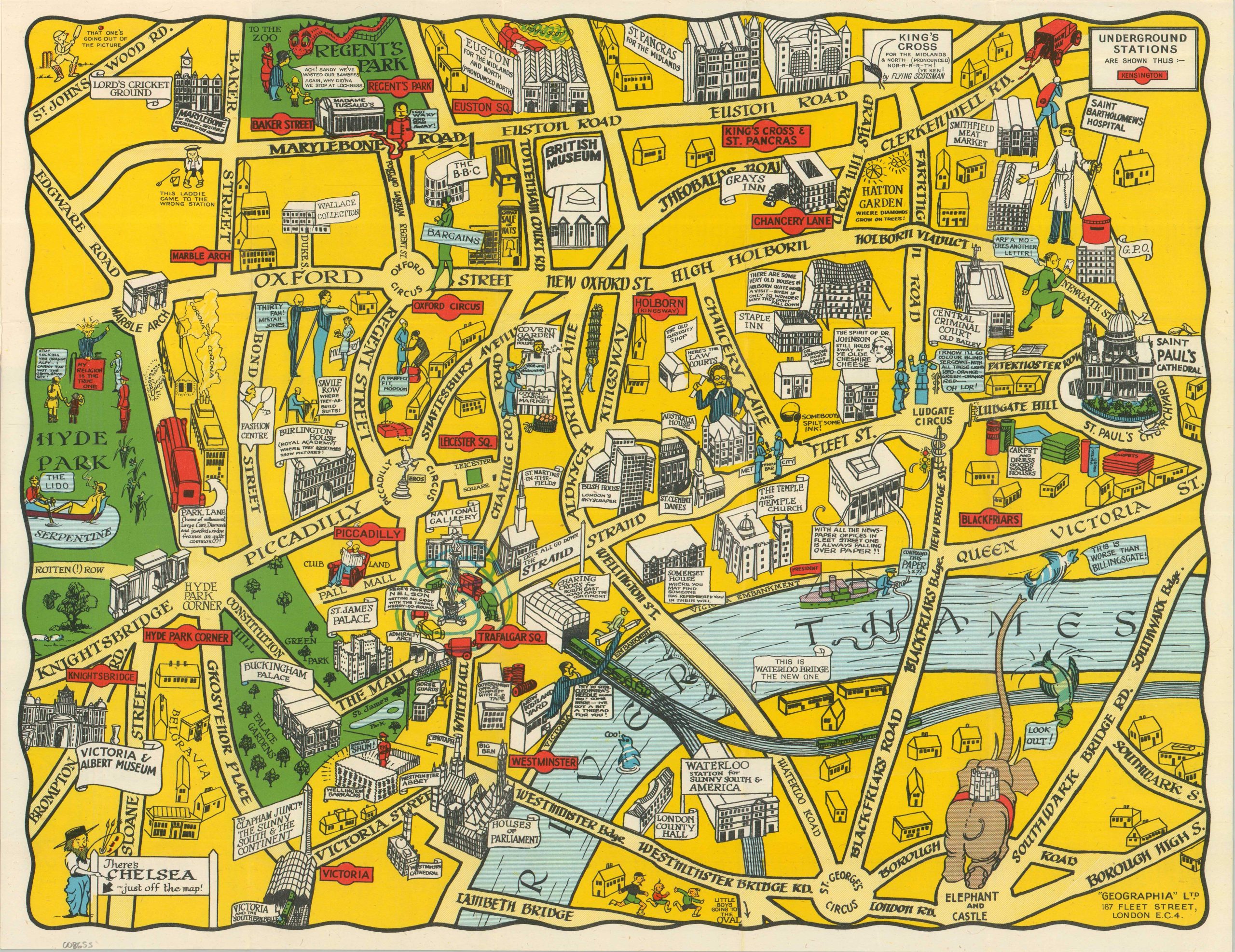
This ‘new’ pictorial map of London was published locally by Geographia, Ltd. Though undated, the presence of the ‘new’ Waterloo Bridge (opened in 1945) and the HMS President in the Thames indicates a likely range of 1946-1948. The lively image encompasses only a portion of the massive city, bracketed by St. Paul’s Cathedral (east), Waterloo and Victoria Stations (south), Hyde Park (west), and Euston Road (north).
Iconic landmarks are faithfully replicated in black and white, while accompanying vignettes add a pop of color and personality, plus a touch of characteristically British humor (humour?). Several areas that remain blank were subject to heavy bomb damage during the war. Small maps on the covers show the Tube network, the Theater District, and the Cinema District.
Map Details
Publication Date: c. 1946
Author: Geographia, Ltd.
Sheet Width (in): 19.00
Sheet Height (in): 14.80
Condition: A
Condition Description: Color printed map on a single-sided sheet affixed to original paper wraps. Covers are lightly worn, but the map is in near fine condition.
$145.00
1 in stock