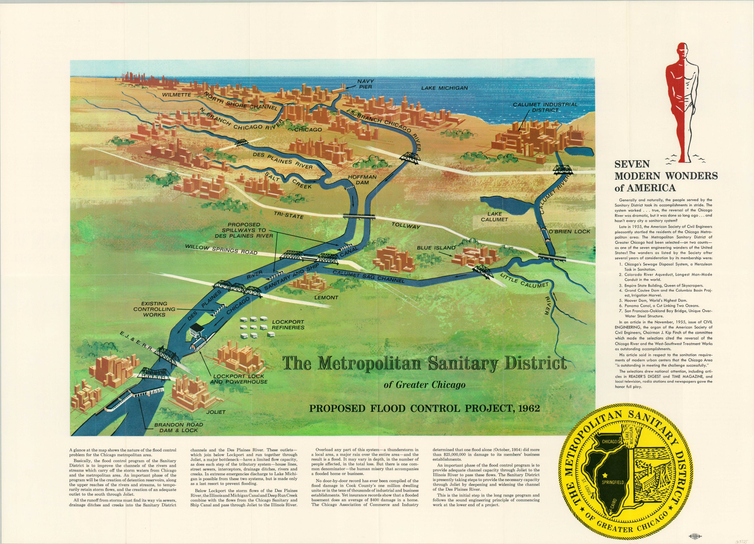
The Metropolitan Sanitary District of Greater Chicago Proposed Flood Control Project 1962
$165.00
“A Herculean Task in Sanitation.”
1 in stock
Description
This illustrated aerial perspective was created by the Metropolitan Sanitary District of Greater Chicago in 1962 to promote a gigantic proposed modernization project. The complex system of locks, channels, and spillways running from Lake Michigan to Joliet are noted across the rapidly growing region, along with industrial districts, bridges, and dams. Text at the verso offers a neat summary;
“Basically, the flood control program of the Sanitary District is to improve the channels of the rivers and streams which carry off the storm waters from Chicago and the metropolitan area.”
Further text on the verso provides a history of the district and its various efforts to improve sanitation across the Windy City. According to a 1955 article in Civil Engineering, Chicago’s Sewage Disposal System was ranked amid the ‘Seven Modern Wonders of America’, listed on the right side of the page.
Map Details
Publication Date: 1962
Author: The Metropolitan Sanitary District of Greater Chicago
Sheet Width (in): 26.3
Sheet Height (in): 18.9
Condition: A
Condition Description: Creasing along originally issued fold lines. Near fine condition overall.
$165.00
1 in stock

