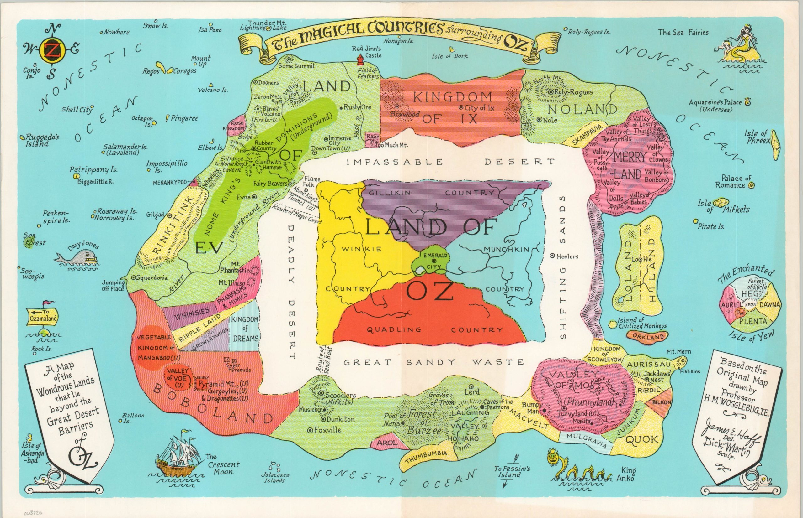
The Marvelous Land of Oz [and] The Magical Countries Surrounding Oz
The official cartography of Frank Baum’s beloved world of Oz.
Out of stock
Description
This wonderful pair of maps was designed in 1975 by James Haff, considered the ‘official cartographer of Oz’, and engraved by Dick Martin for publication by The International Wizard of Oz Club. The organization issued its first maps to visualize the fantastical world of Oz in 1962, with subsequent revisions (by Haff) in 1967, 1971, 1975, and 1980.
The first sheet shows the Marvelous Land of Oz, with the Emerald City in the center, surrounded by the countries of the Munchkins, Quadlings, Winkies, and Gillikins. Various locations of interest (e.g. poppy field, Glinda’ Palace, the site of Dorothy’s house, etc.) are labeled throughout the image, which is flanked on either side by columns showing the Tin Man and Scarecrow.
The second map presents The Magical Countries Surrounding Oz, itself separated from these nations by a vast desert. Here can be seen various points of interest taken from Baum’s non-Oz books. The image is allegedly based on an original map drawn by Professor H.M. Wogglebug, a fictional character introduced in the second Oz book titled (appropriately) The Marvelous Land of Oz, published in 1904.
Map Details
Publication Date: 1975
Author: James Haff
Sheet Width (in): 16.75
Sheet Height (in): 10.75
Condition: A-
Condition Description: Two sheets, each with moderate wear along the vertical centerfold and wrinkling visible near the top of the page. Faint soiling on the Land of Oz also visible in the upper margin. Very good to near fine overall.
Out of stock


