The Marvelous Land of Oz and The Magical Countries Surrounding Oz
$450.00
Modern efforts to define the abstract geography of the World of Oz.
1 in stock

Description
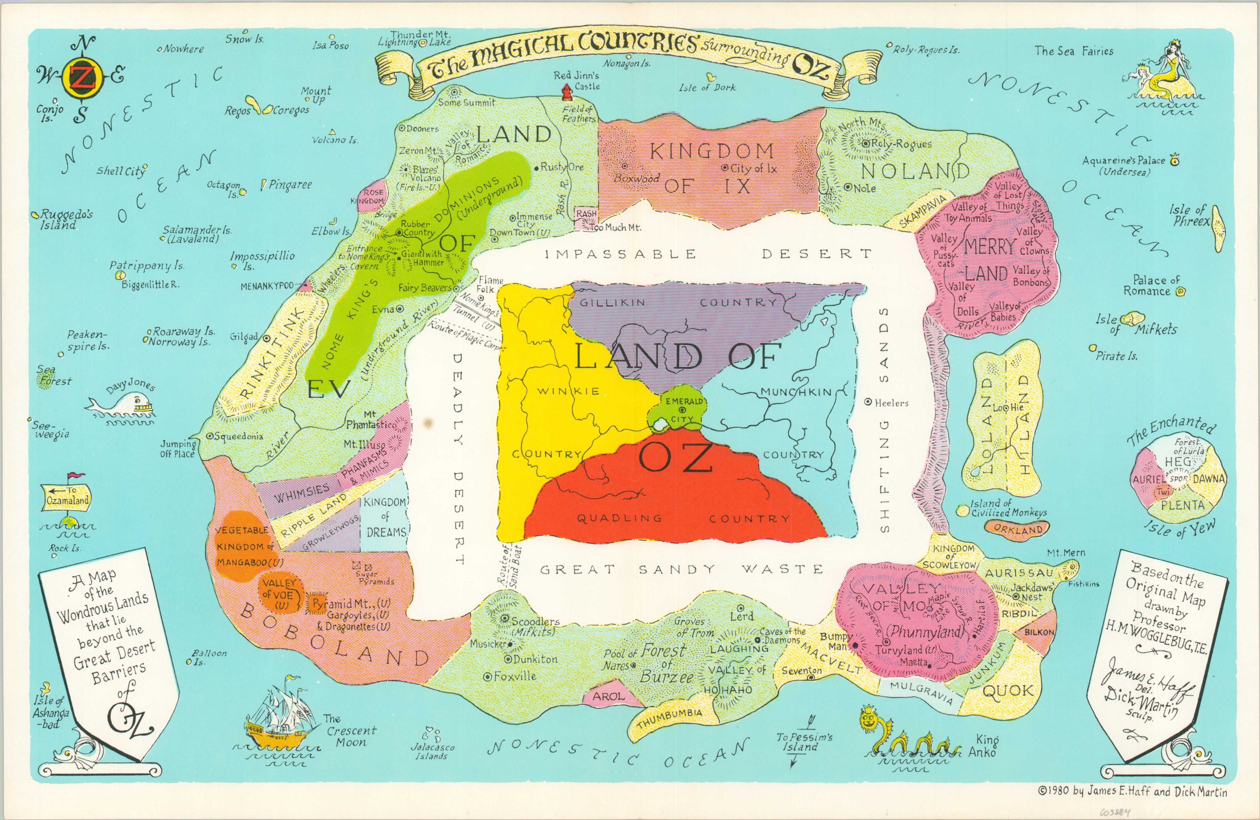
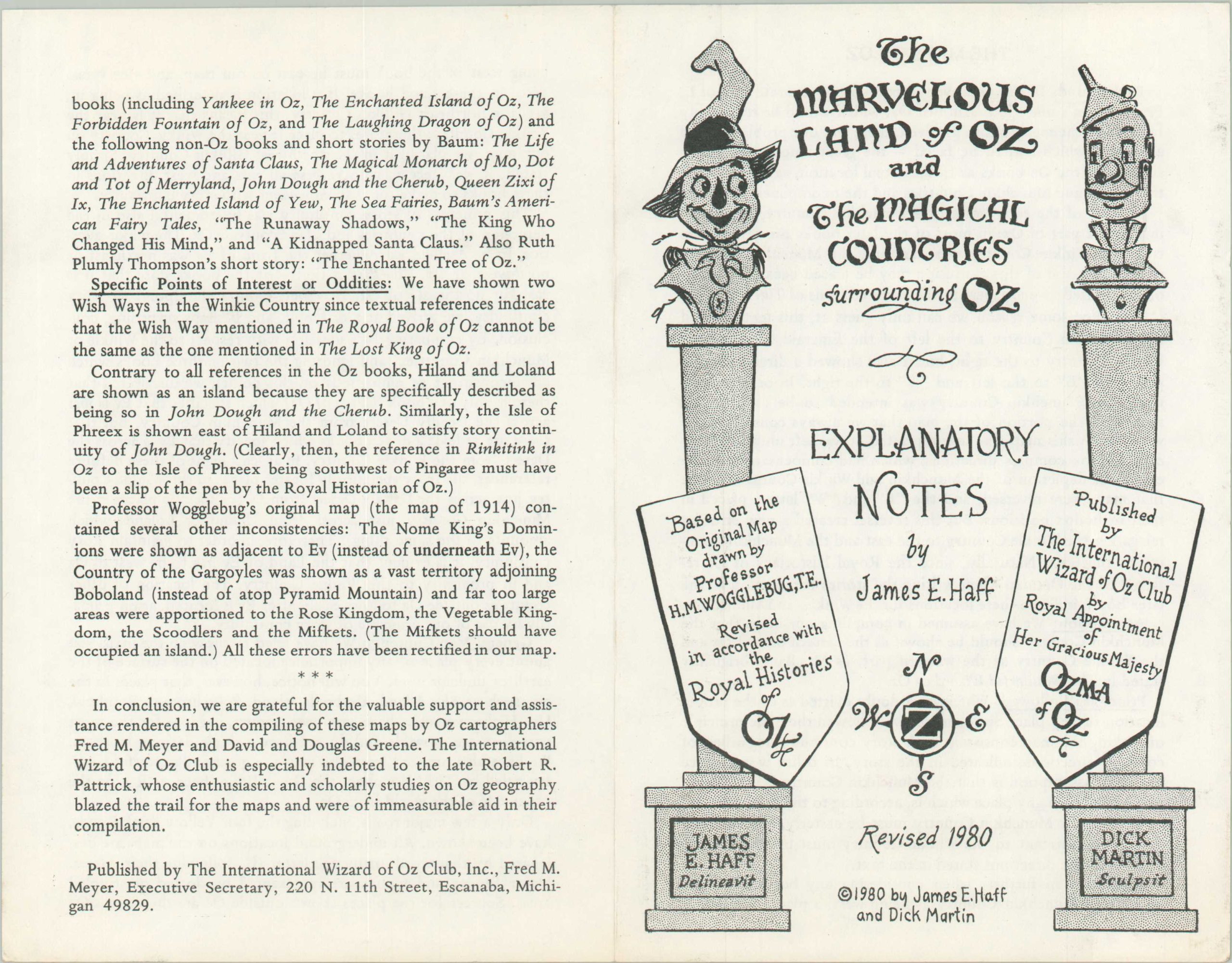
This pair of colorful maps provides one of the most clearly defined cartographic expressions of Frank L. Baum’s beloved magical Land of Oz. They are based on Baum’s original plan, first published in 1914 as part of The Tik-Toks of Oz, but expand the universe to incorporate details from subsequent novels in the series. The accompanying Explanatory Notes provide additional details on the history and creation of the maps, including inconsistencies that had to be interpreted.
The first sheet focuses on the Marvelous Land of Oz, with the Emerald City in the center, surrounded by the countries of the Munchkins, Quadlings, Winkies, and Gillikins. Various locations of interest (e.g. poppy field, Glinda’s Palace, the site of Dorothy’s house, etc.) are labeled throughout the image, which is flanked on either side by columns showing the Tin Man and Scarecrow. The second map presents The Magical Countries Surrounding Oz, itself separated from these nations by vast, almost impenetrable deserts. Here can be seen various points of interest taken from Baum’s non-Oz books.
Both images are allegedly based on original works drawn by Professor H.M. Wogglebug, a fictional character introduced in the second Oz book titled (appropriately) The Marvelous Land of Oz and published in 1904. In reality, the maps were drawn by James Haff and ‘engraved’ by Dick Martin. Published in 1980 by The International Wizard of Oz Club in Escanaba, Michigan.
Map Details
Publication Date: 1980
Author: James Haff and Dick Martin
Sheet Width (in): 16.9
Sheet Height (in): 11
Condition: A
Condition Description: Pair of color printed maps with light wear and creasing along vertical centerfold. Blank on verso. Accompanied by a 4 page booklet
$450.00
1 in stock