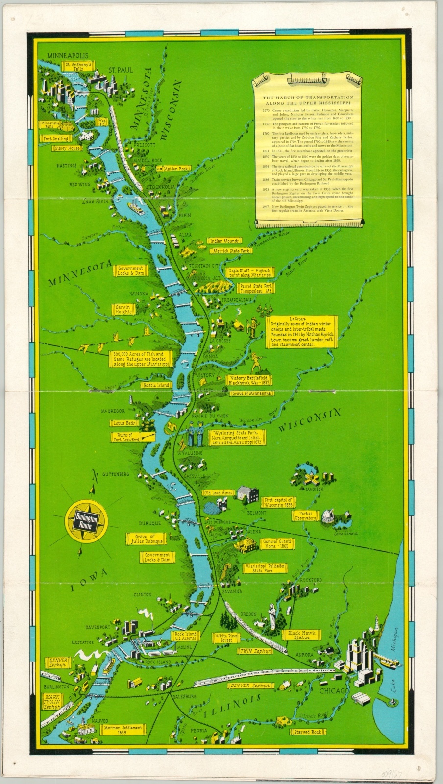
The March of Transportation Along the Upper Mississippi
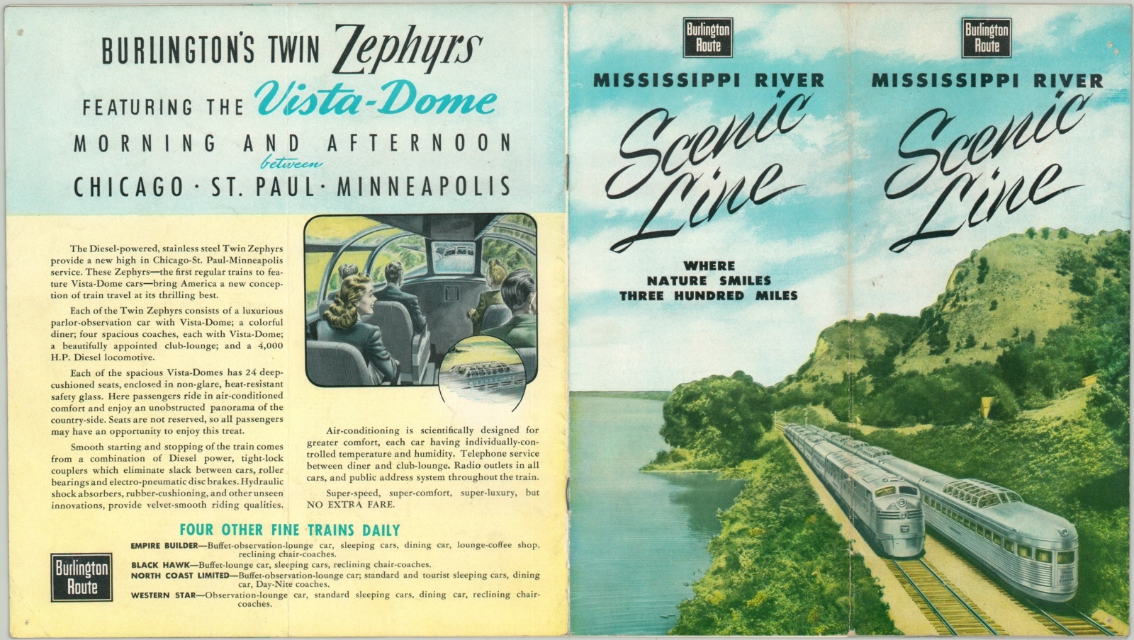
Travel the Scenic Line along the Mississippi, “Where Nature Smiles Three Hundred Miles.”
Out of stock
Description
This lovely pictorial map of the Mississippi River between the Twin Cities and Chicago was published by the Poole Brothers in 1951 on behalf of the Chicago, Burlington & Quincy Railroad. It was issued as the centerfold in a brochure promoting the route and the new Twin Zephyr trains with Vista domes.
Historic sites, natural beauty, and recreation locations are shown in profile and individually labeled, while a timeline in the upper right provides an abbreviated transportation history of the region. Illustrated covers highlight the sleek new design and incredible visibility for the scenic trip.
Map Details
Publication Date: 1951
Author: Poole Brothers
Sheet Width (in): 15.75
Sheet Height (in): 9
Condition: A-
Condition Description: Centerfold map in an eight page stapled brochure, folded over twice. A bit of wear along fold lines and pinholes in each corner.
Out of stock