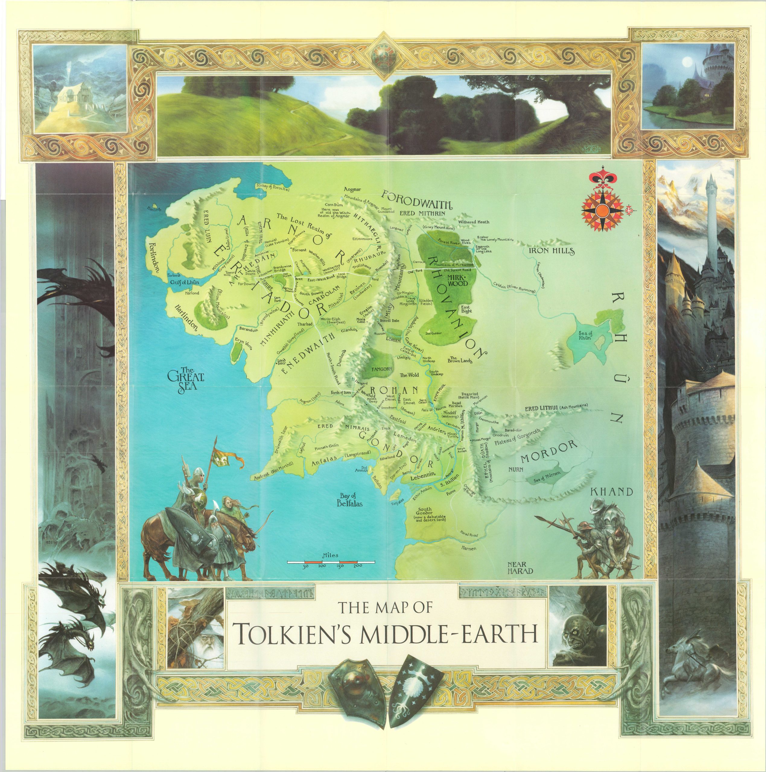
The Map of Tolkien’s Middle Earth
A cartographic analysis of Tolkien’s world of Middle-Earth.
Out of stock
Description
This updated interpretation of the famous world invented by J.R.R. Tolkien was illustrated by John Howe and published by Harper Collins in 1994. Though Tolkien is rightfully credited with creating Middle Earth, it was his son, Christopher, who would draft its first maps.
They were the basis of this image, which adds vibrant colors and detailed illustrations showing some of the fantastical landscapes and characters. Dozens of toponyms identify locations of interest mentioned throughout the books, including The Shire, Helm’s Deep, Rivendell, and Mordor.
The map was created to accompany a small booklet describing the geography of Lord of the Rings that was authored by renowned Tolkien expert Brian Sibley. Its 12 pages are affixed to the back of the front cover and offer detailed information on various landmarks and the mapping of Middle Earth.
Map Details
Publication Date: 1994
Author: John Howe
Sheet Width (in): 28.25
Sheet Height (in): 28.75
Condition: A
Condition Description: Large map folded into 24 segments and affixed to original illustrated paper wraps. Near fine condition overall.
Out of stock

