
The Map of the United States showing divers Routes & Manner of Conveyance in the Westward Expansion
$350.00
The ways by which the West was won.
1 in stock
Description
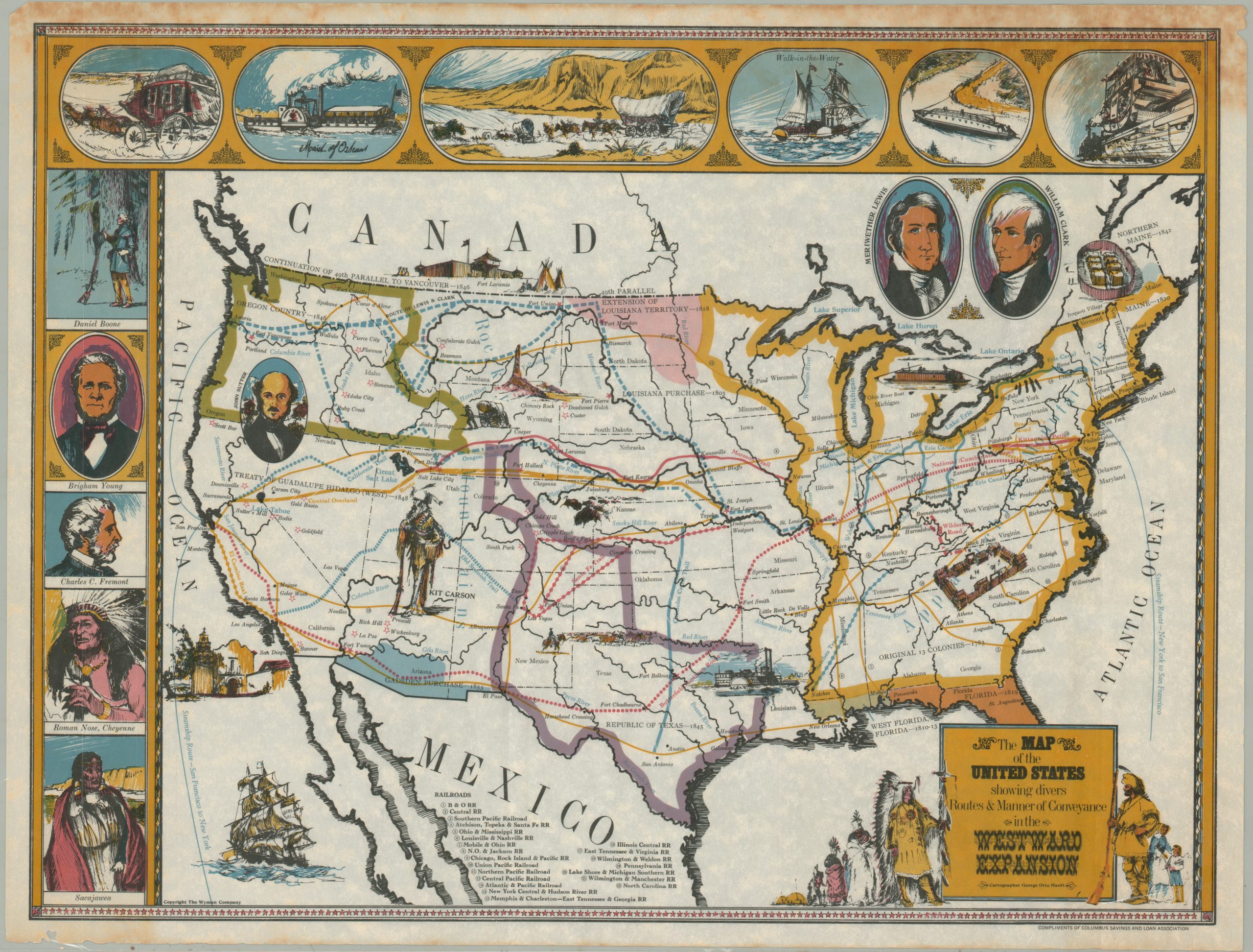
This rare pictorial map of the United States was drawn by George Otto Hanft and copywritten by the Wyman Company around 1967. It was distributed compliments of the Columbus Savings and Loan Association of San Francisco, presumably named for one of the foremost explorers in American history.
The image presents a colorful overview of the nation, with thick lines denoting distinct periods of growth from east to west. The routes of various explorers, emigration trails, mountain men, and military expeditions are noted throughout the image, presenting a system of ‘highways’ long before an official road network was in place. Railroads, yellow, are numbered and identified in a legend at the bottom of the page.
The map is surrounded by illustrated vignettes showcasing historic scenes of exploration and portraits of influential individuals in the growth of the United States. Notable among them are Lewis & Clark, Charles Fremont, and Sacajawea.
Hanft created at least three pictorial maps in the late 1960s, all copywritten by the Wyman Co (possibly Hanft’s own graphic design studio). The most commonly available on the market is his map of California, issued on behalf of the Equitable Savings and Loan Association. There are no references to this example in OCLC or other online repositories.
Source: George Glazer Gallery
Map Details
Publication Date: c. 1967
Author: George Otto Hanft
Sheet Width (in): 24.9
Sheet Height (in): 18.9
Condition: B+
Condition Description: Moderate damp staining visible in the upper corners, extending several inches into the image. Some wear along the outer edges of the sheet, mostly confined to the lower margin. About good condition overall.
$350.00
1 in stock