
The London Underground
$95.00
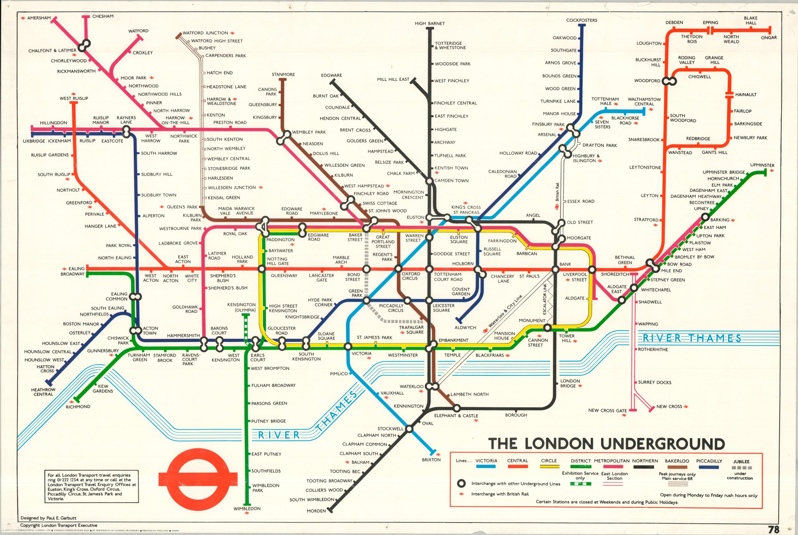
A groovy poster of the London Underground from the late 1970s.
1 in stock
Description
In 1933, maps of the London Underground underwent a revolutionary change when the innovative schematic design by Harry Beck first went into public distribution. Beck’s topological style, using horizontal, vertical, and 45-degree lines, eliminated much of the clutter of earlier maps and provided a comprehensible overview of the rapidly expanding system, albeit at the cost of geographic accuracy and some conventional cartographic detail. Beck’s design was immensely influential and was imitated by transit companies around the world. By the 1950s, however, the increasingly complex Underground network presented new challenges, with extensions, complicated interchange stations, and proposed infrastructure such as the Victoria line requiring modifications to the original design.
In the early 1960s, Paul E. Garbutt developed a revised version that retained Beck’s fundamental principles of straight lines, bright colors, and schematic geography while incorporating several useful modifications. The double-circle interchange symbol clearly identifies transfer points between Underground lines, while connections with British Rail are also distinguished. The Circle Line is given its distinctive “flask” shape, allowing it to accommodate the dense cluster of lines and interchanges around central London. Garbutt’s design ultimately became an important bridge between Beck’s original conception and the modern Underground map.
This example, utilizing Garbutt’s updates, was copyrighted by the London Transport Executive and published in 1978 by Athena International. The commercially produced and officially licensed map reflects the enduring popularity and cultural significance of London’s subterranean transit system. The Jubilee line is shown under construction, while limited Bakerloo services extend to Watford Junction and the District line serves Kensington (Olympia) for exhibition service only.
Map Details
Publication Date: 1978
Author: Paul E. Garbutt
Sheet Width (in): 35.00
Sheet Height (in): 23.50
Condition: B
Condition Description: Color printed map on a single sheet of sturdy, glossy paper. A well loved example, with heavy wear along the edges - pinholes, small chips, numerous tears, etc. The application of old tape on the verso (removed and replaced with archival linen) has stopped anything from getting worse. Lightly wrinkled throughout, but remains in decent condition overall.
$95.00
1 in stock