The Literary Digest Map of U.S.S.R. Union of Soviet Socialist Republics
$400.00
American recognition of the Soviet Union.
1 in stock
Description
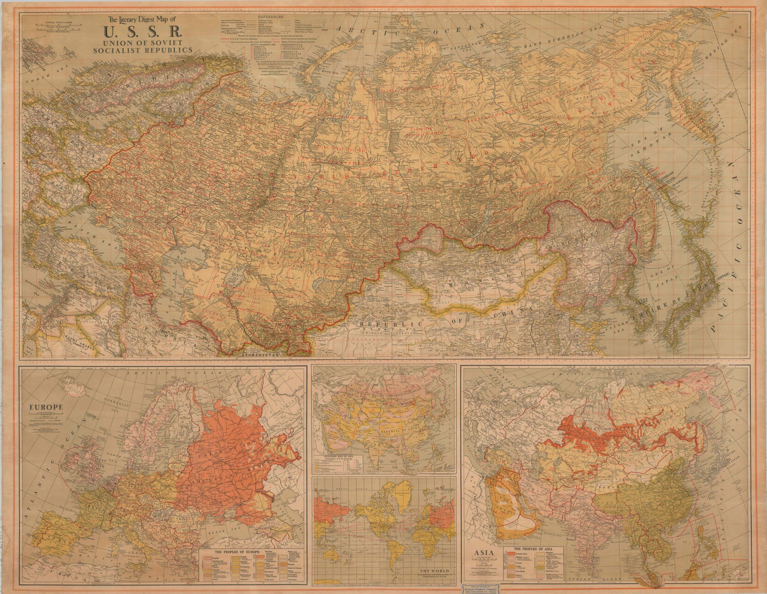
In November 1933, driven by the economic desperation of the Great Depression and the urgent need for a strategic counterweight to rising militarism in Germany and Japan, President Franklin D. Roosevelt broke a sixteen-year diplomatic freeze by officially recognizing the Soviet Union. The American public was eager to learn more about this newly recognized diplomatic partner and potential military ally amidst growing tensions in the Pacific. This large wall map, issued by the Literary Digest, attempts to demystify and define the political and ethnographic organization of the continent-spanning Soviet Union.
The primary image, occupying the upper two-thirds of the sheet, emphasizes the territorial vastness, with Soviet territory stretching from the Baltic and Black Seas to the Bering and Sea of Japan. Red overprinting identifies the complex system of districts, territories, and socialist republics that constituted the U.S.S.R. in the mid-1930s. An incredible amount of information is provided on the national transportation and communication infrastructure – telegraph lines, railroads, wireless stations, highways/post roads, canals. Mines are also pinpointed, highlighting rich mineral resources. Somewhat paradoxically, nomad camps and villages are permanently marked with small triangles.
The bottom part of the sheet is occupied by four insets, the two largest of which show the Peoples of Europe and the Peoples of Asia. Using a series of simplified ethnographic designations and basic color schemes, they show an interesting perspective on the complex national identities of the continents. Two smaller images are an Economic Map of Asia and The World Showing Routes and Distances from the United States to U.S.S.R.
The map was copyrighted in 1934 by the Funk & Wagnalls Company of New York, publishers of the Literary Digest. Compiled, engraved, and printed by the J.W. Clement Company of the Matthews-Northrup Works in Buffalo. To add to the complex production history, a sticker in the lower center notes this example as having been sold and mounted by the Denoyer-Geppert Company of Chicago.
Map Details
Publication Date: 1934
Author: Matthews-Northrup Works
Sheet Width (in): 51.25
Sheet Height (in): 40.75
Condition: B+
Condition Description: Color printed map, mounted on linen but removed from original wooden rollers. Moderate soiling along the outer edges of the sheet, concentrated in the upper left corner. The color has faded somewhat and there is some cracking/wrinkling, but overall in good to very good condition.
$400.00
1 in stock