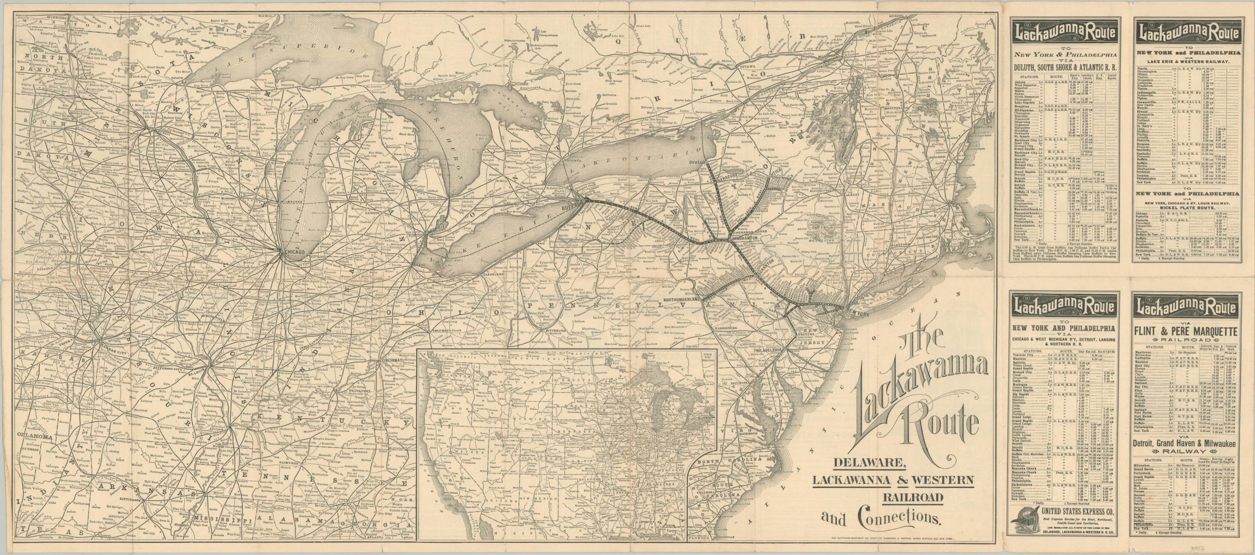
The Lackawanna Route
Detailed route map for the Delaware, Lackawanna and Western Railroad published in 1892.
Out of stock
Description
The Delaware, Lackawanna, and Western Railroad was incorporated in Pennsylvania in 1853 to connect the state’s booming anthracite coal fields to the huge consumer market in New York City. The company enjoyed relatively steady growth for the next several decades, eventually connecting to the Great Lakes at Buffalo and Oswego and the Susquehanna River at Northumberland.
This map and timetable was printed in Buffalo by the Matthews-Northrup Company in 1892 on behalf of the railroad. It shows the network near its height, encompassing nearly 1,000 miles of track across the Northeast. The image stretches as far west as Oklahoma, first opened for settlement just a few years prior and still an attractive destination for emigrants arriving in New York. It also includes connecting lines to Chicago, host city of the 1893 Columbian Exposition.
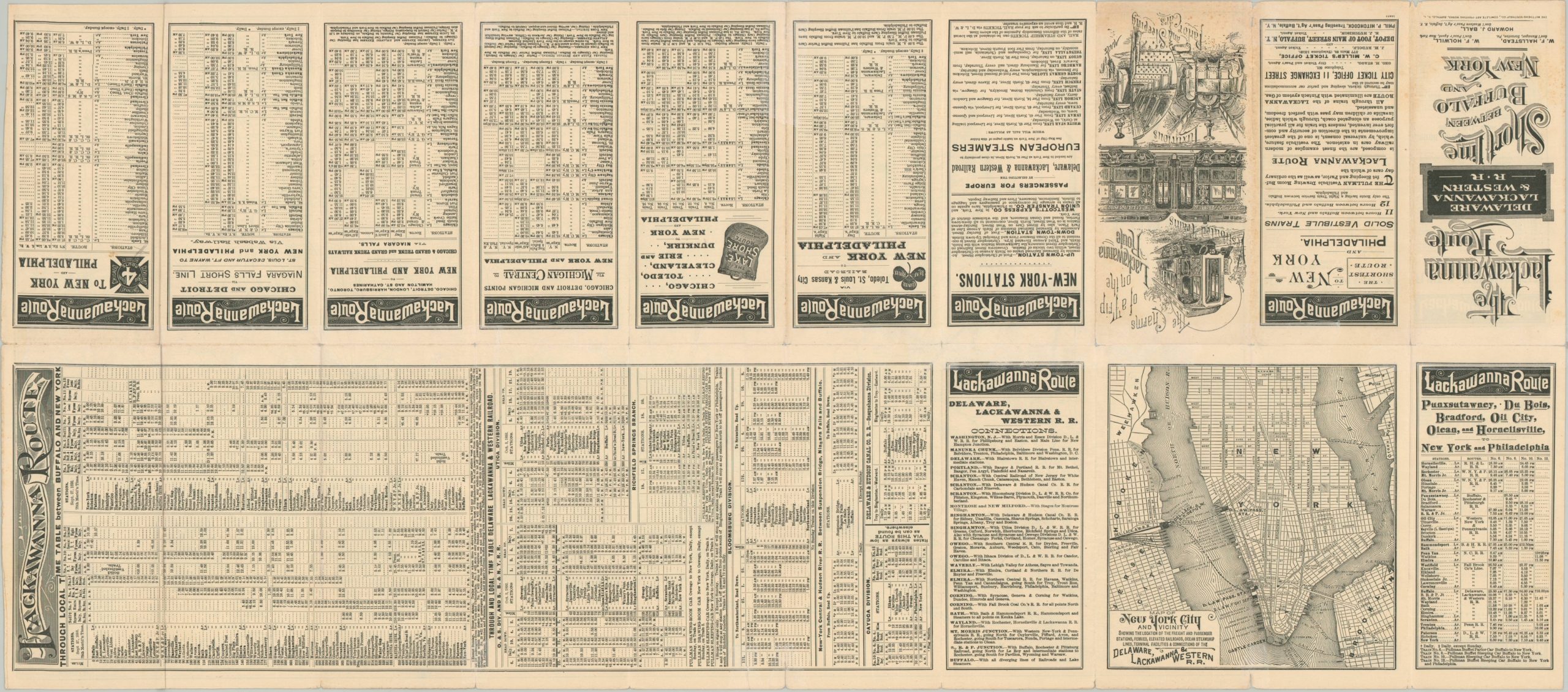
By this point, passenger service was an integral part of the business, and numerous luxurious amenities like Pullman Sleeping Cars and vestibuled trains are advertised on the verso. Here can also be seen a street plan of Lower Manhattan emphasizing the railroad’s connections (via ferry) from Hoboken to New York City.
Source. American Rails
Map Details
Publication Date: 1892
Author: Matthews-Northrup Works
Sheet Width (in): 36
Sheet Height (in): 15.75
Condition: B+
Condition Description: Railroad map and timetable brochure formerly folded into 20 segments. Now flattened, with heavy repairs on the verso along separation of the fold lines. Some light creasing and a few minor edge tears remain. Faint discoloration visible in the center of the sheet, along the vertical fold line. Good to very good condition overall.
Out of stock