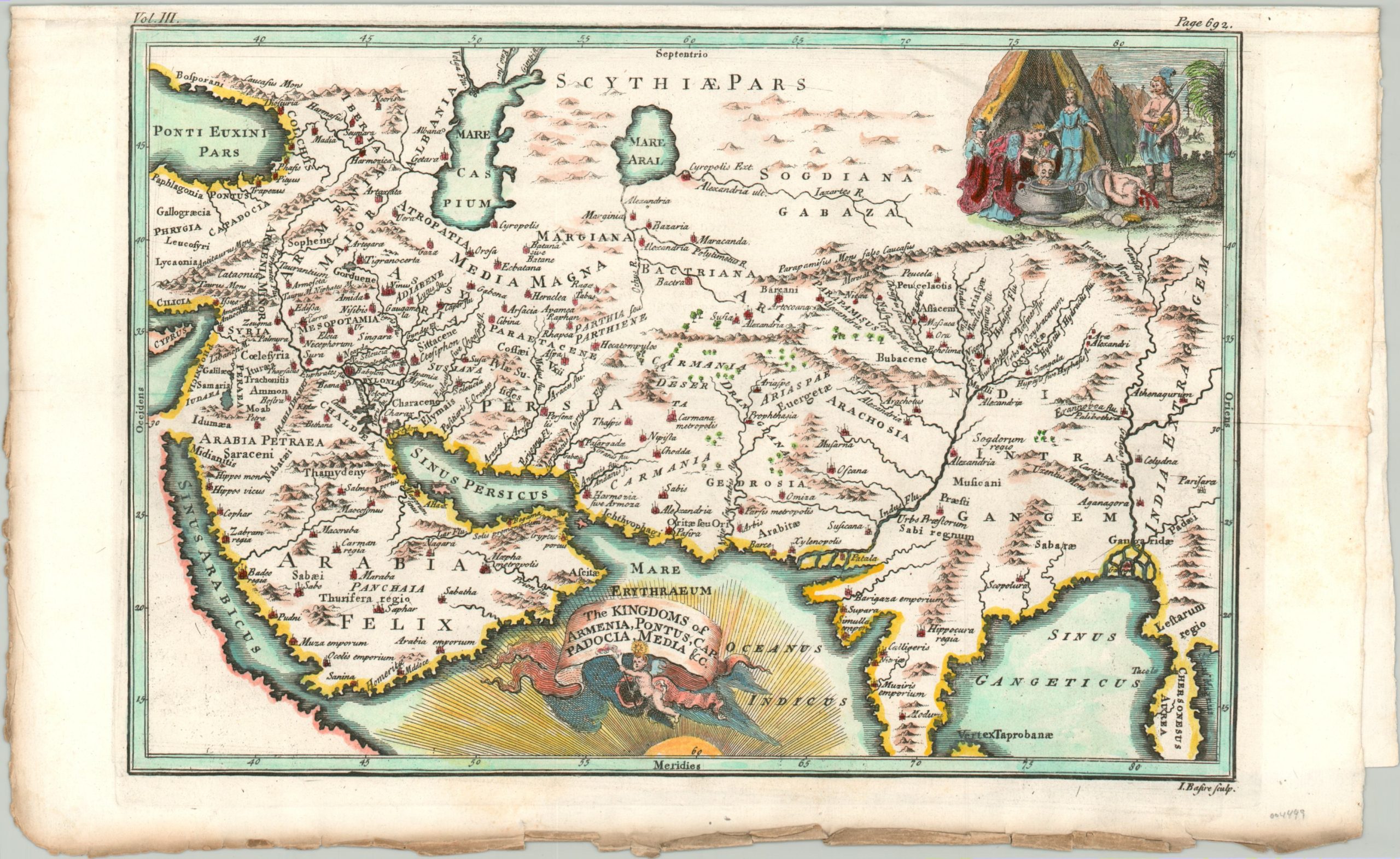
The Kingdoms of Armenia, Pontus, Cappadocia, Media, &c.
$125.00
A fascinating map of Asia from the mid-18th century.
1 in stock
Description
This attractive map presents a huge territory between eastern Asia Minor and the Malay Peninsula. It was created by Isaac Basire in London around 1750 and highlights the region’s geography at the time of the Roman Empire, including the conquests of Alexander the Great. Settlements, political regions, and geographic features all reflect the scholarship of Ptolemy and other classical authors, recreated by European cartographers over 1,500 years later. Historic cities like Babylon, Ur, and Nineveh can be seen, among many others.
A fascinating cartouche can be seen in the upper right. It presents a scene with the head of a decapitated king being dropped into a pot. This is possibly a recreation of the Biblical story in which a beautiful widow named Judith is taken into the tent of an attacking Assyrian king named Holofernes. After passing out from drinking too much, Holofernes is beheaded by Judith and her maid Abra. Leaderless, the Assyrians falter and allow the Israelites to prevail in the war.
Map Details
Publication Date: c. 1750
Author: Isaac Basire
Sheet Width (in): 14.25
Sheet Height (in): 8.5
Condition: A-
Condition Description: Copperplate engraved map occupies half a larger sheet of laid paper, folded in half. Moderate wear along the outer edges of the sheet, including discoloration and numerous small tears. The damage is confined to the margins, and the image presents a sharp imprint with attractive modern hand color.
$125.00
1 in stock

