The Journal of a Tour into the Territory Northwest of the Alleghany Mountains
$2,300.00
Early account of travels through Ohio, with one of the first printed maps of the state.
1 in stock


Description
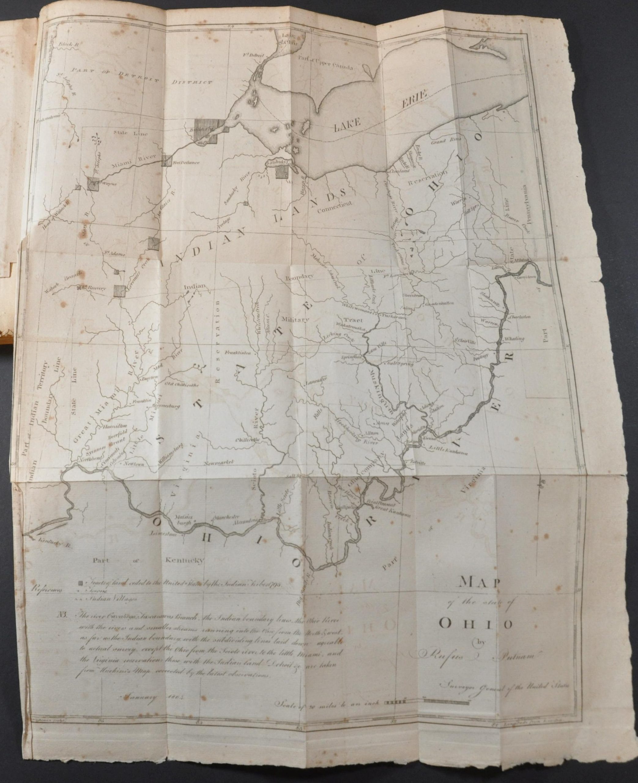
This is the first edition of Thaddeus Harris’s influential account of his 1803 travels through the new state of Ohio. It was printed in Boston in 1805 by Manning & Loring and contains one of the earliest large-format printed maps of Ohio, created by Rufus Putnam. Putnam, known as “the Father of the Northwest Territory” was instrumental in surveying and settling the region.
The first part of the book contains extracts from Harris’ journal, beginning with his approach to the Allegheny Mountains on April 7 of 1803 and ending with a June 20th arrival in Yorktown. Of particular interest are his observations about petroleum found near Pittsburgh and its possible uses among the indigenous community. The account concludes with an itinerary with distances between points and tables of weather observations.
The second half of the volume is a printed description of Ohio that provides a fascinating overview of its history, political organization, economic opportunities, geographic composition, and much more. Of particular interest is information on the early indigenous settlements along the Ohio River – some of the first sites in the Northwest Territory to be examined for their archaeological value. It’s followed by the maps and plans, described below.
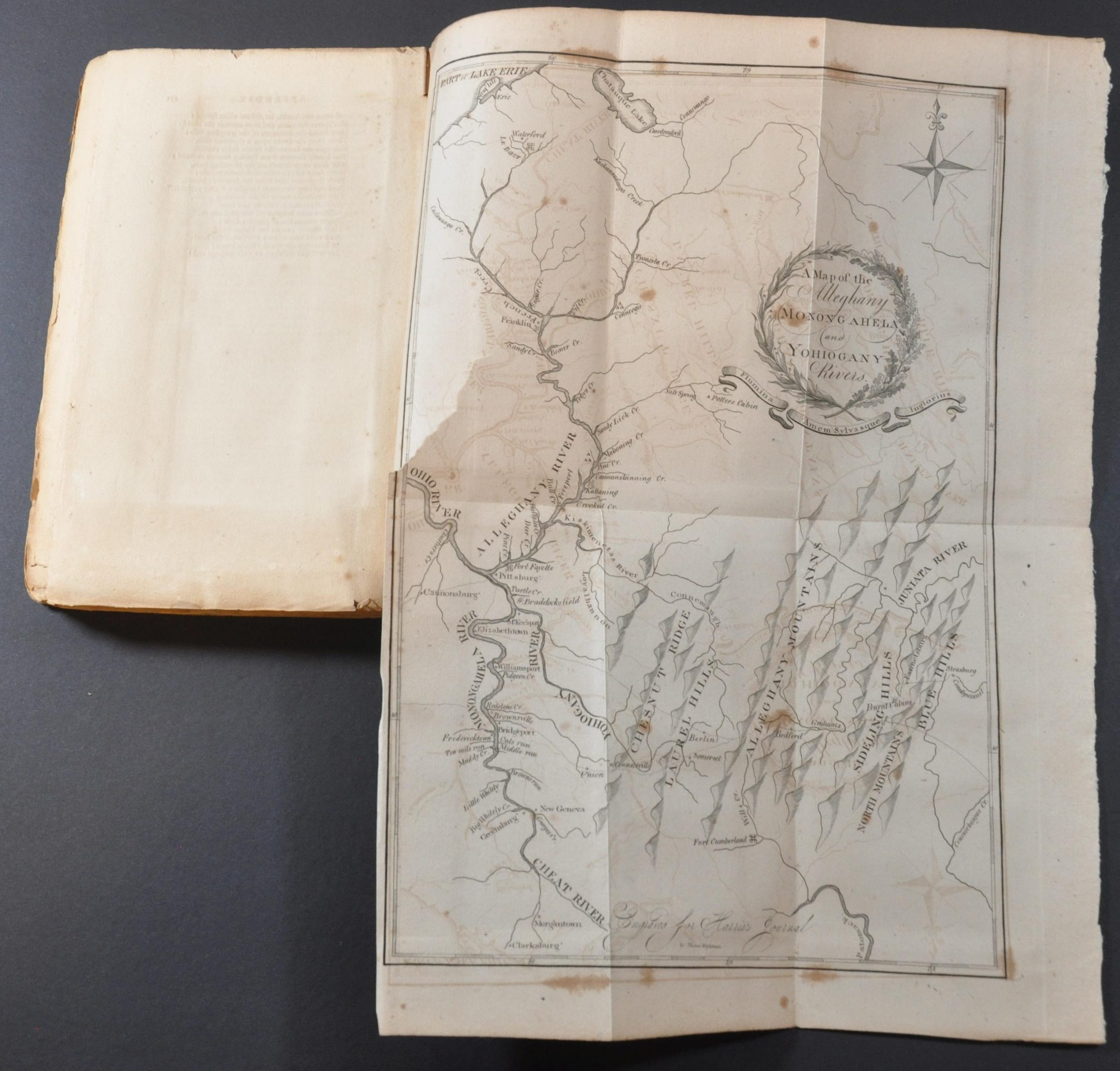
A Map of the Alleghany, Monongahela, and Yohiogany Rivers – 10.7″ x 14.6″ with moderate to heavy scattered spotting and offsetting visible throughout the image. About a 3″ diagonal tear on the left side of the sheet where bound into the volume.
Map of the State of Ohio by Rufus Putnam – 14.8″ x 19.25″ – Light to moderate spotting visible in several areas, most concentrated in the upper left. Light offsetting also present in a few places. The sheet has curled in the lower left along the neatline. About a 2″ diagonal tear on the left side where bound into the volume. Good condition.
A Plat of that Part of the State of Ohio which is appropriated for Military Services – 12.1″ x 8.4″ – Heavily spotted throughout, but issued on thick paper with full margins.
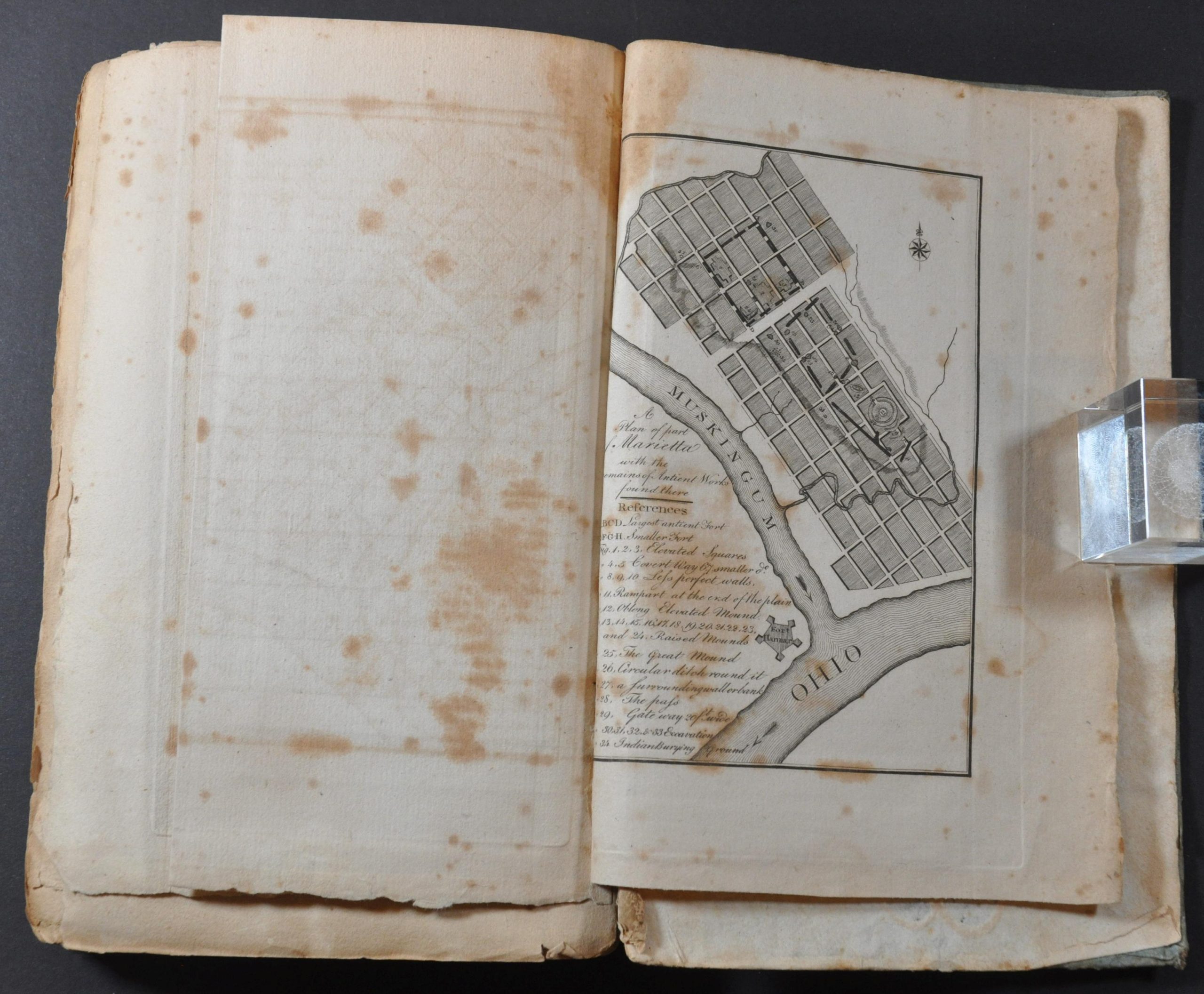
A Plan of Part of Marietta with the remains of antient works found there – 5.5″ x 8.1″. Single page plan of Marietta that identifies 34 separate features from the ancient Native American ruins found there. Heavy spotting present and a damp stain in the right margin.
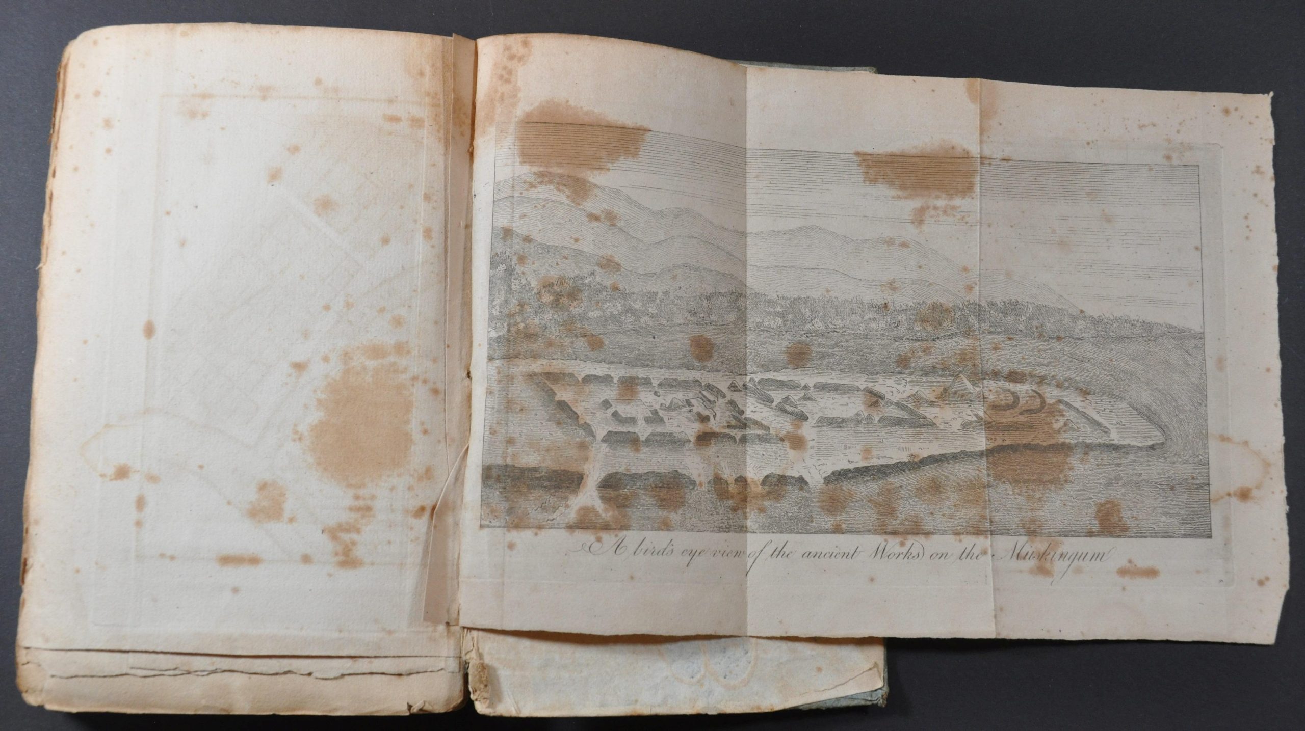
A Bird’s Eye View of the antient Works on the Muskingum – Unevenly cut sheet that measures 11.3″ x 7.8″. Heavily spotted throughout.
Map Details
Publication Date: 1805
Author: Thaddeus Mason Harris
Sheet Width (in): 5.75
Sheet Height (in): 8.75
Condition: B
Condition Description: 271 hand cut pages bound in original blue-paper backed boards. Moderate spotting and offsetting throughout the contents. Title page has an old owner's inscription cut out. Fore-edges are worn and soiled. Includes all five folding maps and plates (see description).
$2,300.00
1 in stock