The Islands of Pun and the Free Associations
A whimsical world where geography is one giant punchline.
Out of stock
Description
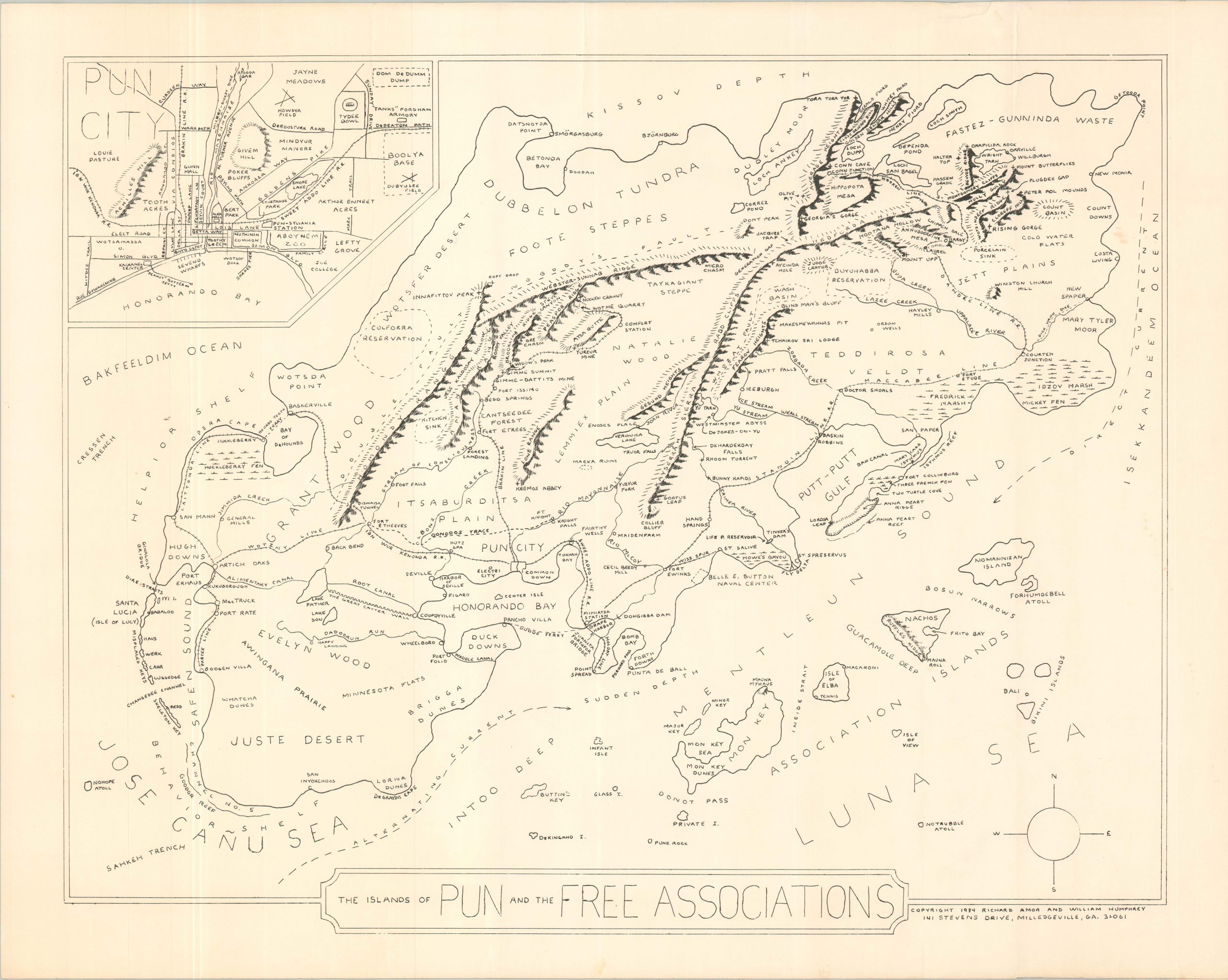
Drawn to scale (and to tickle the funny bone), this humorous fictional map charts a course through the most laughable latitudes and longitudes imaginable. Dozens of different geographic features are depicted and named using a clever variety of puns – some quite clever, others groan-inducing. Every line seems like a punchline!
An inset in the upper left shows a larger-scale outline of ‘Pun City’, allowing for the description of transportation infrastructure, important buildings, etc. A notable and unfortunate omission from the waterfront district is ‘Pier Pressure.’
The map was designed and copyrighted by Richard Amor and William Humphrey of Milledgeville, Georgia in 1984.
Map Details
Publication Date: 1984
Author: Richard Amor and William Humphrey
Sheet Width (in): 28.4
Sheet Height (in): 22.5
Condition: B+
Condition Description: Black and white printed map on a single-sided sheet. Wrinkled throughout, from where previously rolled, and some soiling on the verso results in a bit of see through in the upper right corner (see scan). Good to very good condition overall.
Out of stock