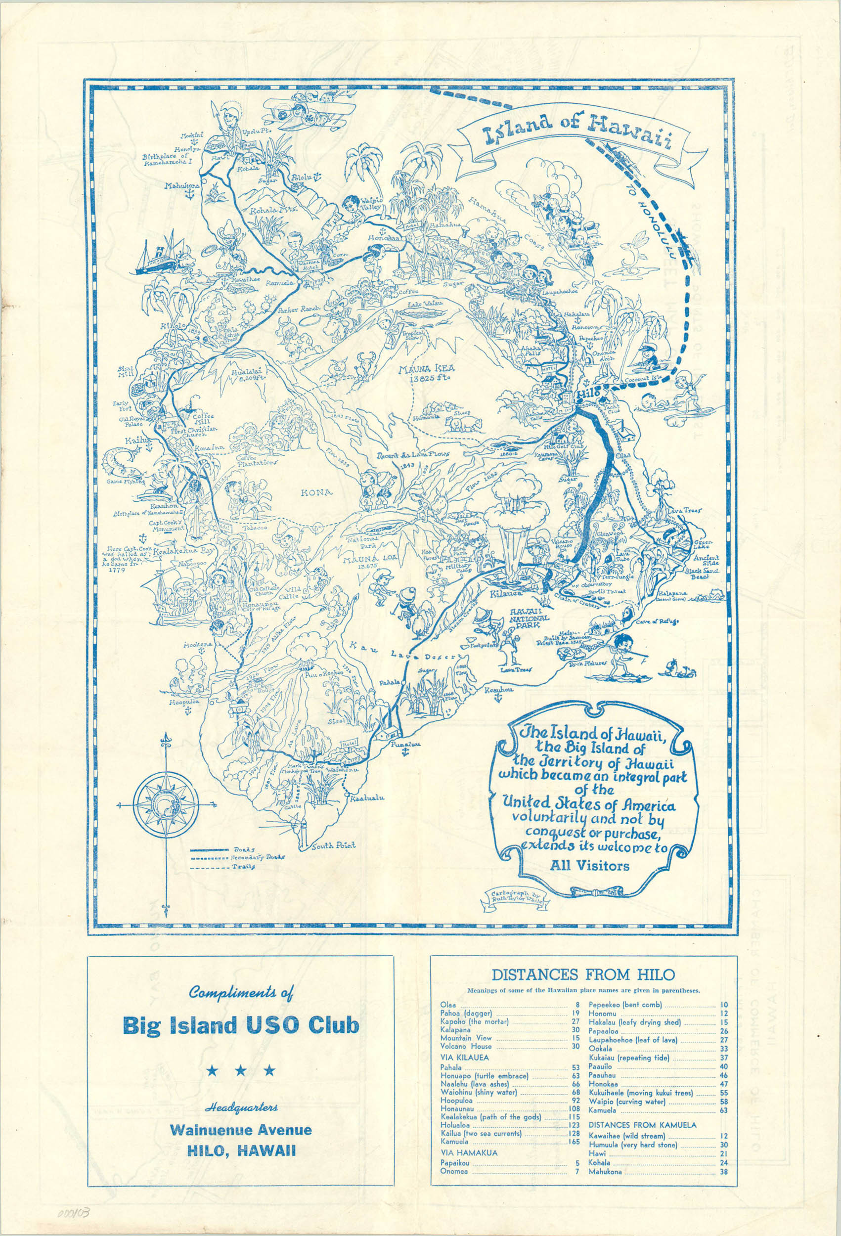
The Island of Hawaii
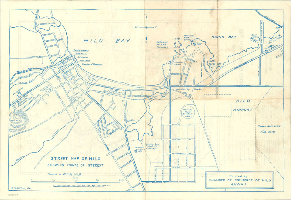
Pictorial map of Hawaii’s Big Island drawn by the talented Ruth Taylor White with city plan of Hilo on verso.
Out of stock
Description
This WWII era pictorial map of the island of Hawaii was designed by the well known cartographer Ruth Taylor White. Published prior to statehood, the map displays White’s characteristic style in the form of exaggerated human figures partaking in various activities for which the island was known. Horseback riding, surfing and hiking are prime examples. Notable historic locations such as the embarkation point of Captain Cook and the birthplace of Kamehameha are also shown. A cartouche describes, perhaps over-enthusiastically, the nature of the relationship between Hawaii and the United States and assures its welcome to all visitors. The scope of the embrace is a different font, alluding to a possible previous wording that may have been changed.
On the verso is a city plan of Hilo, the largest city on the island, drawn by B.D. Chilson.
Map Details
Publication Date: c. 1944
Author: Ruth Taylor White
Sheet Width (in): 14.5
Sheet Height (in): 21
Condition: B+
Condition Description: The map is in very good condition, with a slightly faded image and fold lines.
Out of stock