The Indexed Pocket Map of Wheaton Dupage County, Illinois
$110.00
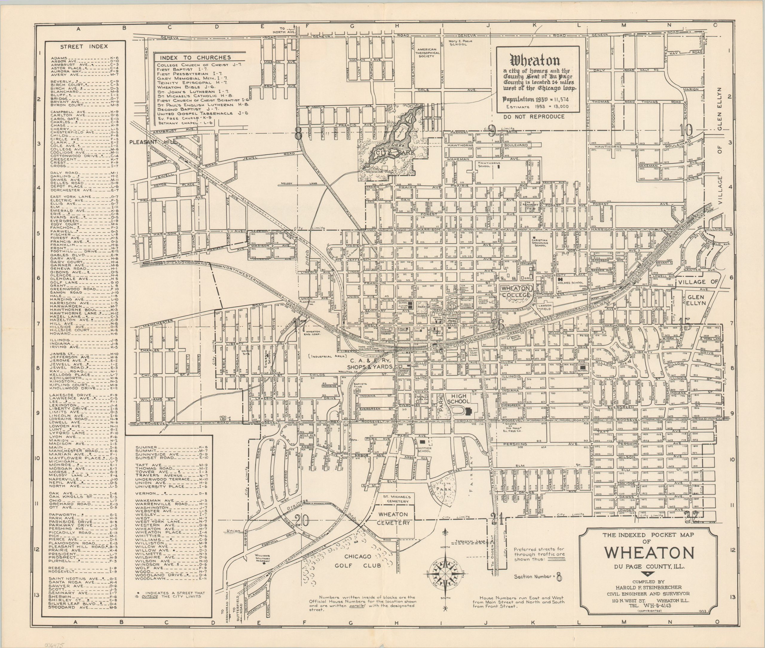
Mid-century city plan of Wheaton, Illinois – a growing suburb about 25 miles west of Chicago.
1 in stock
Description
This charming and legible overview of Wheaton, Illinois was designed, copyrighted, and published locally by engineer/surveyor Harold F. Steinbrecher in 1953. A sticker on the back, hinting at its intended audience, indicates the sheet was distributed by the Roy Langan Insurance Agency (also of Wheaton).
The image presents a detailed summary of the western Chicago suburb mid-century; identifying streets, major industries, schools, cemeteries, parks, and other items of interest to residents and visitors alike. Notable locations include Wheaton College, the Chicago, Aurora, and Elgin Railroad Yards, and the Chicago Golf Club. The left side of the sheet offers an alphabetical street index, while a list of the town’s 14 churches (more than 1 for every 1,000 inhabitants) is shown nearby.
Map Details
Publication Date: 1953
Author: Harold F. Steinbrecher
Sheet Width (in): 21.9
Sheet Height (in): 18.4
Condition: A
Condition Description: Creasing and light wear along old fold lines, including tiny edge tears confined to the margins. Very good condition overall. Sticker on the verso, otherwise blank.
$110.00
1 in stock