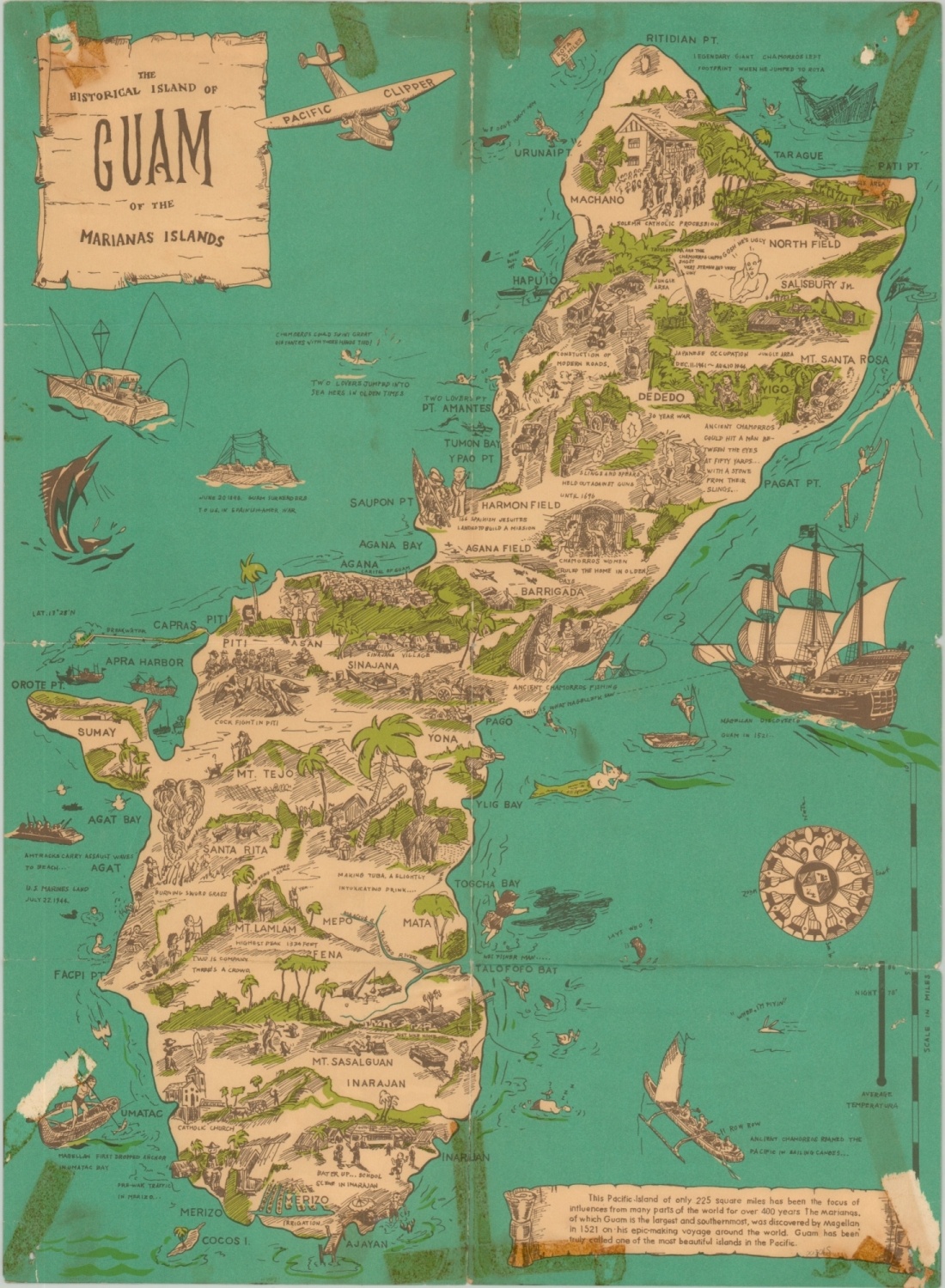
The Historical Island of Guam of the Marianas Islands
Postwar folding pictorial map of Guam, the westernmost territory of the United States, published by the Islander Company.
Out of stock
Description
Showing a mix of illustrations and text related to the island’s history, including Magellan’s discovery in 1521, this map was designed to appeal to an American audience less than 20 years after the end of WWII.
Depictions of the wars’ events are confined to the heroic marine landing, air bases, and a racist caricature of a Japanese solider. The brutal occupation of the Japanese killed as many as 10% of the island’s inhabitants. Other illustrations include Agana (the capital, now Hagåtña), ancient fishing techniques, and the construction of modern roads.
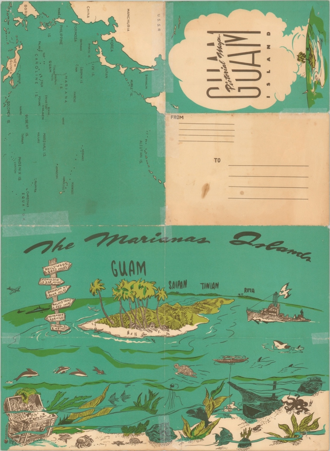
After the war, the island was re-organized under the Guam Organic Act of 1950, which established the island as an unincorporated territory of the United States, which it remains to this day. On the verso of the map is a map of the Philippine Sea and oblique angle view of the Mariana’s Islands.
Source: Rumsey: 8550.001
Map Details
Publication Date: 1958
Author: Bruce Nelson
Sheet Width (in): 14.90
Sheet Height (in): 20.30
Condition: C
Condition Description: Fair condition, with numerous spots of discoloration from old cellophane tape adhesive, tears and chips in the corners, and separation along fold lines. Repairs with archival tape on the verso of the sheet. Image remains intact and almost entirely complete (note loss in the lower corners).
Out of stock