The Historic Ranchos of Los Angeles
Charming pictorial reminder of the Spanish and Mexican heritage of California.
Out of stock
Description
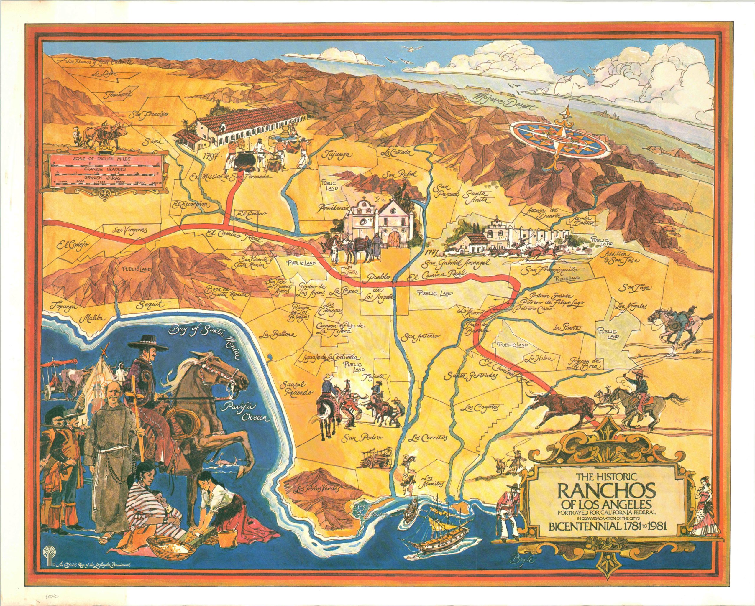
Published by the California Federal Savings Bank for the Bicentennial Committee in 1981, this map shows the historic ranchos that originally comprised the area that makes up today’s Los Angeles. The ranchos were land grants provided to settlers on behalf of the Mexican government (or Spanish Crown), designed to encourage self-sufficiency. The issuing governments were generally hands-off, making the ranchos catalysts for regional identity and independent success.
Many of the rancho names on the map still reflect neighborhoods or areas of the city today, including Santa Anita, La Cienega, La Brea, Santa Monica, and others. Alongside the names and boundaries of the original ranchos are stylistic illustrations of life on the Spanish frontier, with missions, cowboys and sailing ships. As noted in a separate sheet about the ranchos (written by the curator of the Natural History Museum of Los Angeles County), “An era had fallen, but it left a history of a frontier people growing to fill the land – a story much more interesting than the fiction of displaced noblemen amusing themselves in oversized gardens.”
Map Details
Publication Date: 1981
Author: Boyle
Sheet Width (in): 30.00
Sheet Height (in): 24
Condition: A
Condition Description: The map is in excellent condition and has one small spot of discoloration in the lower right hand corner. Otherwise very fine.
Out of stock