
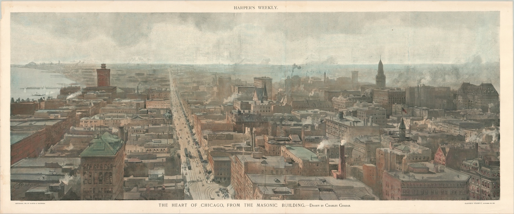
The Heart of Chicago, From the Masonic Building
Late 19th century Chicago from the roof of its newest skyscraper.
Out of stock
Description
The Masonic Temple in Chicago was designed by the iconic architectural firm of Burnham and Root and constructed at the corner of Randolph and State Streets in 1892. It was the highest accessible place in the city until the mid-1920s thanks to height restrictions put in place the same year.
This view from the top of the edifice, looking south down State Street, was issued in the October 29, 1892 issue of Harper’s Weekly. Streetcars and crowded sidewalks carve through a dense urban district populated by countless brick buildings. Billowing chimneys and a few scattered cupolas, clock towers, and church steeples dot the skyline. To the left is Lake Michigan, and a faint outline of the Columbian Exposition grounds at Jackson Park can also be seen in the far background.
Map Details
Publication Date: 1892
Author: Harper's Weekly
Sheet Width (in): 37.3
Sheet Height (in): 15.4
Condition: A
Condition Description: Creased along centerfold and two extraneous vertical folds on either side. A bit of wear along the outer edges, but overall in near fine shape.
Out of stock