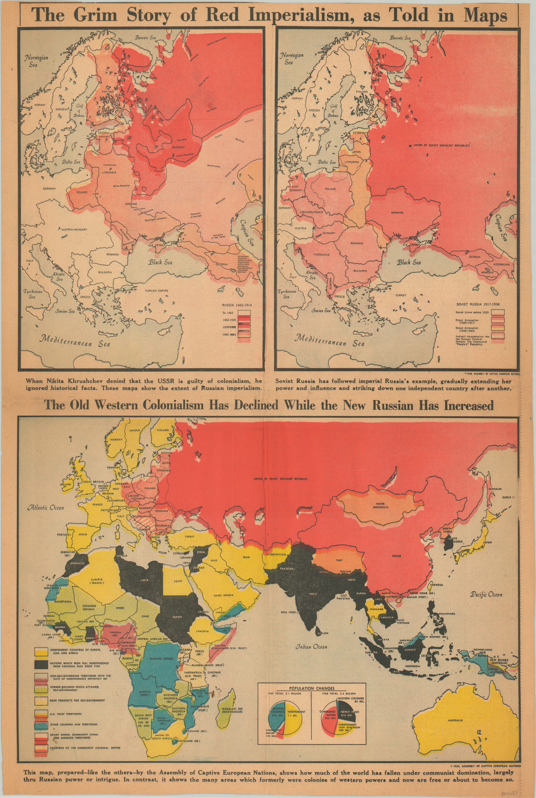
The Grim Story of Red Imperialism, as Told in Maps
An attempt at self preservation by Eastern European nations during the Cold War.
Out of stock
Description
This highly engaging newspaper map was issued in a 1960 edition of the Chicago Tribune. It uses three images to highlight the growth of Russian colonialism in Eastern Europe and across the world. The top maps show how the extent of the USSR and its satellite states extended well beyond the former territory of the Tsars. The difference in time is striking – nearly 500 years for imperial Russia, but only 40 for the Soviets.
The lower map juxtaposes how significant portions of the Eastern Hemisphere were gaining independence, while at the same time communism’s reach was growing in the east and west. Vietnam in particular would become a hotbed of conflict for the United States just shortly after publication.
Designed by the Assembly of Captive European Nations, the images are deliberately intimidating and evocative. The coalition represented nine European nations under Soviet influence – Albania, Bulgaria, Czechoslovakia, Estonia, Hungary, Latvia, Lithuania, Poland and Romania – and focused on peaceful efforts to liberate them from Communist occupation.
Map Details
Publication Date: 1960
Author: Assembly of Captive European Nations
Sheet Width (in): 14.60
Sheet Height (in): 21.60
Condition: B
Condition Description: Trimmed edges, narrowly along the top, and creasing vertically and horizontally. Newssheet toned consistently with age. Remains in good condition, with bright color.
Out of stock

