
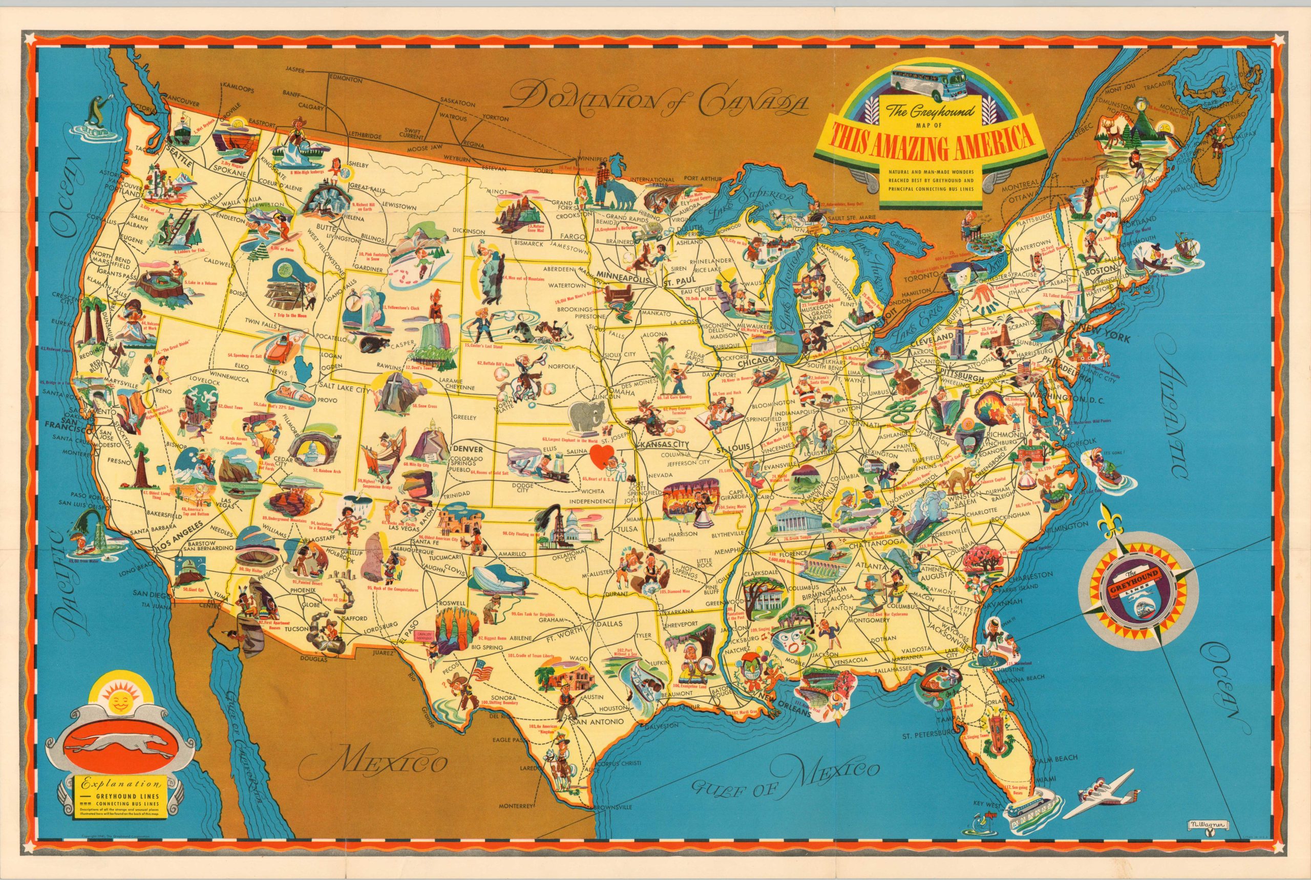
The Greyhound Map of This Amazing America
$175.00
“Natural and Man-Made Wonders Reached Best by Greyhound and Pincipal Connection Bus Lines.”
1 in stock
Description
This wonderful pictorial map of the United States was illustrated by N. Wagner and published in 1941 to promote Greyhound Lines. The company issued several similar promotional pieces during the 1930s-1950s to encourage ridership from coast to coast. All of America (except Hawaii and Alaska Territories, inaccessible by road) is presented and connected by a convenient network of bus routes. Brightly colored vignettes representing a variety of interesting attractions, 117 in total, can be found in every corner of the country.
The need for the image to feel ‘full’ (rather than selecting the ‘best’) is apparent; upon closer inspection, the amusement available at certain sites (Heart of U.S.A, Gas Tank for Dirigibles, Greyhound’s Birthplace) is probably quite limited! Text on the verso describes each of the locations of interest presented on the map, from Union Lake’s Wet/Drydock (#1) to the Sea-Going Buses in Key West (#117).
Map Details
Publication Date: 1941
Author: N. Wagner
Sheet Width (in): 30
Sheet Height (in): 20
Condition: B+
Condition Description: Brightly colored pictorial map, printed on both sides and moderately worn along old fold lines - probably as issued. Some wear and closed separations along the seams has been reinforced on the verso with archival tape, with very minimal image loss along the top, just East of Helena. Good to very good condition overall.
$175.00
1 in stock