The Greater Coachella Valley
$65.00
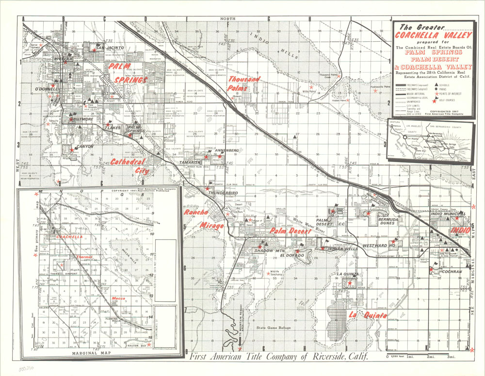
Real estate map of the Coachella Valley and Palm Springs.
Description
Published over thirty years before the first Coachella music festival, this map shows the area from Palm Springs to Indio along Interstate 10 and the Southern Pacific Railroad. It was the latter transportation route that brought the first wave of settlement to the area in the late 1800’s, who largely focused on agriculture and livestock. A second wave flocked to the area after World War II, as more temperature efficient architecture and better infrastructure led to residents staying in the area year-round. This real estate map is capitalizing on that appreciation for desert living that continues in those communities today and depicts modern conveniences like schools, parks, golf courses and other locations of interest.
Map Details
Publication Date: 1967
Author: Jack Richards
Sheet Width (in): 22
Sheet Height (in): 17
Condition: A
Condition Description: The map is in superb condition, with very minor wear along the outer edge.
$65.00